SL4-136-3501

| NASA Photo ID | SL4-136-3501 |
| Focal Length | 100mm |
| Date taken | |
| Time taken | GMT |

Cloud masks available for this image:
Spacecraft nadir point:
Photo center point: 17.0° S, 140.0° E
Photo center point by machine learning:
Photo center point: 17.0° S, 140.0° E
Photo center point by machine learning:
Nadir to Photo Center:
Spacecraft Altitude: nautical miles (0km)
Country or Geographic Name: | AUSTRALIA-Q |
Features: | GULF OF CARPENTARIA |
| Features Found Using Machine Learning: | |
Cloud Cover Percentage: | 50 (26-50)% |
Sun Elevation Angle: | ° |
Sun Azimuth: | ° |
Camera: | Hasselblad |
Focal Length: | 100mm |
Camera Tilt: | Low Oblique |
Format: | SO368: Kodak Ektachrome MS, equivalent to 2448 Kodak Aerochrome, ASA64, thin base, fine grain |
Film Exposure: | Normal |
| Additional Information | |
| Width | Height | Annotated | Cropped | Purpose | Links |
|---|---|---|---|---|---|
| 4400 pixels | 4600 pixels | No | No | Download Image | |
| 4400 pixels | 4600 pixels | No | No | Original file from film scan | Download Image |
| 478 pixels | 500 pixels | No | No | Download Image |
Download Packaged File
Download a Google Earth KML for this Image
View photo footprint information
Download a GeoTIFF for this photo
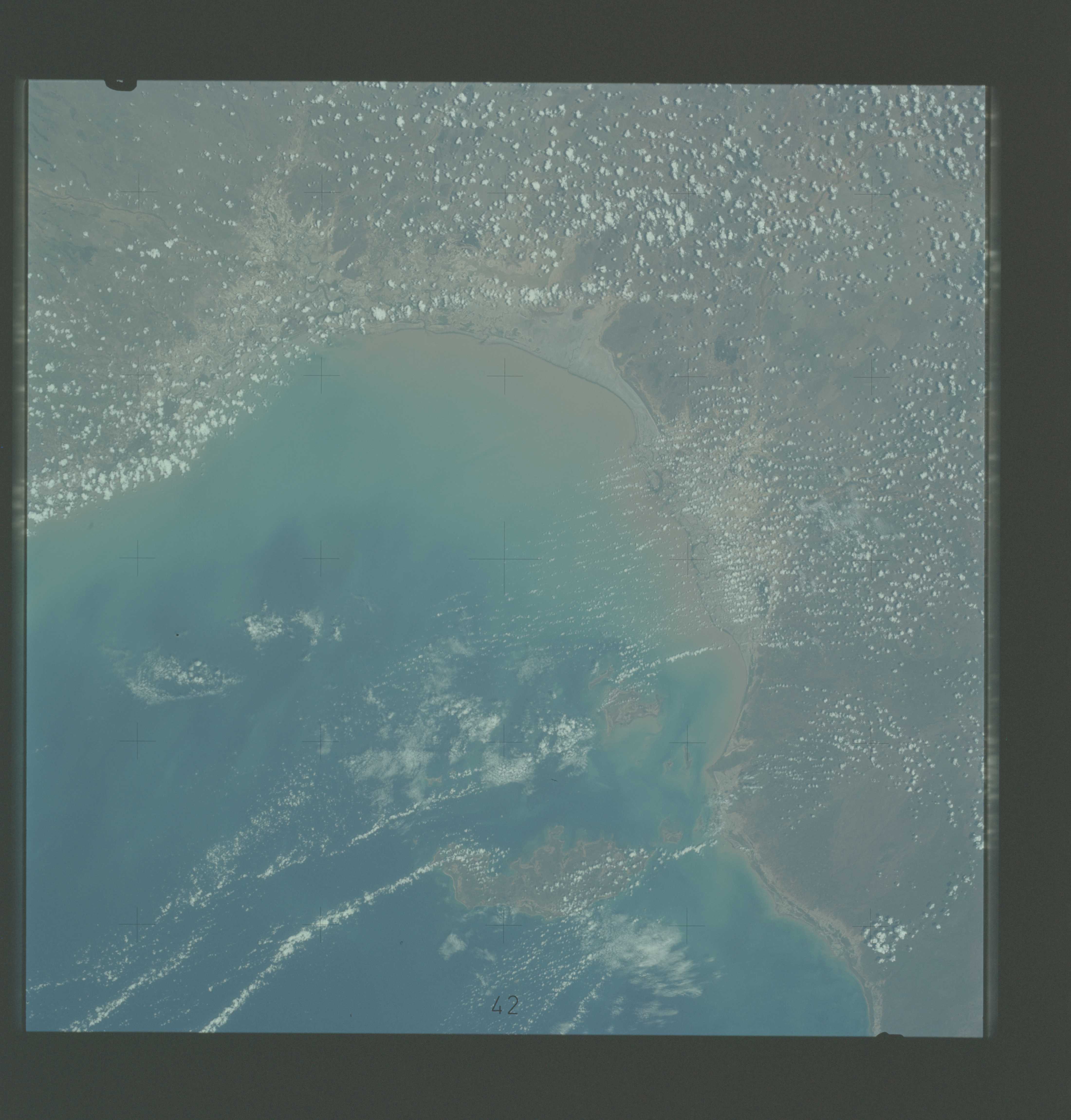
Image Caption: A vertical view of a portion of the State of Queensland, Australia, (17.0S, 140.0E) as photographed from the Skylab space station in Earth orbit. A Skylab 4 crewman used a hand-held 70mm Hasselblad camera to take this picture. The body of water is the southeastern part of the Gulf of Carpentaria. This picture was taken in support studies of the north Australian drought region. The largest island seen is Mornington. The town of Normanton can also be seen. Of interest here is the sediment-laden waters at the perimeter of the Gulf showing how rains at the end of the drought are washing the top soil into the sea after the drought killed the covering vegatation. Also noted is that the vegetation patterns tend more toward those of other arid regions (i.e. they follow topographic and hydrographic patterns) rather than those in other parts of Australia (i.e. more convenient and easier to see, rectilinear patterns which are prevalent in less arid areas.)
