SL3-87-112
| NASA Photo ID | SL3-87-112 |
| Focal Length | 457mm |
| Date taken | 1973.09.15 |
| Time taken | 18:05:13 GMT |

Cloud masks available for this image:
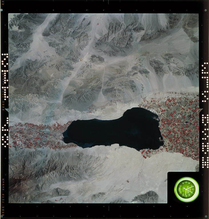
Spacecraft nadir point: 33.4° N, 115.8° W
Photo center point: 33.4° N, 115.8° W
Photo center point by machine learning:
Photo center point: 33.4° N, 115.8° W
Photo center point by machine learning:
Nadir to Photo Center:
Spacecraft Altitude: 230 nautical miles (426km)
Country or Geographic Name: | |
Features: | CALIFORNIA, SALTON SEA, CONCHELLA VALLEY, CHOCOLATE MOUNTAINS |
| Features Found Using Machine Learning: | |
Cloud Cover Percentage: | 0 (no clouds present) |
Sun Elevation Angle: | ° |
Sun Azimuth: | ° |
Camera: | Skylab Earth Terrain (S190B) |
Focal Length: | 457mm |
Camera Tilt: | 0 degrees |
Format: | E3443: Kodak infrared color, "minus blue" Wratten filter |
Film Exposure: | |
| Additional Information | |
| Width | Height | Annotated | Cropped | Purpose | Links |
|---|---|---|---|---|---|
| 4592 pixels | 4815 pixels | No | No | Scientist Request | Download Image |
| 732 pixels | 768 pixels | No | No | Download Image |
Download Packaged File
Download a Google Earth KML for this Image
View photo footprint information
Download a GeoTIFF for this photo
Image Caption: none
