SL3-22-214
| NASA Photo ID | SL3-22-214 |
| Focal Length | 152mm |
| Date taken | 1973.08.05 |
| Time taken | 16:32:52 GMT |
Cloud masks available for this image:
Spacecraft nadir point: 46.8° N, 119.4° W
Photo center point: 46.8° N, 119.4° W
Photo center point by machine learning:
Photo center point: 46.8° N, 119.4° W
Photo center point by machine learning:
Nadir to Photo Center:
Spacecraft Altitude: 239 nautical miles (443km)
Country or Geographic Name: | |
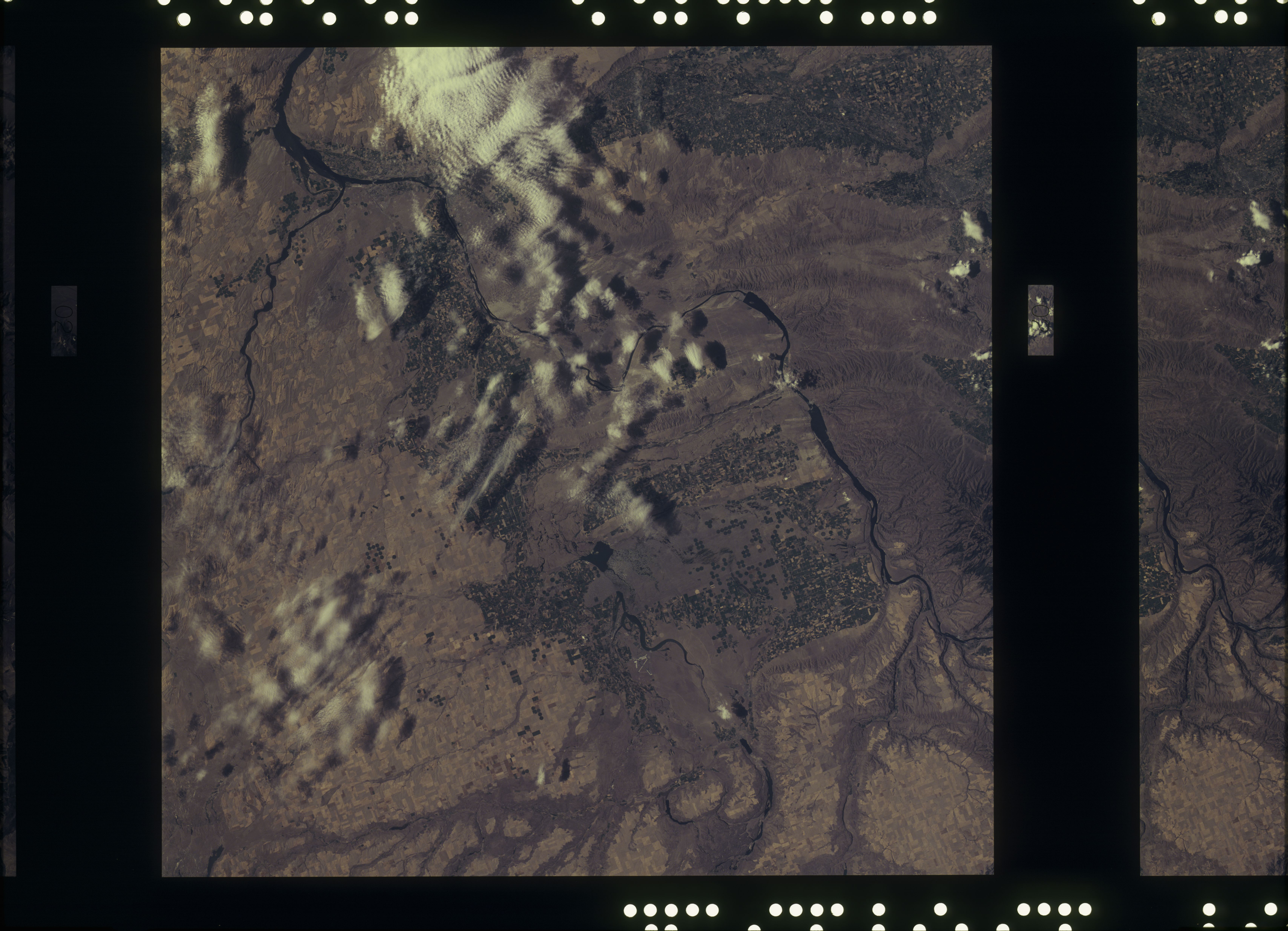
Features: | WASHINGTON, COLUMBIA RIVER, SNAKE RIVER, YAKIMA, PASCO |
| Features Found Using Machine Learning: | |
Cloud Cover Percentage: | 15 (11-25)% |
Sun Elevation Angle: | ° |
Sun Azimuth: | ° |
Camera: | Skylab Multispectral (S190A) |
Focal Length: | 152mm |
Camera Tilt: | 0 degrees |
Format: | SO356: Unknown SkyLab |
Film Exposure: | |
| Additional Information | |
| Width | Height | Annotated | Cropped | Purpose | Links |
|---|---|---|---|---|---|
| 6830 pixels | 4937 pixels | No | No | Download Image | |
| 500 pixels | 361 pixels | No | No | Download Image |
Download Packaged File
Download a Google Earth KML for this Image
View photo footprint information
Download a GeoTIFF for this photo
Image Caption: A vertical view of southeastern Washington States as photographed from Earth orbit by one of the six lenses of the Itek-furnished S190-A Multispectral Photographic Facility Experiment aboard the Skylab space station. The Snake River flows into the Columbia River in the most southerly corner of the picture. The Wallula Lake is below the junction of the two rivers. The Yakima Valley is at the southwestern edge of the photograph. The Columbia Basin is in the center of the picture. The Cascade Range extends across the northwest corner of the photograph.
