SL3-122-2513
| NASA Photo ID | SL3-122-2513 |
| Focal Length | 100mm |
| Date taken | 1973.__.__ |
| Time taken | GMT |

Cloud masks available for this image:
Spacecraft nadir point:
Photo center point: 52.0° N, 118.5° W
Photo center point by machine learning:
Photo center point: 52.0° N, 118.5° W
Photo center point by machine learning:
Nadir to Photo Center:
Spacecraft Altitude: nautical miles (0km)
Country or Geographic Name: | CANADA-BC |
Features: | ROCKY MTNS-TRENCH, LAKES |
| Features Found Using Machine Learning: | |
Cloud Cover Percentage: | 5 (1-10)% |
Sun Elevation Angle: | ° |
Sun Azimuth: | ° |
Camera: | Hasselblad |
Focal Length: | 100mm |
Camera Tilt: | Low Oblique |
Format: | SO368: Kodak Ektachrome MS, equivalent to 2448 Kodak Aerochrome, ASA64, thin base, fine grain |
Film Exposure: | Normal |
| Additional Information | |
| Width | Height | Annotated | Cropped | Purpose | Links |
|---|---|---|---|---|---|
| 4400 pixels | 4600 pixels | No | No | Download Image | |
| 4400 pixels | 4600 pixels | No | No | Original file from film scan | Download Image |
| 478 pixels | 500 pixels | No | No | Download Image |
Download Packaged File
Download a Google Earth KML for this Image
View photo footprint information
Download a GeoTIFF for this photo
Image Caption:
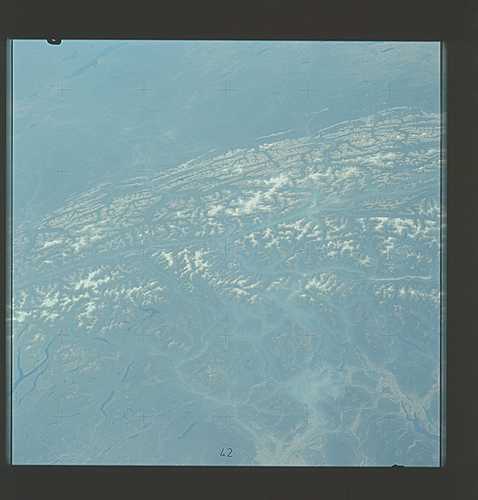
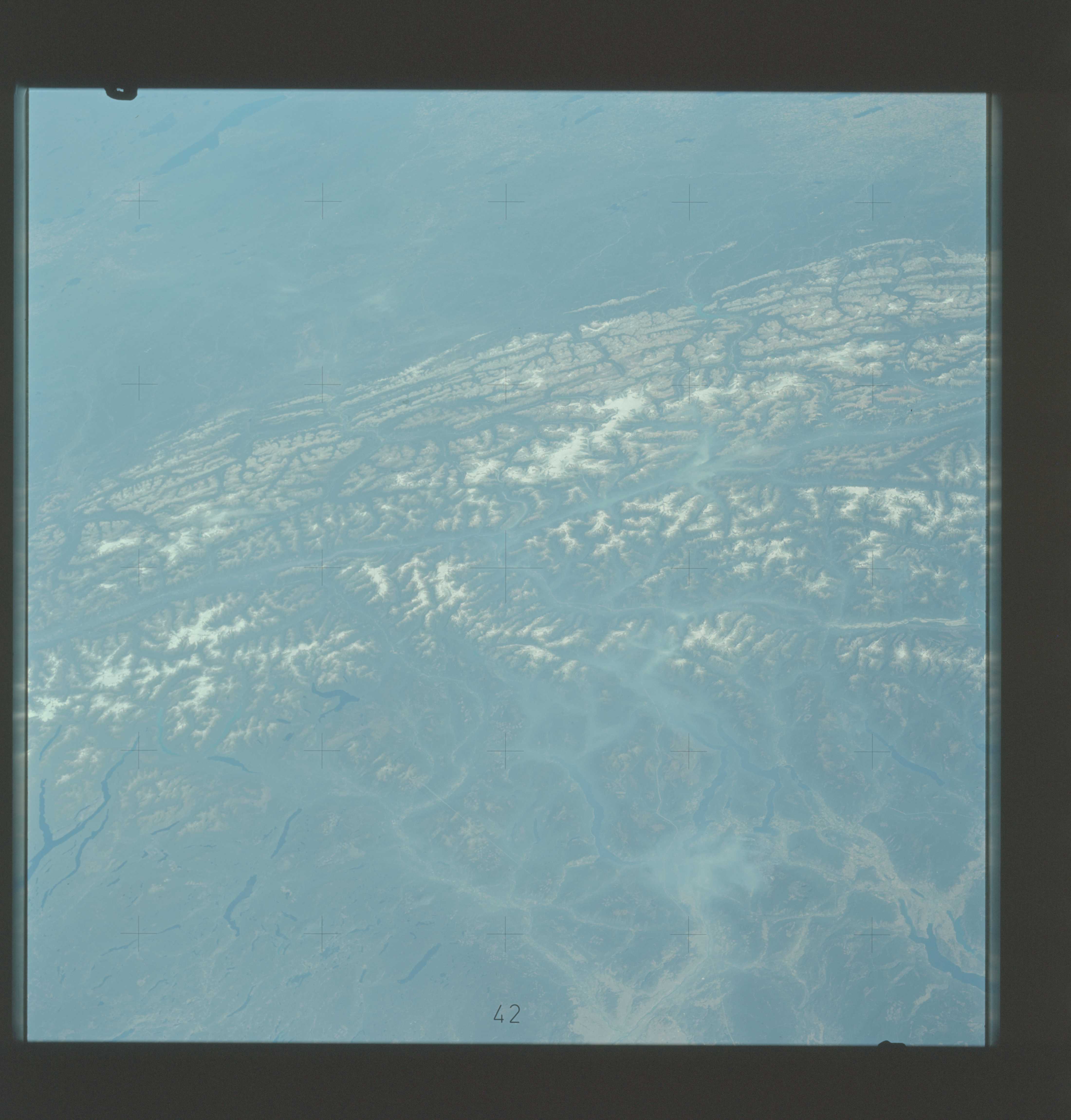
Rocky Mountain Trench
A low-oblique view across the southern Canadian Rocky Mountains
shows the mountain ridge terrain dissected by a number of U-
shaped glacial valleys containing rivers and lakes. The largest
valley is the Rocky Mountain Trench which has a structural ori-
gin. (SL3-122-2513)
Rocky Mountain Trench
A low-oblique view across the southern Canadian Rocky Mountains
shows the mountain ridge terrain dissected by a number of U-
shaped glacial valleys containing rivers and lakes. The largest
valley is the Rocky Mountain Trench which has a structural ori-
gin. (SL3-122-2513)
