SL3-121-2357
| NASA Photo ID | SL3-121-2357 |
| Focal Length | 100mm |
| Date taken | 1973.__.__ |
| Time taken | GMT |
Resolutions offered for this image:
3678 x 3683 pixels 639 x 639 pixels 4400 x 4600 pixels 6427 x 6427 pixels 4400 x 4600 pixels 478 x 500 pixels
3678 x 3683 pixels 639 x 639 pixels 4400 x 4600 pixels 6427 x 6427 pixels 4400 x 4600 pixels 478 x 500 pixels

Cloud masks available for this image:
Spacecraft nadir point:
Photo center point: 44.5° N, 110.5° W
Photo center point by machine learning:
Photo center point: 44.5° N, 110.5° W
Photo center point by machine learning:
Nadir to Photo Center:
Spacecraft Altitude: nautical miles (0km)
Country or Geographic Name: | USA-WYOMING |
Features: | YELLOWSTONE PK, GR. TETONS |
| Features Found Using Machine Learning: | |
Cloud Cover Percentage: | 0 (no clouds present) |
Sun Elevation Angle: | ° |
Sun Azimuth: | ° |
Camera: | Hasselblad |
Focal Length: | 100mm |
Camera Tilt: | Low Oblique |
Format: | SO368: Kodak Ektachrome MS, equivalent to 2448 Kodak Aerochrome, ASA64, thin base, fine grain |
Film Exposure: | Normal |
| Additional Information | |
| Width | Height | Annotated | Cropped | Purpose | Links |
|---|---|---|---|---|---|
| 3678 pixels | 3683 pixels | No | No | Earth From Space collection | Download Image |
| 639 pixels | 639 pixels | No | No | Earth From Space collection | Download Image |
| 4400 pixels | 4600 pixels | No | No | Download Image | |
| 6427 pixels | 6427 pixels | No | No | Publisher Request | Download Image |
| 4400 pixels | 4600 pixels | No | No | Original file from film scan | Download Image |
| 478 pixels | 500 pixels | No | No | Download Image |
Download Packaged File
Download a Google Earth KML for this Image
View photo footprint information
Download a GeoTIFF for this photo
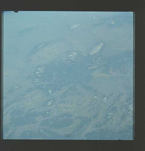
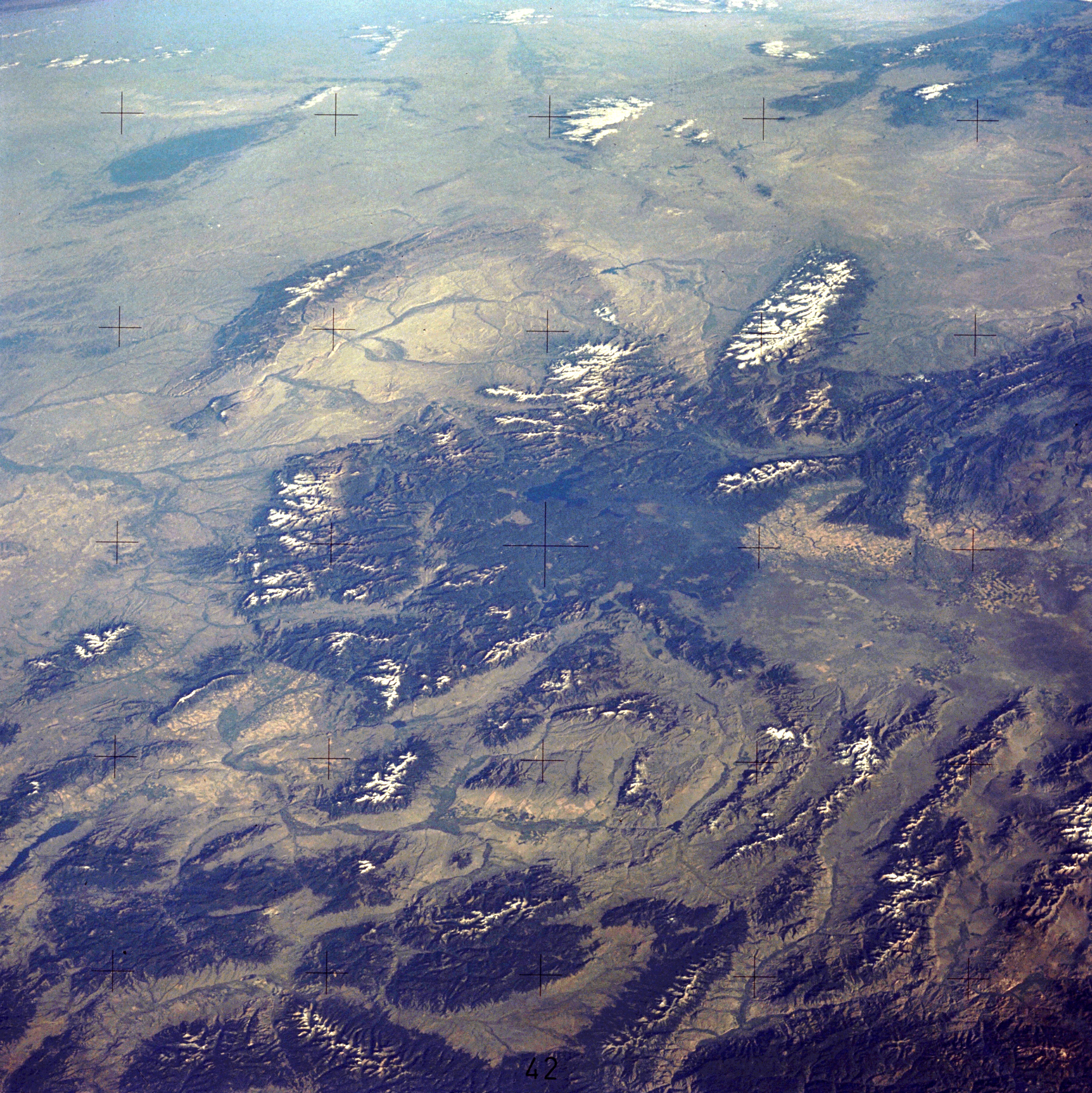
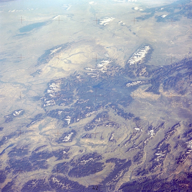
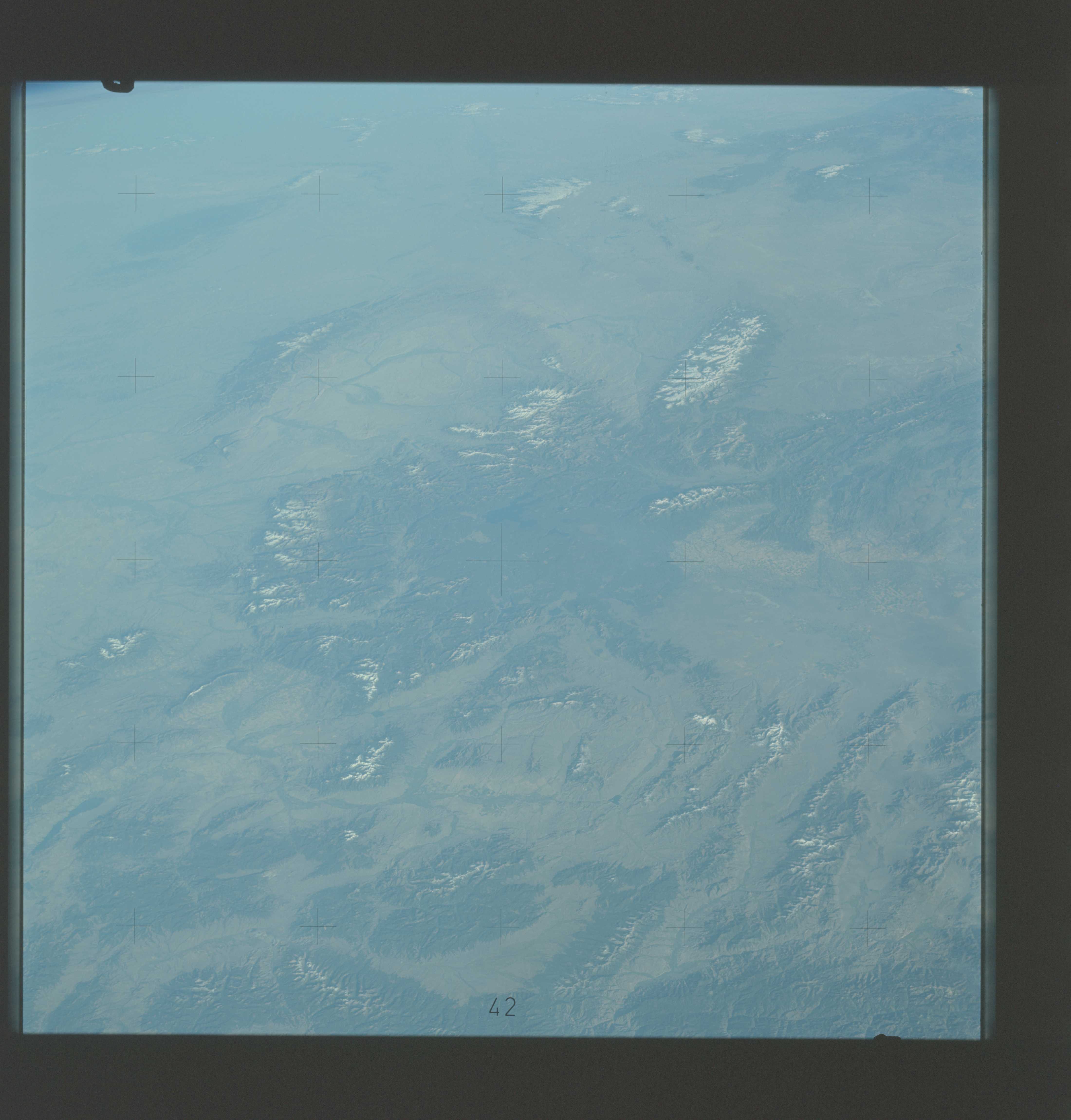
Image Caption: SL3-121-2357 Northern Rocky Mountains and Yellowstone Lake, Wyoming, U.S.A. August 1973
The northern Rocky Mountains, including parts of Montana, Wyoming, and Idaho, are apparent in this synoptic, southeast-looking photograph. The small dark blue area in the center of the photograph is Yellowstone Lake. Several snow-capped mountain ranges with elevations of more than 9000 feet (2700 meters) can be seen-the Absaroka Range east of Yellowstone Lake, the Big Horn Mountains east of the Absarokas, and the Wind River Range south of the lake. Using Yellowstone Lake again as a reference point, several major river basin areas are also visible--the Big Horn Basin is east, the Great Divide Basin is south, and the Snake River Basin is west. Other valleys and basins are interspersed between the smaller mountain ranges north and northwest of Yellowstone Lake. Agricultural field patterns are barely visible in many of the valleys.
The northern Rocky Mountains, including parts of Montana, Wyoming, and Idaho, are apparent in this synoptic, southeast-looking photograph. The small dark blue area in the center of the photograph is Yellowstone Lake. Several snow-capped mountain ranges with elevations of more than 9000 feet (2700 meters) can be seen-the Absaroka Range east of Yellowstone Lake, the Big Horn Mountains east of the Absarokas, and the Wind River Range south of the lake. Using Yellowstone Lake again as a reference point, several major river basin areas are also visible--the Big Horn Basin is east, the Great Divide Basin is south, and the Snake River Basin is west. Other valleys and basins are interspersed between the smaller mountain ranges north and northwest of Yellowstone Lake. Agricultural field patterns are barely visible in many of the valleys.
