SL2-15-281
| NASA Photo ID | SL2-15-281 |
| Focal Length | 152mm |
| Date taken | 1973.06.13 |
| Time taken | GMT |
Cloud masks available for this image:
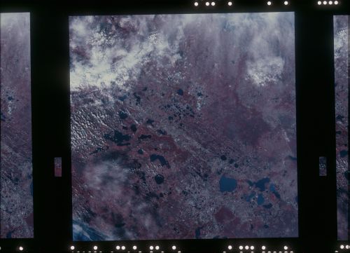
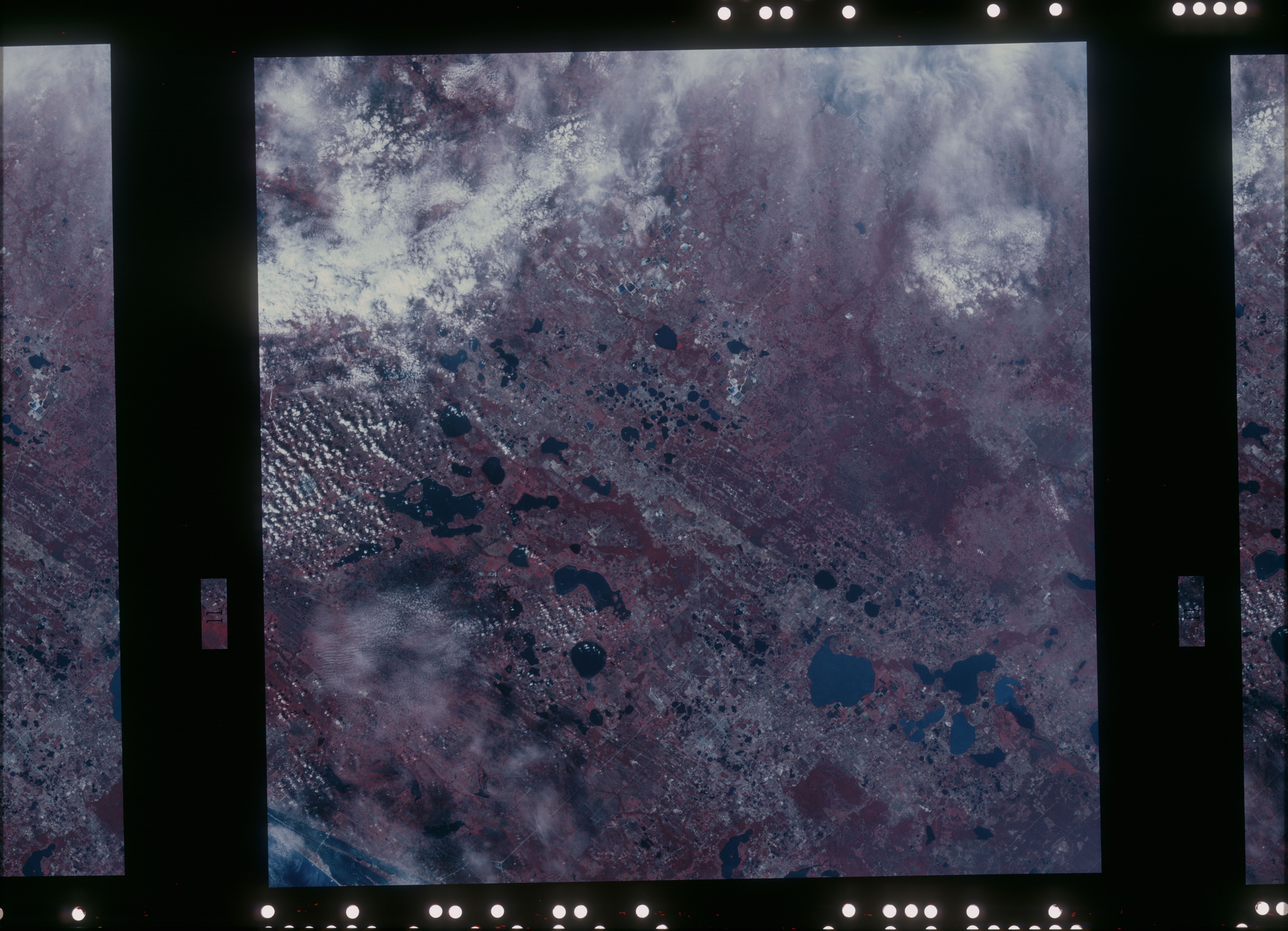
Spacecraft nadir point: 28.2° N, 81.6° W
Photo center point: 28.2° N, 81.6° W
Photo center point by machine learning:
Photo center point: 28.2° N, 81.6° W
Photo center point by machine learning:
Nadir to Photo Center:
Spacecraft Altitude: 237 nautical miles (439km)
Country or Geographic Name: | |
Features: | |
| Features Found Using Machine Learning: | |
Cloud Cover Percentage: | 40 (26-50)% |
Sun Elevation Angle: | ° |
Sun Azimuth: | ° |
Camera: | Skylab Multispectral (S190A) |
Focal Length: | 152mm |
Camera Tilt: | 0 degrees |
Format: | E2443: Kodak color infrared |
Film Exposure: | |
| Additional Information | |
| Width | Height | Annotated | Cropped | Purpose | Links |
|---|---|---|---|---|---|
| 6830 pixels | 4937 pixels | No | No | Download Image | |
| 500 pixels | 361 pixels | No | No | Download Image |
Download Packaged File
Download a Google Earth KML for this Image
View photo footprint information
Download a GeoTIFF for this photo
Image Caption: This color infrared photo of the Orlando, FL area (28.5N,81.5W) shows the extensive citrus tree orchards as neat bright red field patterns. The extensive road and highway network in the central Florida region is clearly visible. Also, the recent urban growth caused by the opening of the Disney World amusement complex just southwest of Orlando is clearly evident. This view spans the width of the state from Tampa Bay to the Atlantic coast.
