NM23-776-820
| NASA Photo ID | NM23-776-820 |
| Focal Length | 250mm |
| Date taken | 1997.05.05 |
| Time taken | 09:09:00 GMT |
Resolutions offered for this image:
4031 x 4031 pixels 639 x 639 pixels 5700 x 6000 pixels 500 x 526 pixels
4031 x 4031 pixels 639 x 639 pixels 5700 x 6000 pixels 500 x 526 pixels

Cloud masks available for this image:
Spacecraft nadir point: 49.0° N, 5.0° E
Photo center point: 47.0° N, 6.0° E
Photo center point by machine learning:
Photo center point: 47.0° N, 6.0° E
Photo center point by machine learning:
Nadir to Photo Center: South
Spacecraft Altitude: 207 nautical miles (383km)
Country or Geographic Name: | FRANCE |
Features: | LAKE GENEVA |
| Features Found Using Machine Learning: | |
Cloud Cover Percentage: | 0 (no clouds present) |
Sun Elevation Angle: | 46° |
Sun Azimuth: | 124° |
Camera: | Hasselblad |
Focal Length: | 250mm |
Camera Tilt: | 33 degrees |
Format: | 2443: Kodak Aerochrome 2443, color IR, thin base, EA-5 process thru June 1999, E-6 process afterward |
Film Exposure: | Normal |
| Additional Information | |
| Width | Height | Annotated | Cropped | Purpose | Links |
|---|---|---|---|---|---|
| 4031 pixels | 4031 pixels | No | No | Earth From Space collection | Download Image |
| 639 pixels | 639 pixels | No | No | Earth From Space collection | Download Image |
| 5700 pixels | 6000 pixels | No | No | Download Image | |
| 500 pixels | 526 pixels | No | No | Download Image |
Download Packaged File
Download a Google Earth KML for this Image
View photo footprint information
Download a GeoTIFF for this photo
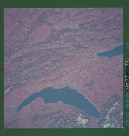
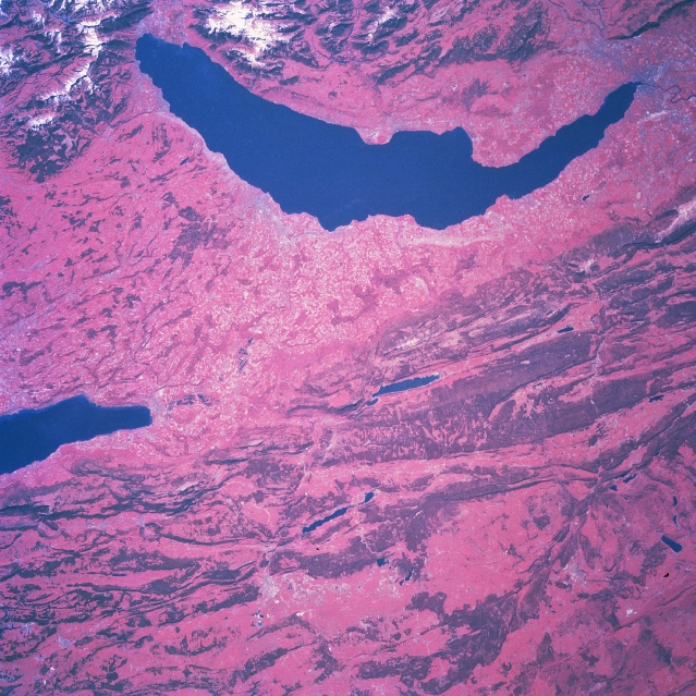
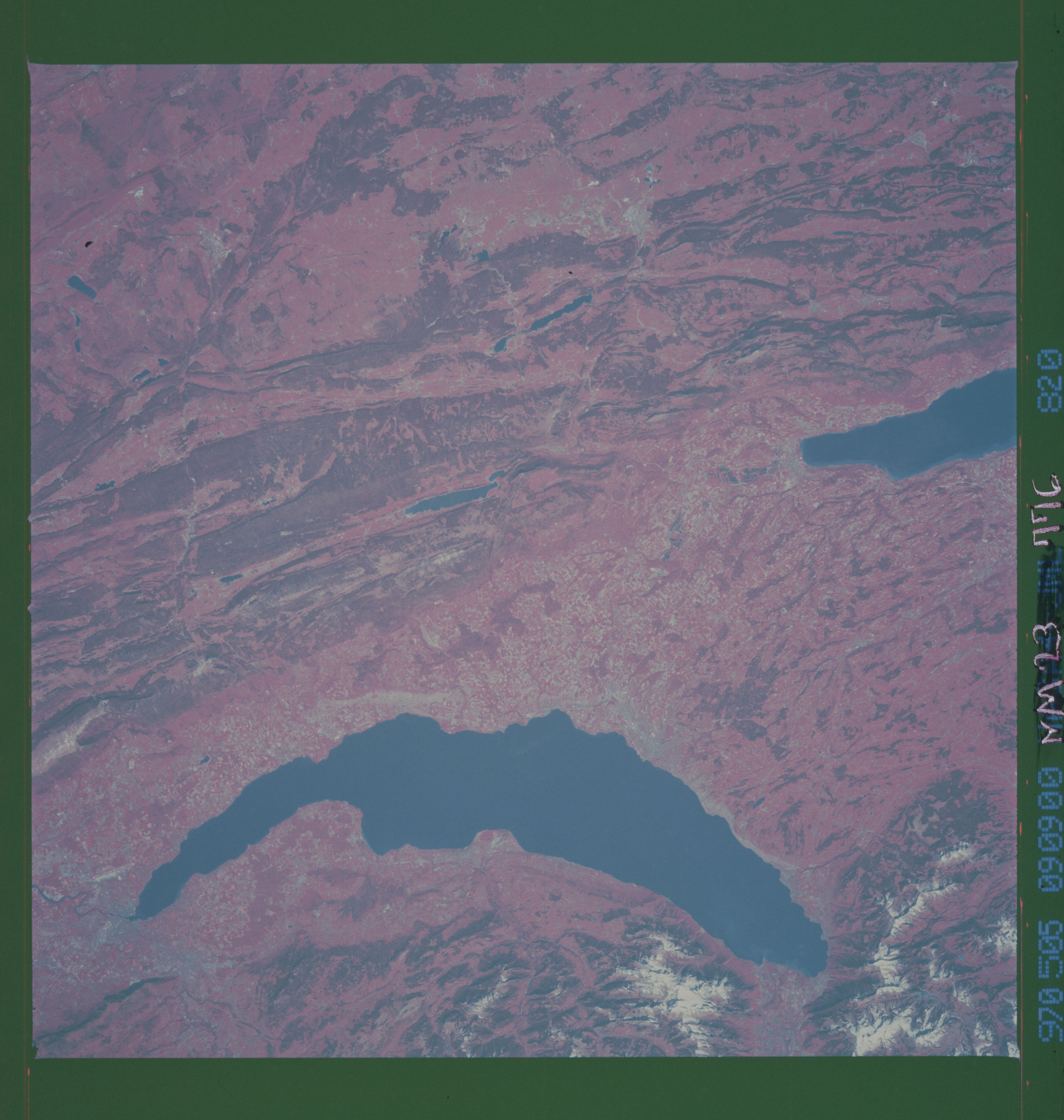
Image Caption: NM23-776-820 Lake Geneva Area, Switzerland Winter/Spring 1997
The western end of Switzerland, including all of Lake Geneva (crescent-shaped, dark feature) is visible in this color infrared image (green vegetation is presented in red colors) that looks south towards the Alps. A small part of the snow capped Swiss Alps (upper left) and the French Alps (upper middle) can be seen along the top margin of the picture. The Swiss city of Geneva is located at the southwest end (upper right) of Lake Geneva. The light-colored, linear feature north of the city is Geneva International Airport. The Jura Mountains, genetically part of the Alpine System, of northwest Switzerland (darker swaths of red) resemble the folded Appalachian System of mountains in the eastern United States. Synclinal valleys are separated by anticlinal ridges but are joined by narrow gorges. The deeper reds represent the green foliage of the forests in this color infrared image, accentuating the parallel, linear-looking ridgelines. The wide basins between some of the ridges are mainly grasslands. The eastern end (lower center) of the Jura Mountains offers a much easier ground route than the rest of the mountains which are a barrier to ground transportation. Tunnels have been cut through the Jura Mountains to permit surface connections between northwestern Europe and Italy.
The western end of Switzerland, including all of Lake Geneva (crescent-shaped, dark feature) is visible in this color infrared image (green vegetation is presented in red colors) that looks south towards the Alps. A small part of the snow capped Swiss Alps (upper left) and the French Alps (upper middle) can be seen along the top margin of the picture. The Swiss city of Geneva is located at the southwest end (upper right) of Lake Geneva. The light-colored, linear feature north of the city is Geneva International Airport. The Jura Mountains, genetically part of the Alpine System, of northwest Switzerland (darker swaths of red) resemble the folded Appalachian System of mountains in the eastern United States. Synclinal valleys are separated by anticlinal ridges but are joined by narrow gorges. The deeper reds represent the green foliage of the forests in this color infrared image, accentuating the parallel, linear-looking ridgelines. The wide basins between some of the ridges are mainly grasslands. The eastern end (lower center) of the Jura Mountains offers a much easier ground route than the rest of the mountains which are a barrier to ground transportation. Tunnels have been cut through the Jura Mountains to permit surface connections between northwestern Europe and Italy.
