NM23-776-760
| NASA Photo ID | NM23-776-760 |
| Focal Length | 100mm |
| Date taken | 1997.05.04 |
| Time taken | 14:55:18 GMT |
Resolutions offered for this image:
4096 x 4056 pixels 640 x 633 pixels 5700 x 6000 pixels 500 x 526 pixels 629 x 630 pixels 629 x 630 pixels
4096 x 4056 pixels 640 x 633 pixels 5700 x 6000 pixels 500 x 526 pixels 629 x 630 pixels 629 x 630 pixels

Cloud masks available for this image:
Spacecraft nadir point: 38.8° N, 1.0° W
Photo center point: 40.5° N, 0.5° E
Photo center point by machine learning:
Photo center point: 40.5° N, 0.5° E
Photo center point by machine learning:
Nadir to Photo Center: Northeast
Spacecraft Altitude: 211 nautical miles (391km)
Country or Geographic Name: | SPAIN |
Features: | RIO EBRO DELTA |
| Features Found Using Machine Learning: | |
Cloud Cover Percentage: | 5 (1-10)% |
Sun Elevation Angle: | 46° |
Sun Azimuth: | 252° |
Camera: | Hasselblad |
Focal Length: | 100mm |
Camera Tilt: | 33 degrees |
Format: | 2443: Kodak Aerochrome 2443, color IR, thin base, EA-5 process thru June 1999, E-6 process afterward |
Film Exposure: | Normal |
| Additional Information | |
| Width | Height | Annotated | Cropped | Purpose | Links |
|---|---|---|---|---|---|
| 4096 pixels | 4056 pixels | No | No | Earth From Space collection | Download Image |
| 640 pixels | 633 pixels | No | No | Earth From Space collection | Download Image |
| 5700 pixels | 6000 pixels | No | No | Download Image | |
| 500 pixels | 526 pixels | No | No | Download Image | |
| 629 pixels | 630 pixels | No | No | Download Image | |
| 629 pixels | 630 pixels | Download Image |
Download Packaged File
Download a Google Earth KML for this Image
View photo footprint information
Download a GeoTIFF for this photo
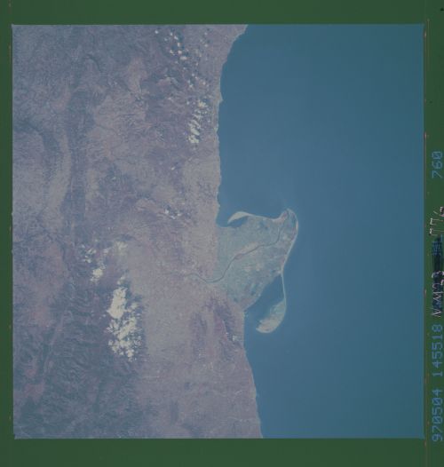
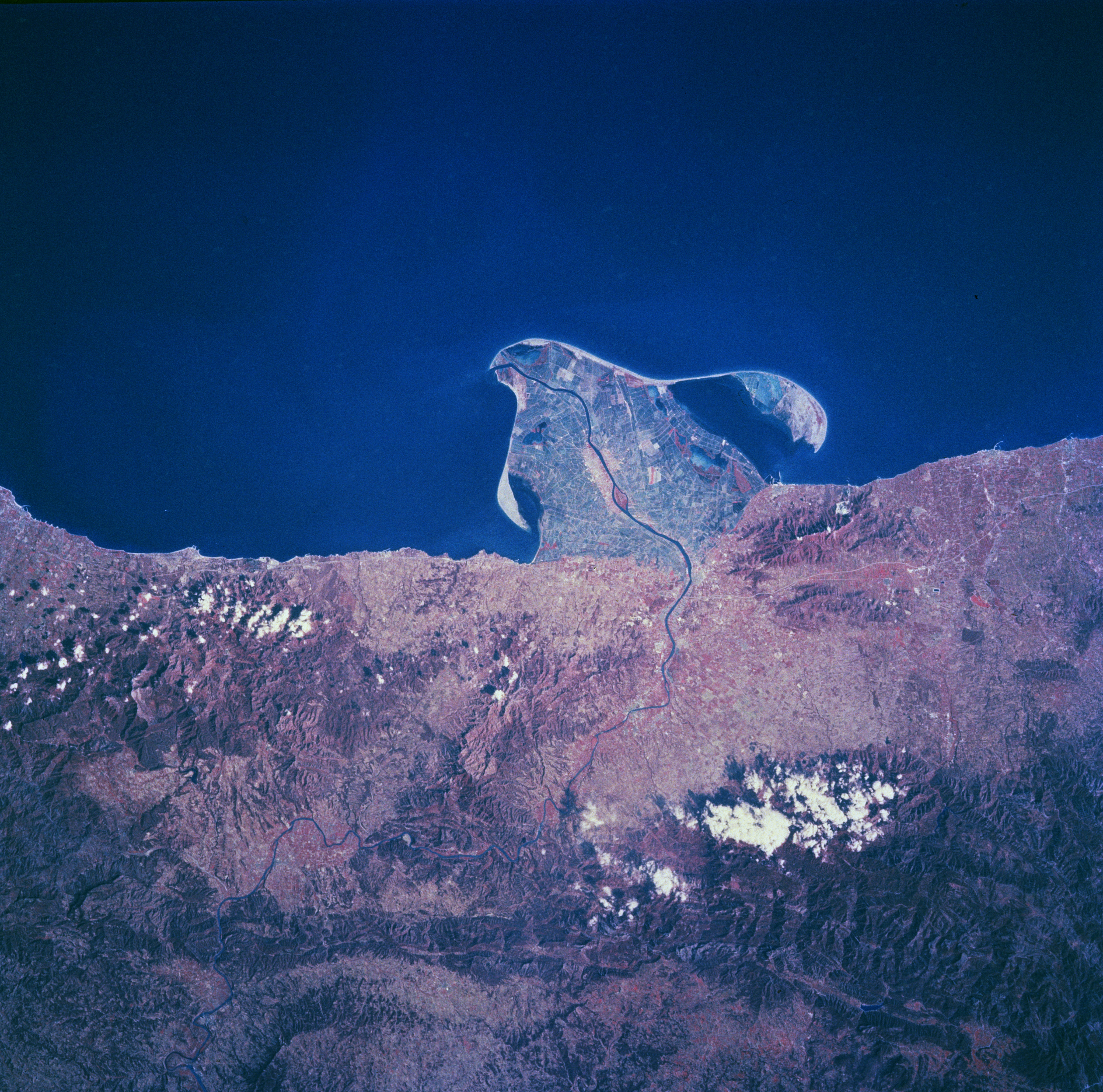
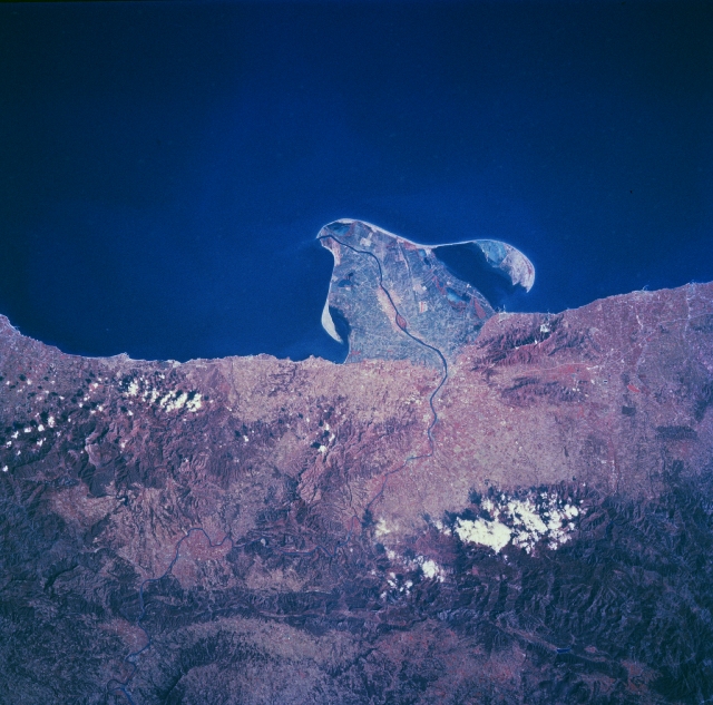
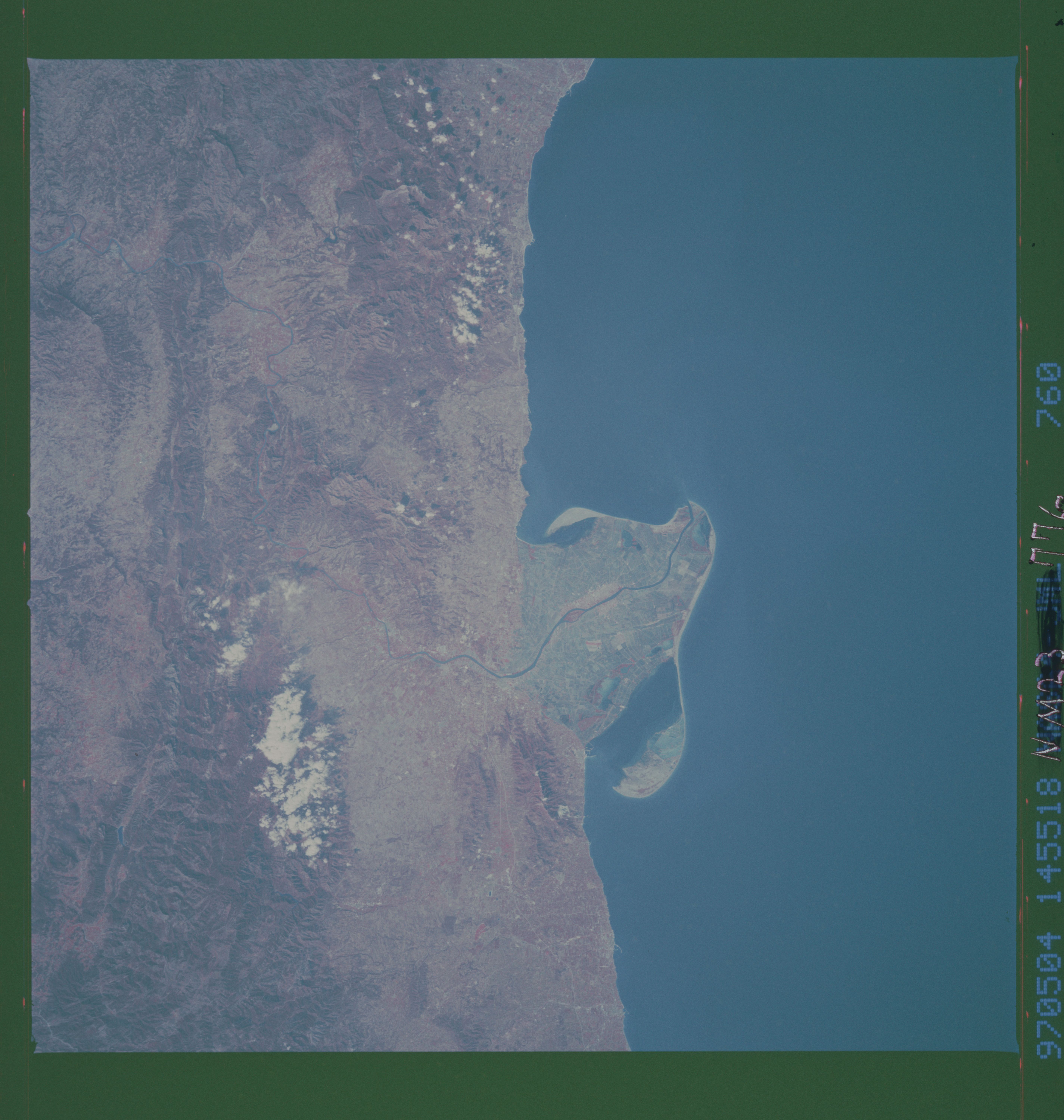
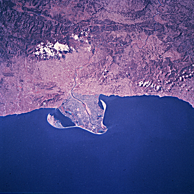
Image Caption: NM23-776-760 Ebro River Delta, Spain Winter/Spring 1997
Southwest of Barcelona along the east coast of Spain, the Ebro River has created a uniquely shaped delta that protrudes into the Mediterranean Sea. The thin, winding dark line (center of the image) is the main channel of the Ebro River. The island of Buda, located at the mouth of the river and on the south side of the main channel on the Ebro, is part of the Ebro Delta Nature Park. The delta is one of the major wetlands along the east coast of Spain. A great diversity of animal habitats presently exists in this environmentally sensitive delta. The construction of many dams inland within the Ebro River Basin has already reduced the flow of water through the delta, thereby reducing the natural silt deposition and retarding future growth of the delta into the Mediterranean Sea. By constructing numerous canals and irrigation ditches that crisscross the delta, conservationists and agricultural operators alike have contributed to and benefited from the effective management and use of the delta. The color infrared film helps to identify the land-water boundaries and the swath of deeper reds (vegetated landscape) inland from the coast show the mountains that parallel the coast, known as the Catalonian Range.
Southwest of Barcelona along the east coast of Spain, the Ebro River has created a uniquely shaped delta that protrudes into the Mediterranean Sea. The thin, winding dark line (center of the image) is the main channel of the Ebro River. The island of Buda, located at the mouth of the river and on the south side of the main channel on the Ebro, is part of the Ebro Delta Nature Park. The delta is one of the major wetlands along the east coast of Spain. A great diversity of animal habitats presently exists in this environmentally sensitive delta. The construction of many dams inland within the Ebro River Basin has already reduced the flow of water through the delta, thereby reducing the natural silt deposition and retarding future growth of the delta into the Mediterranean Sea. By constructing numerous canals and irrigation ditches that crisscross the delta, conservationists and agricultural operators alike have contributed to and benefited from the effective management and use of the delta. The color infrared film helps to identify the land-water boundaries and the swath of deeper reds (vegetated landscape) inland from the coast show the mountains that parallel the coast, known as the Catalonian Range.
