NM23-762-192
| NASA Photo ID | NM23-762-192 |
| Focal Length | 100mm |
| Date taken | 1997.05.02 |
| Time taken | 13:34:51 GMT |
Resolutions offered for this image:
4064 x 4096 pixels 635 x 640 pixels 5700 x 6000 pixels 500 x 526 pixels
4064 x 4096 pixels 635 x 640 pixels 5700 x 6000 pixels 500 x 526 pixels


Cloud masks available for this image:
Spacecraft nadir point: 51.0° N, 5.2° W
Photo center point: 51.5° N, 9.5° W
Photo center point by machine learning:
Photo center point: 51.5° N, 9.5° W
Photo center point by machine learning:
Nadir to Photo Center: West
Spacecraft Altitude: 209 nautical miles (387km)
Country or Geographic Name: | IRELAND |
Features: | BANTRY BAY |
| Features Found Using Machine Learning: | |
Cloud Cover Percentage: | 10 (1-10)% |
Sun Elevation Angle: | 51° |
Sun Azimuth: | 211° |
Camera: | Hasselblad |
Focal Length: | 100mm |
Camera Tilt: | 51 degrees |
Format: | 5046: Kodak, natural color positive, Lumiere 100/5046, ASA 100, standard base |
Film Exposure: | Normal |
| Additional Information | |
| Width | Height | Annotated | Cropped | Purpose | Links |
|---|---|---|---|---|---|
| 4064 pixels | 4096 pixels | No | No | Earth From Space collection | Download Image |
| 635 pixels | 640 pixels | No | No | Earth From Space collection | Download Image |
| 5700 pixels | 6000 pixels | No | No | Download Image | |
| 500 pixels | 526 pixels | No | No | Download Image |
Download Packaged File
Download a Google Earth KML for this Image
View photo footprint information
Download a GeoTIFF for this photo
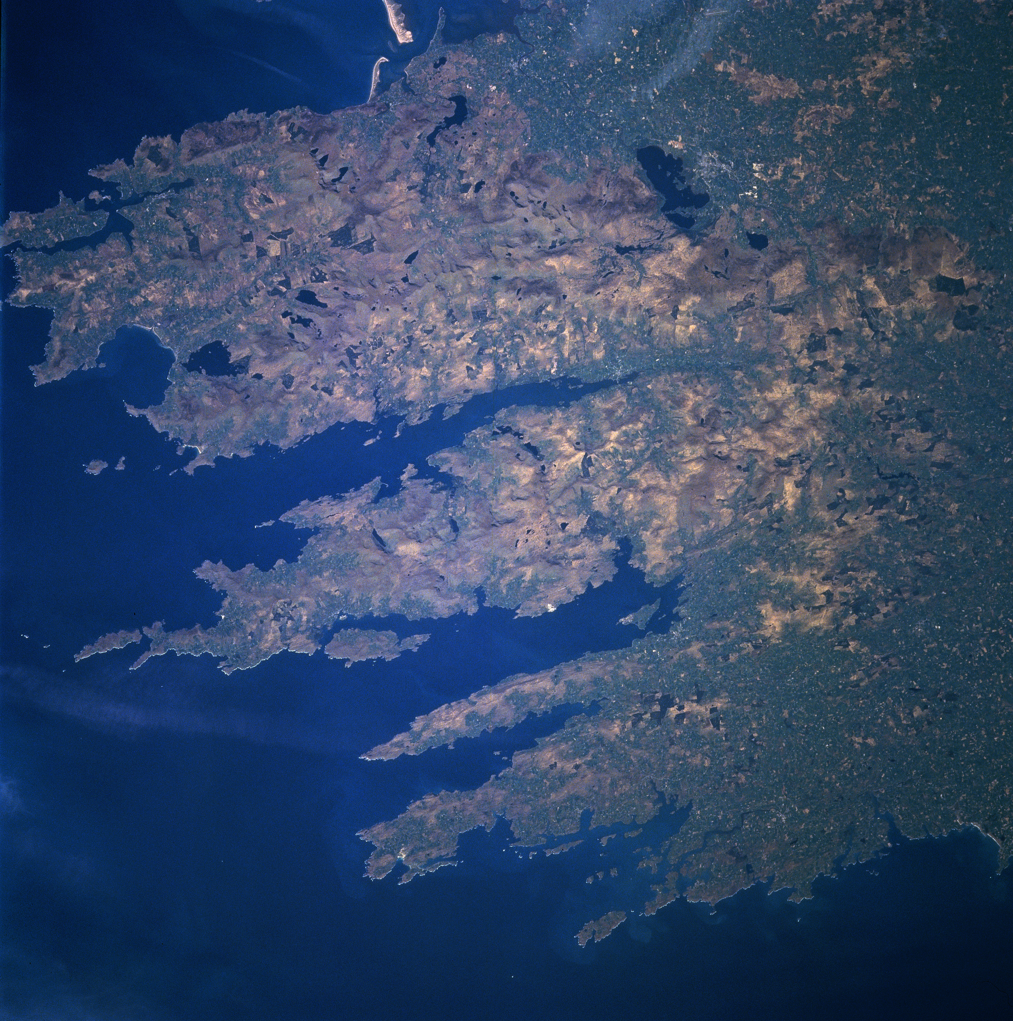
Image Caption: NM23-762-192 Bantry Bay, Macgillicuddy's Reeks, Ireland Winter/Spring 1997
The rugged southwestern coast of Ireland can be seen in this north-looking view. The Macgillicuddy's Reeks Mountain Range, the highest in Ireland, with many peaks exceeding 3000 feet (915 meters) covers most of the area in this image. Dingle Bay is the largest bay in this scene (upper left). Numerous lakes are visible throughout the Macgillicuddy's Reeks, with the largest, Lake Leane seen just to the east of the mountain range near the upper center of the image. The lakes in this region of Ireland, including Lake Leane, were formed over 13000 years by retreating glaciers of the last Ice Age. Extending from near the center of the image to the left (west-southwest) is the deep, narrow Kenmare River. The Kenmare River is 5 miles (8 km) wide at its mouth. Just south of the Kenmare Raiver is Bantry Bay. The Bay is 21 miles (34 km) long and 4 miles (6 km) wide. Bantry Bay was the site of two unsuccessful French landings in 1689 and 1796 to help Irish insurrections. South of Bantry Bay is Mizen Head, the southernmost point of the country of Ireland.
The rugged southwestern coast of Ireland can be seen in this north-looking view. The Macgillicuddy's Reeks Mountain Range, the highest in Ireland, with many peaks exceeding 3000 feet (915 meters) covers most of the area in this image. Dingle Bay is the largest bay in this scene (upper left). Numerous lakes are visible throughout the Macgillicuddy's Reeks, with the largest, Lake Leane seen just to the east of the mountain range near the upper center of the image. The lakes in this region of Ireland, including Lake Leane, were formed over 13000 years by retreating glaciers of the last Ice Age. Extending from near the center of the image to the left (west-southwest) is the deep, narrow Kenmare River. The Kenmare River is 5 miles (8 km) wide at its mouth. Just south of the Kenmare Raiver is Bantry Bay. The Bay is 21 miles (34 km) long and 4 miles (6 km) wide. Bantry Bay was the site of two unsuccessful French landings in 1689 and 1796 to help Irish insurrections. South of Bantry Bay is Mizen Head, the southernmost point of the country of Ireland.
