NM23-761-742
| NASA Photo ID | NM23-761-742 |
| Focal Length | 100mm |
| Date taken | 1997.05.__ |
| Time taken | GMT |
Resolutions offered for this image:
4042 x 4042 pixels 640 x 640 pixels 5700 x 6000 pixels 500 x 526 pixels 499 x 458 pixels 480 x 479 pixels
4042 x 4042 pixels 640 x 640 pixels 5700 x 6000 pixels 500 x 526 pixels 499 x 458 pixels 480 x 479 pixels


Cloud masks available for this image:
Spacecraft nadir point:
Photo center point: 38.0° N, 121.5° W
Photo center point by machine learning:
Photo center point: 38.0° N, 121.5° W
Photo center point by machine learning:
Nadir to Photo Center:
Spacecraft Altitude: nautical miles (0km)
Country or Geographic Name: | USA-CALIFORNIA |
Features: | SAN FRANCISCO |
| Features Found Using Machine Learning: | |
Cloud Cover Percentage: | 0 (no clouds present) |
Sun Elevation Angle: | ° |
Sun Azimuth: | ° |
Camera: | Hasselblad |
Focal Length: | 100mm |
Camera Tilt: | Low Oblique |
Format: | 5046: Kodak, natural color positive, Lumiere 100/5046, ASA 100, standard base |
Film Exposure: | Normal |
| Additional Information | |
| Width | Height | Annotated | Cropped | Purpose | Links |
|---|---|---|---|---|---|
| 4042 pixels | 4042 pixels | No | No | Earth From Space collection | Download Image |
| 640 pixels | 640 pixels | No | No | Earth From Space collection | Download Image |
| 5700 pixels | 6000 pixels | No | No | Download Image | |
| 500 pixels | 526 pixels | No | No | Download Image | |
| 499 pixels | 458 pixels | No | No | Download Image | |
| 480 pixels | 479 pixels | Download Image |
Download Packaged File
Download a Google Earth KML for this Image
View photo footprint information
Download a GeoTIFF for this photo
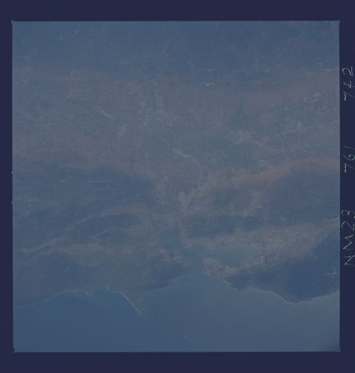
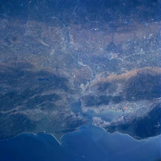
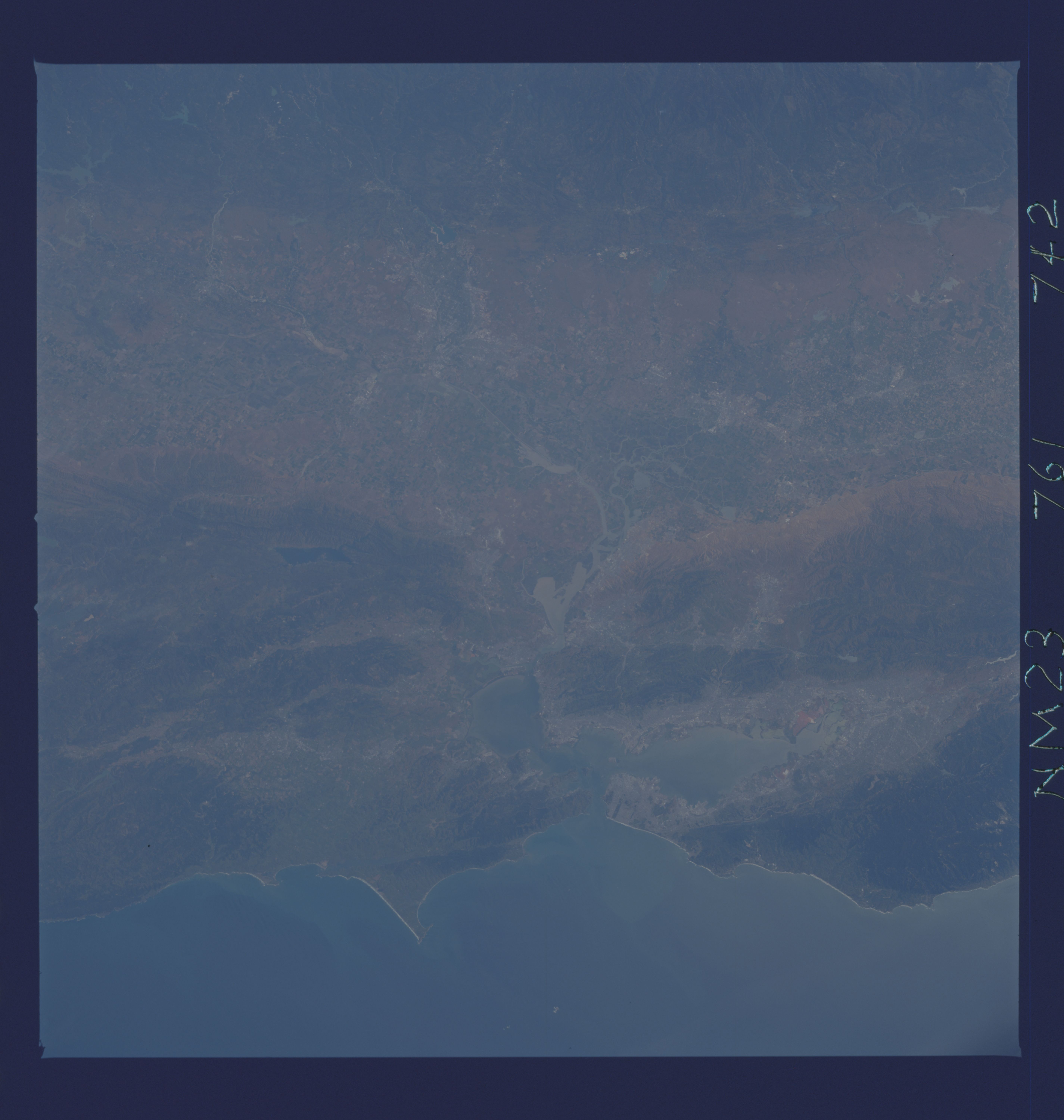
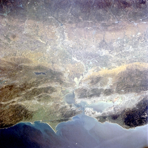
Image Caption: NM23-761-742 Great Valley, California, USA Winter-Spring 1997
The major, lighter colored swath that extends laterally across the terrain (generally oriented northwest-southeast) is the central, low lying section of the Great Valley of California. The northern part of the valley is drained by the south-flowing Sacramento River and the southern part of the valley is drained by the north-flowing San Joaquin River. These rivers merge east of the San Francisco Bay area where they form a sizable delta, partially visible in this image. Even though the Great Valley receives limited precipitation (varies from 20 inches--7.8 centimeters--at the north end of the valley to 6 inches--2.3 centimeters--at the south end of the valley), an extensive irrigation network permits intensive agriculture throughout the valley. The darker landscape along the coast shows the extent of the forested Coastal Ranges that surrounds the San Francisco Bay area. Several major faults, including the San Andreas Fault (linear feature along west side of the bay) and the Hayward Fault (linear feature along east side of the bay) can be traced across this highly faulted and fractured region. The darker line towards the eastern edge of the picture (top) shows a series of parallel faults at the base of the foothills of the Sierra Nevada Mountains. Lake Berryessa (dark rectangular feature) is visible northeast of the bay area.
The major, lighter colored swath that extends laterally across the terrain (generally oriented northwest-southeast) is the central, low lying section of the Great Valley of California. The northern part of the valley is drained by the south-flowing Sacramento River and the southern part of the valley is drained by the north-flowing San Joaquin River. These rivers merge east of the San Francisco Bay area where they form a sizable delta, partially visible in this image. Even though the Great Valley receives limited precipitation (varies from 20 inches--7.8 centimeters--at the north end of the valley to 6 inches--2.3 centimeters--at the south end of the valley), an extensive irrigation network permits intensive agriculture throughout the valley. The darker landscape along the coast shows the extent of the forested Coastal Ranges that surrounds the San Francisco Bay area. Several major faults, including the San Andreas Fault (linear feature along west side of the bay) and the Hayward Fault (linear feature along east side of the bay) can be traced across this highly faulted and fractured region. The darker line towards the eastern edge of the picture (top) shows a series of parallel faults at the base of the foothills of the Sierra Nevada Mountains. Lake Berryessa (dark rectangular feature) is visible northeast of the bay area.
