NM23-761-677
| NASA Photo ID | NM23-761-677 |
| Focal Length | 100mm |
| Date taken | 1997.05.03 |
| Time taken | 15:30:18 GMT |
Resolutions offered for this image:
4048 x 4048 pixels 639 x 639 pixels 5700 x 6000 pixels 500 x 526 pixels 507 x 505 pixels 479 x 480 pixels
4048 x 4048 pixels 639 x 639 pixels 5700 x 6000 pixels 500 x 526 pixels 507 x 505 pixels 479 x 480 pixels


Cloud masks available for this image:
Spacecraft nadir point: 34.8° N, 111.5° W
Photo center point: 32.5° N, 106.5° W
Photo center point by machine learning:
Photo center point: 32.5° N, 106.5° W
Photo center point by machine learning:
Nadir to Photo Center: East
Spacecraft Altitude: 207 nautical miles (383km)
Country or Geographic Name: | USA-NEW MEXICO |
Features: | WHITE SANDS, EL PASO |
| Features Found Using Machine Learning: | |
Cloud Cover Percentage: | 0 (no clouds present) |
Sun Elevation Angle: | 35° |
Sun Azimuth: | 94° |
Camera: | Hasselblad |
Focal Length: | 100mm |
Camera Tilt: | Low Oblique |
Format: | 5046: Kodak, natural color positive, Lumiere 100/5046, ASA 100, standard base |
Film Exposure: | Normal |
| Additional Information | |
| Width | Height | Annotated | Cropped | Purpose | Links |
|---|---|---|---|---|---|
| 4048 pixels | 4048 pixels | No | No | Earth From Space collection | Download Image |
| 639 pixels | 639 pixels | No | No | Earth From Space collection | Download Image |
| 5700 pixels | 6000 pixels | No | No | Download Image | |
| 500 pixels | 526 pixels | No | No | Download Image | |
| 507 pixels | 505 pixels | No | No | Download Image | |
| 479 pixels | 480 pixels | Download Image |
Download Packaged File
Download a Google Earth KML for this Image
View photo footprint information
Download a GeoTIFF for this photo
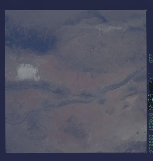
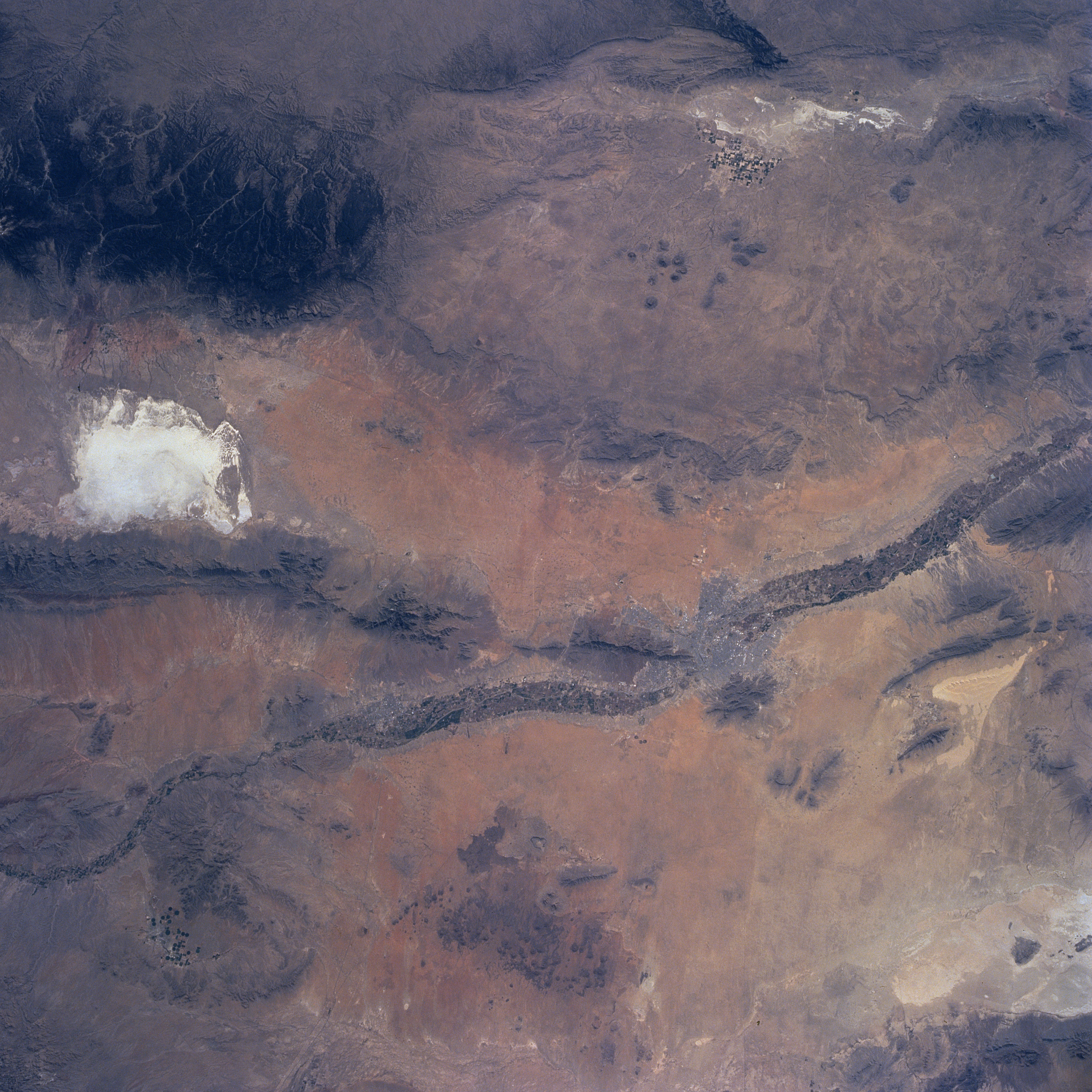
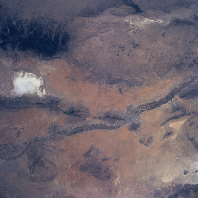
Image Caption: NM23-761-677 Rio Grande Valley, Texas and New Mexico, USA Winter-Spring 1997
Many major natural features, as well as a few human modified landscapes are observed in this synoptic view that shows extreme west Texas, south central New Mexico, and a very small part of Mexico southwest of Ciudad Juarez. The intensively cultivated (irrigated) floodplain of the Rio Grande can be discerned (darker, linear swath) that crosses the picture from northwest to southeast. The Salt Basin of west Texas (small, highly reflective area near the east edge of the image); the much larger and brighter (also highly reflective) White Sands National Monument (the world's largest gypsum dunefield) in south central New Mexico; and the highly reflective salt flats in Mexico (southwest quadrant of the picture) confirms that the entire scene is a desert environment. The San Andres Mountains and the larger, darker Sacramento Mountains (densely forested) border White Sands west and east respectively. The location of El Paso (TX) and Las Cruces (NM) plus El Paso's twin city in Mexico, Ciudad Juarez, can be identified. There is also a small area of irrigated agriculture, mainly center pivot, along the northwest edge of the Salt Basin immediately west of the Guadalupe Mountains (eastern edge of image).
Many major natural features, as well as a few human modified landscapes are observed in this synoptic view that shows extreme west Texas, south central New Mexico, and a very small part of Mexico southwest of Ciudad Juarez. The intensively cultivated (irrigated) floodplain of the Rio Grande can be discerned (darker, linear swath) that crosses the picture from northwest to southeast. The Salt Basin of west Texas (small, highly reflective area near the east edge of the image); the much larger and brighter (also highly reflective) White Sands National Monument (the world's largest gypsum dunefield) in south central New Mexico; and the highly reflective salt flats in Mexico (southwest quadrant of the picture) confirms that the entire scene is a desert environment. The San Andres Mountains and the larger, darker Sacramento Mountains (densely forested) border White Sands west and east respectively. The location of El Paso (TX) and Las Cruces (NM) plus El Paso's twin city in Mexico, Ciudad Juarez, can be identified. There is also a small area of irrigated agriculture, mainly center pivot, along the northwest edge of the Salt Basin immediately west of the Guadalupe Mountains (eastern edge of image).
