NM23-752-340
| NASA Photo ID | NM23-752-340 |
| Focal Length | 100mm |
| Date taken | 1997.04.27 |
| Time taken | 10:25:05 GMT |
Resolutions offered for this image:
5700 x 6000 pixels 500 x 526 pixels 2520 x 2476 pixels 2300 x 2260 pixels
5700 x 6000 pixels 500 x 526 pixels 2520 x 2476 pixels 2300 x 2260 pixels

Cloud masks available for this image:
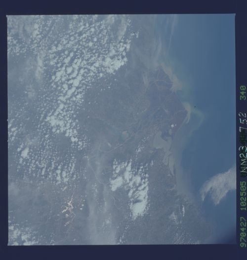
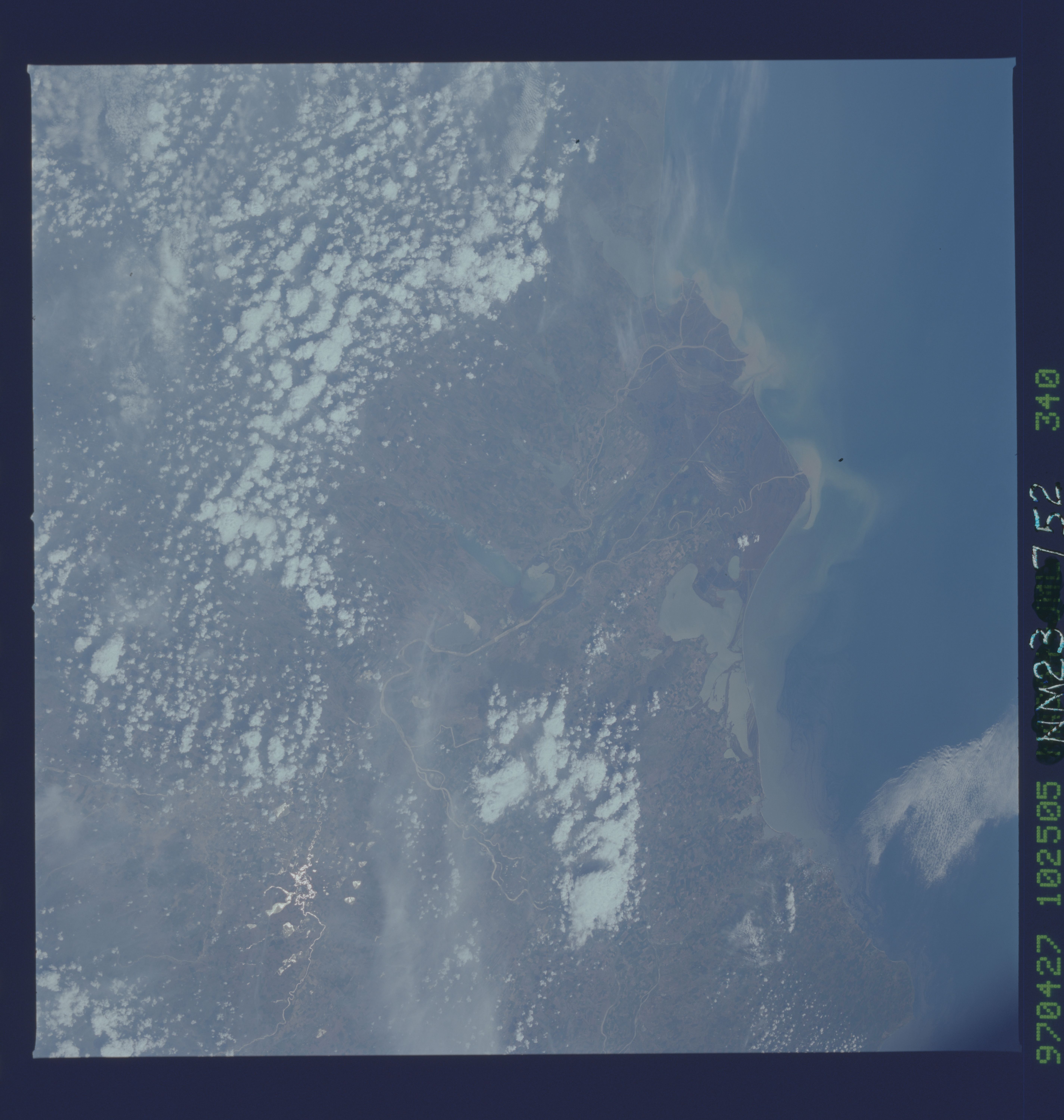
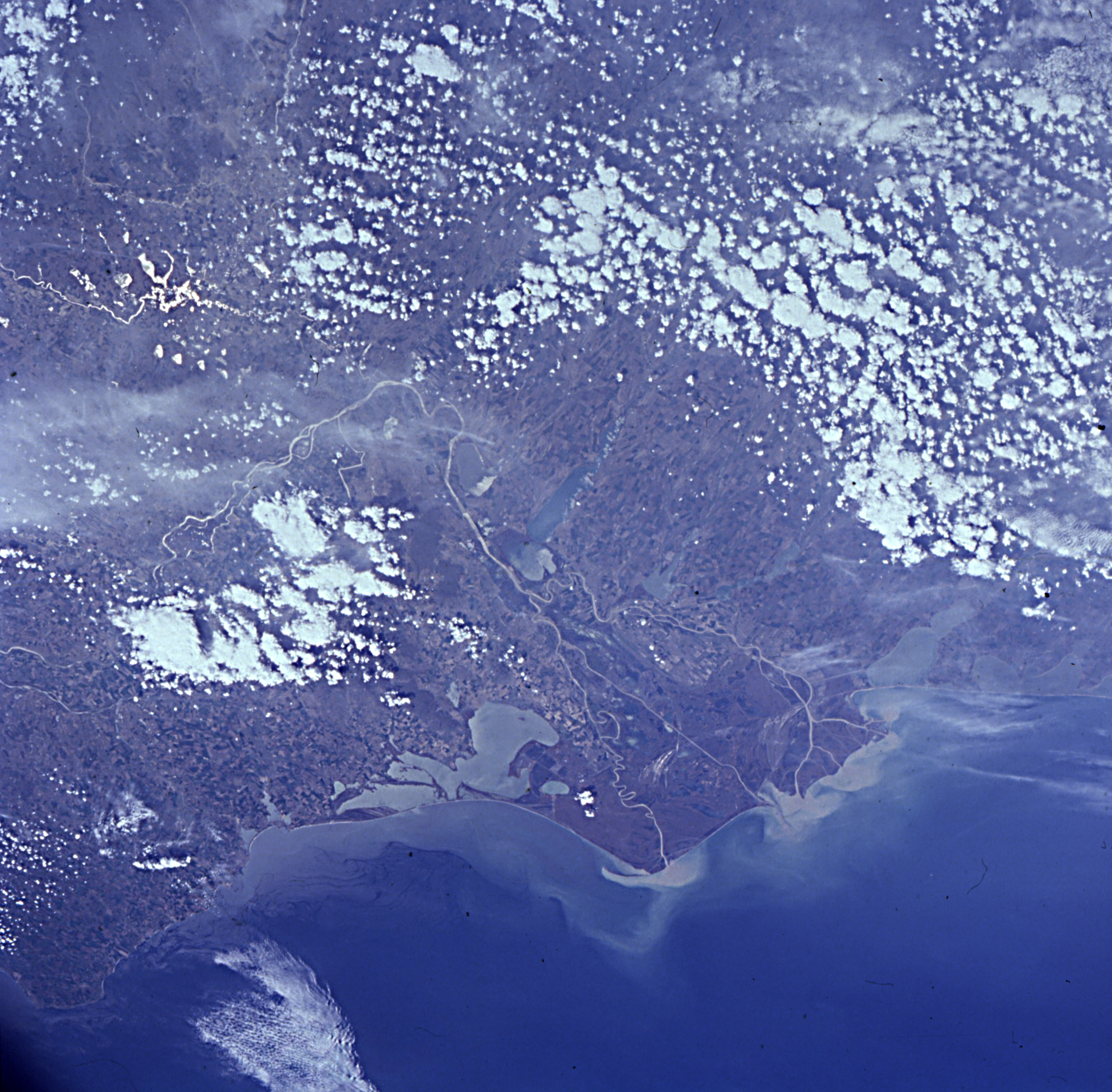
Spacecraft nadir point: 48.7° N, 32.5° E
Photo center point: 45.0° N, 28.5° E
Photo center point by machine learning:
Photo center point: 45.0° N, 28.5° E
Photo center point by machine learning:
Nadir to Photo Center: Southwest
Spacecraft Altitude: 209 nautical miles (387km)
Country or Geographic Name: | ROMANIA |
Features: | DANUBE RIVER DELTA |
| Features Found Using Machine Learning: | |
Cloud Cover Percentage: | 40 (26-50)% |
Sun Elevation Angle: | 55° |
Sun Azimuth: | 196° |
Camera: | Hasselblad |
Focal Length: | 100mm |
Camera Tilt: | Low Oblique |
Format: | 5046: Kodak, natural color positive, Lumiere 100/5046, ASA 100, standard base |
Film Exposure: | Normal |
| Additional Information | |
| Width | Height | Annotated | Cropped | Purpose | Links |
|---|---|---|---|---|---|
| 5700 pixels | 6000 pixels | No | No | Download Image | |
| 500 pixels | 526 pixels | No | No | Download Image | |
| 2520 pixels | 2476 pixels | Download Image | |||
| 2300 pixels | 2260 pixels | No | No | Download Image |
Download Packaged File
Download a Google Earth KML for this Image
View photo footprint information
Download a GeoTIFF for this photo
Image Caption: none
