NM23-746-711

| NASA Photo ID | NM23-746-711 |
| Focal Length | 250mm |
| Date taken | 1997.04.25 |
| Time taken | 18:23:52 GMT |
Resolutions offered for this image:
4036 x 4036 pixels 639 x 639 pixels 5700 x 6000 pixels 500 x 526 pixels 504 x 508 pixels 479 x 479 pixels
4036 x 4036 pixels 639 x 639 pixels 5700 x 6000 pixels 500 x 526 pixels 504 x 508 pixels 479 x 479 pixels

Cloud masks available for this image:
Spacecraft nadir point: 46.1° N, 85.9° W
Photo center point: 48.0° N, 89.0° W
Photo center point by machine learning:
Photo center point: 48.0° N, 89.0° W
Photo center point by machine learning:
Nadir to Photo Center: Northwest
Spacecraft Altitude: 209 nautical miles (387km)
Country or Geographic Name: | CANADA-O |
Features: | ROYALE ISLAND, THUNDER B. |
| Features Found Using Machine Learning: | |
Cloud Cover Percentage: | 5 (1-10)% |
Sun Elevation Angle: | 56° |
Sun Azimuth: | 199° |
Camera: | Hasselblad |
Focal Length: | 250mm |
Camera Tilt: | 46 degrees |
Format: | 5046: Kodak, natural color positive, Lumiere 100/5046, ASA 100, standard base |
Film Exposure: | Normal |
| Additional Information | |
| Width | Height | Annotated | Cropped | Purpose | Links |
|---|---|---|---|---|---|
| 4036 pixels | 4036 pixels | No | No | Earth From Space collection | Download Image |
| 639 pixels | 639 pixels | No | No | Earth From Space collection | Download Image |
| 5700 pixels | 6000 pixels | No | No | Download Image | |
| 500 pixels | 526 pixels | No | No | Download Image | |
| 504 pixels | 508 pixels | No | No | Download Image | |
| 479 pixels | 479 pixels | Download Image |
Download Packaged File
Download a Google Earth KML for this Image
View photo footprint information
Download a GeoTIFF for this photo
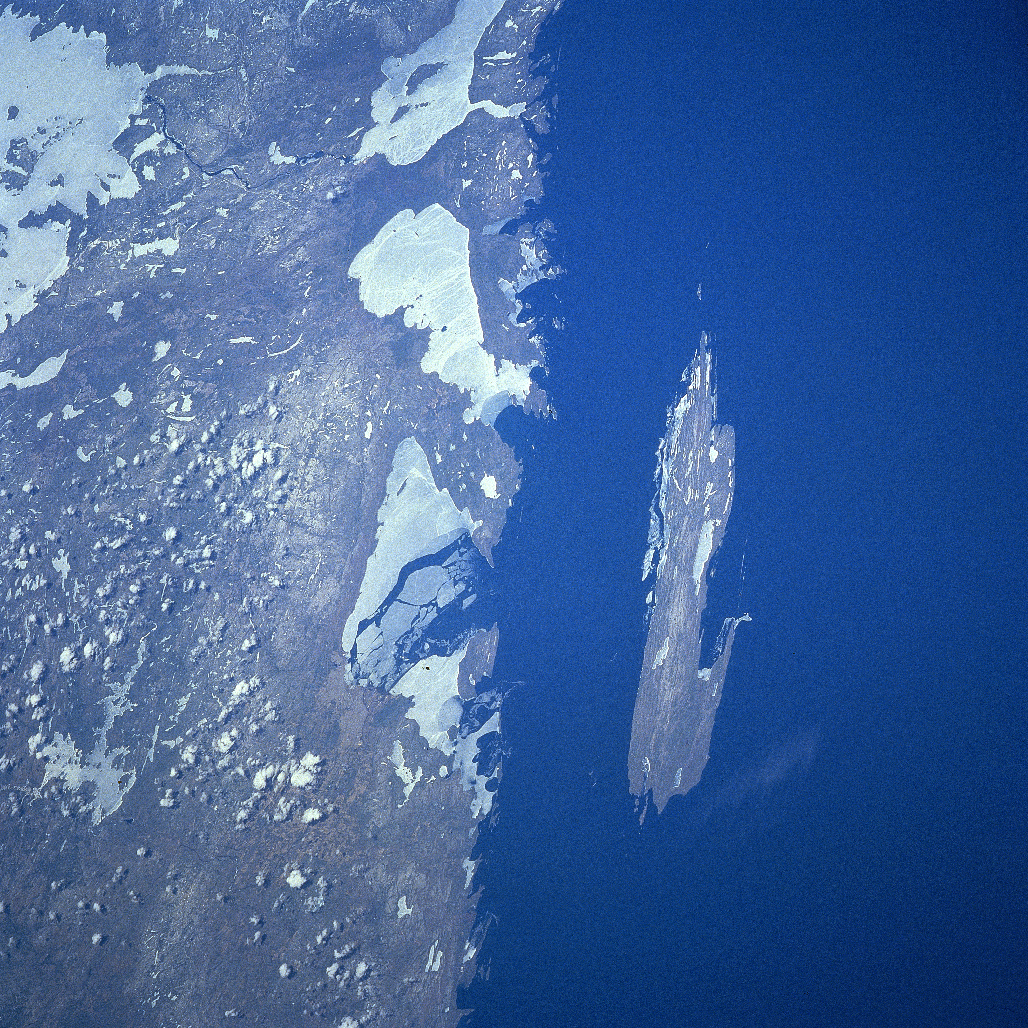
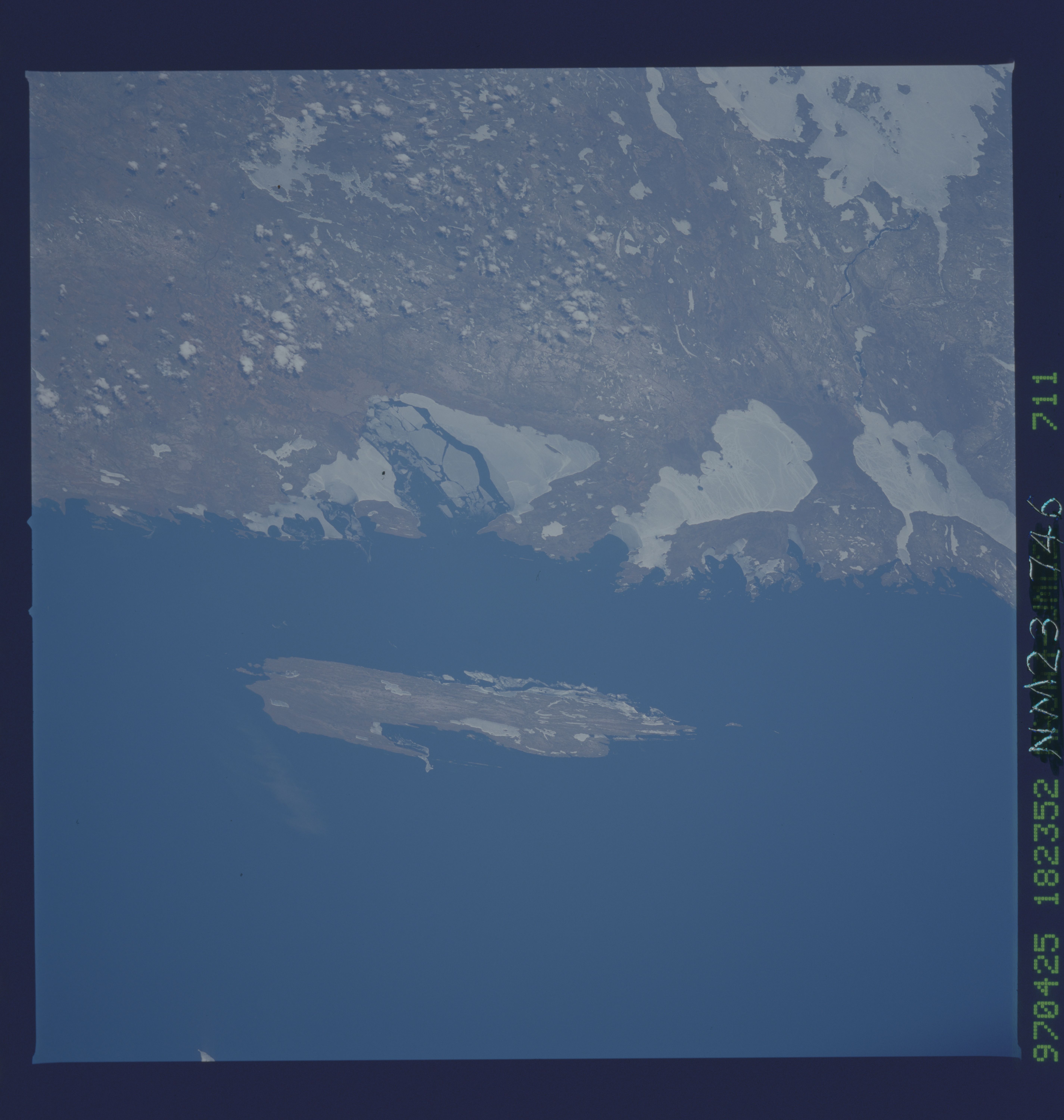
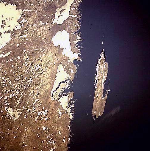
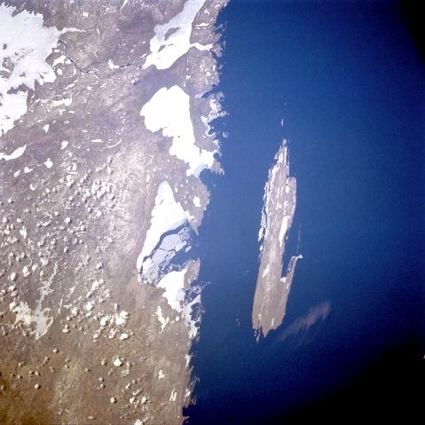
Image Caption: NM23-746-711 Thunder Bay, Isle Royale, Ontario, Canada Winter 1997
This east-northeast-looking low-oblique view shows the shoreline and ice covered bays of southwestern Ontario and Isle Royale just off shore. Isle Royale and its smaller islands is a wilderness area in northwest Lake Superior and is part of the International Biosphere Reserve System. Isle Royale is a semi-primitive forested area 9 miles (14 km) wide and 45 miles (72 km) long and has a land area of 210 sq. miles (545 sq. km). The island has rugged fjord-like shorelines with excellent harbors and is dotted with 30 lakes. The highest point on the island near its southwestern end is Mount Desor at 1346 feet (411 meters). Bald eagles, timber wolves, and a great herd of moose enjoy their natural habitat. Tourism on the island is limited from late April to early October. Fishing in the bays around the island is excellent. Partially ice-covered Thunder Bay, an inlet of Lake Superior, is visible just to the left (northwest) of Isle Royale. The southern portions of the ice covered Lake Nipogoon, one of the largest freshwater lakes in Ontario, is discernible in the top-left portion of the image.
This east-northeast-looking low-oblique view shows the shoreline and ice covered bays of southwestern Ontario and Isle Royale just off shore. Isle Royale and its smaller islands is a wilderness area in northwest Lake Superior and is part of the International Biosphere Reserve System. Isle Royale is a semi-primitive forested area 9 miles (14 km) wide and 45 miles (72 km) long and has a land area of 210 sq. miles (545 sq. km). The island has rugged fjord-like shorelines with excellent harbors and is dotted with 30 lakes. The highest point on the island near its southwestern end is Mount Desor at 1346 feet (411 meters). Bald eagles, timber wolves, and a great herd of moose enjoy their natural habitat. Tourism on the island is limited from late April to early October. Fishing in the bays around the island is excellent. Partially ice-covered Thunder Bay, an inlet of Lake Superior, is visible just to the left (northwest) of Isle Royale. The southern portions of the ice covered Lake Nipogoon, one of the largest freshwater lakes in Ontario, is discernible in the top-left portion of the image.
