NM23-744-633
| NASA Photo ID | NM23-744-633 |
| Focal Length | 250mm |
| Date taken | 1997.04.22 |
| Time taken | 18:05:04 GMT |
Resolutions offered for this image:
3994 x 3994 pixels 640 x 640 pixels 5700 x 6000 pixels 500 x 526 pixels 503 x 509 pixels 479 x 479 pixels
3994 x 3994 pixels 640 x 640 pixels 5700 x 6000 pixels 500 x 526 pixels 503 x 509 pixels 479 x 479 pixels

Cloud masks available for this image:
Spacecraft nadir point: 44.0° N, 68.3° W
Photo center point: 42.0° N, 70.5° W
Photo center point by machine learning:
Photo center point: 42.0° N, 70.5° W
Photo center point by machine learning:
Nadir to Photo Center: Southwest
Spacecraft Altitude: 210 nautical miles (389km)
Country or Geographic Name: | USA-MASSACHUSETTS |
Features: | CAPE COD |
| Features Found Using Machine Learning: | |
Cloud Cover Percentage: | 0 (no clouds present) |
Sun Elevation Angle: | 53° |
Sun Azimuth: | 220° |
Camera: | Hasselblad |
Focal Length: | 250mm |
Camera Tilt: | 40 degrees |
Format: | 5046: Kodak, natural color positive, Lumiere 100/5046, ASA 100, standard base |
Film Exposure: | Normal |
| Additional Information | |
| Width | Height | Annotated | Cropped | Purpose | Links |
|---|---|---|---|---|---|
| 3994 pixels | 3994 pixels | No | No | Earth From Space collection | Download Image |
| 640 pixels | 640 pixels | No | No | Earth From Space collection | Download Image |
| 5700 pixels | 6000 pixels | No | No | Download Image | |
| 500 pixels | 526 pixels | No | No | Download Image | |
| 503 pixels | 509 pixels | No | No | Download Image | |
| 479 pixels | 479 pixels | Download Image |
Download Packaged File
Download a Google Earth KML for this Image
View photo footprint information
Download a GeoTIFF for this photo
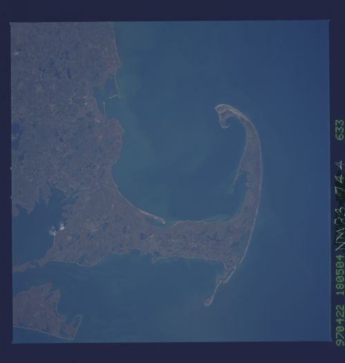
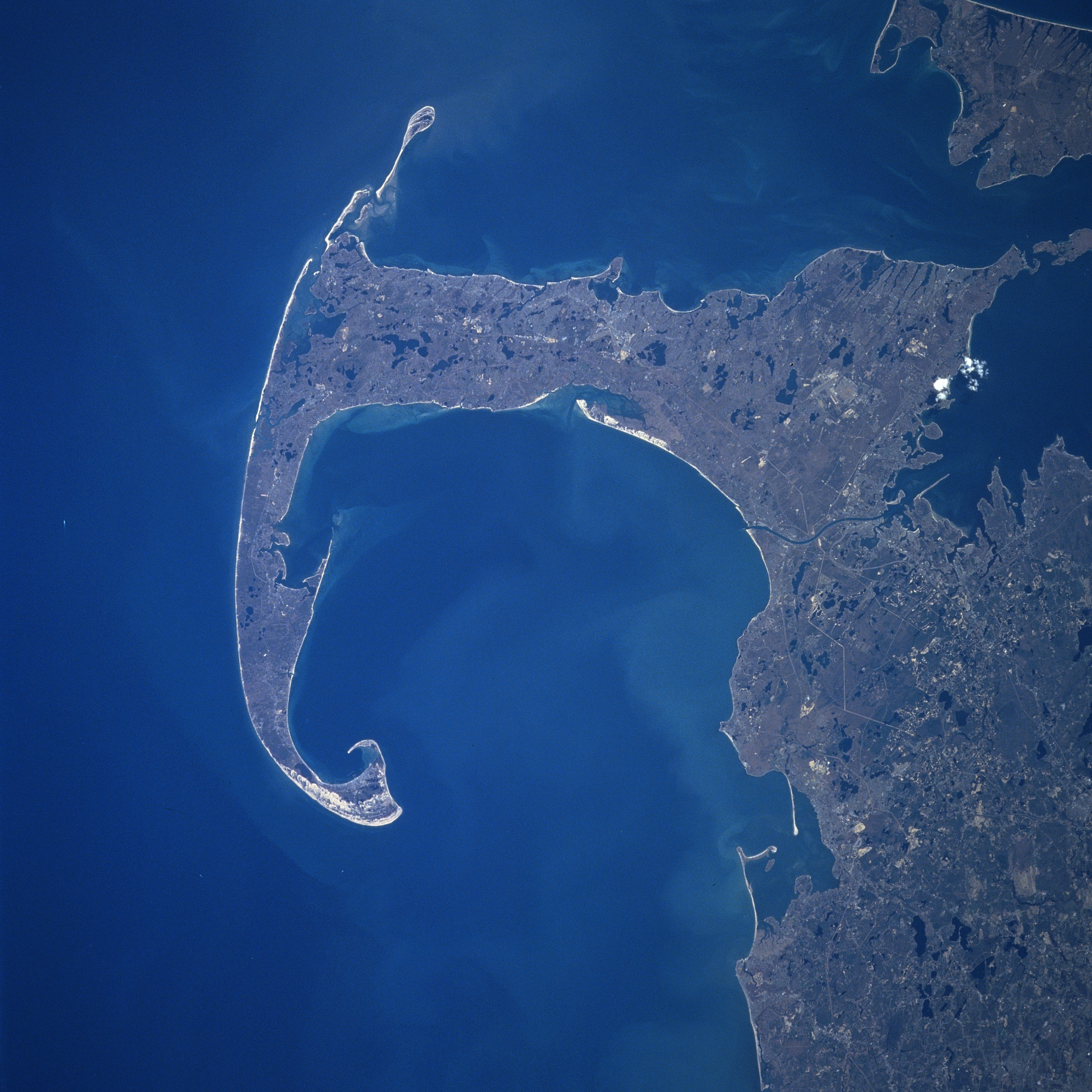
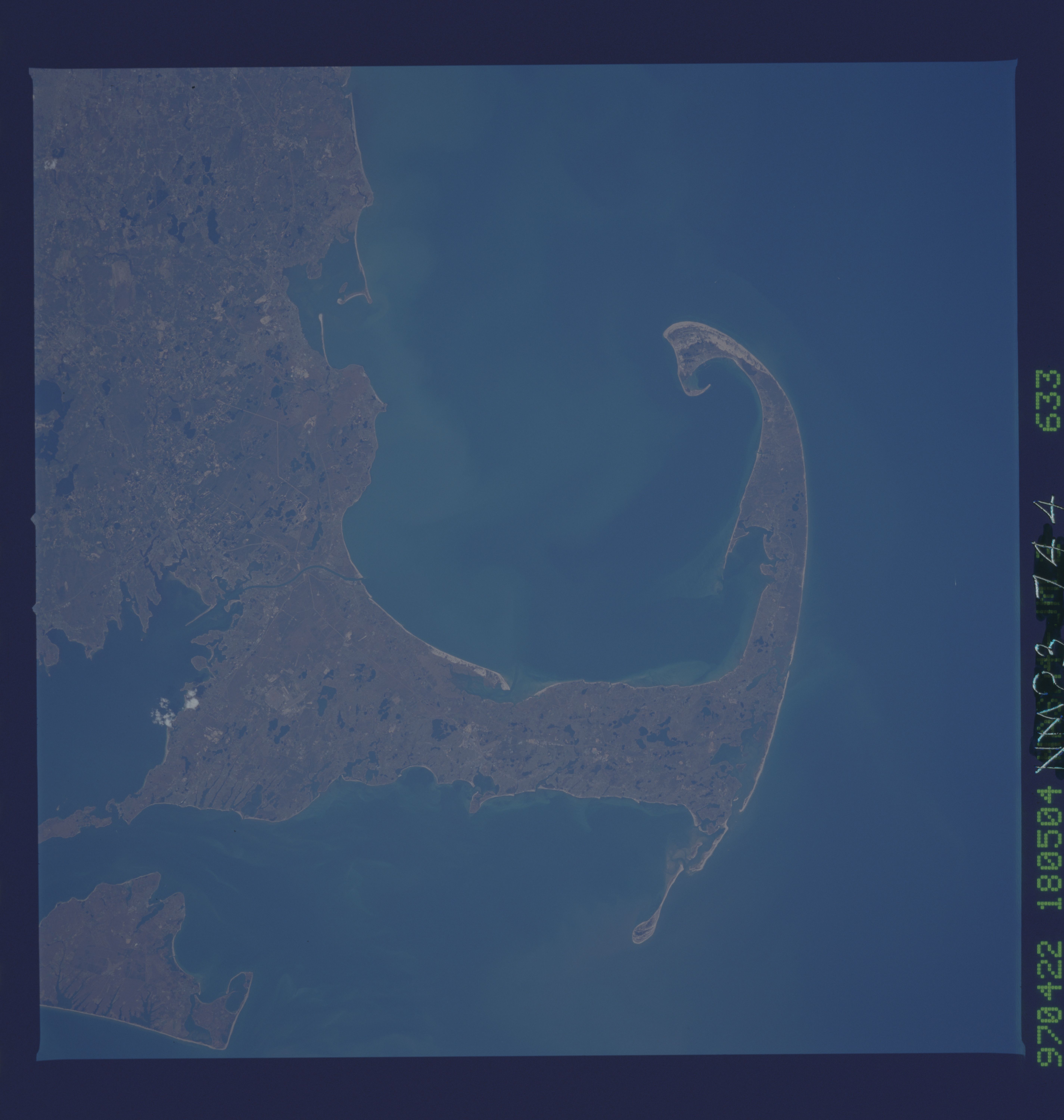
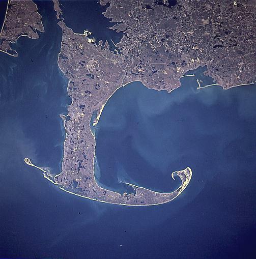
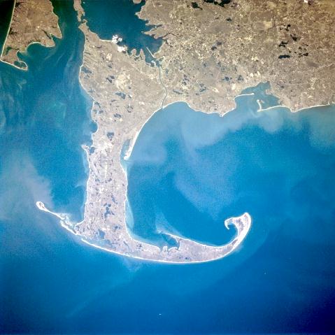
Image Caption: NM23-744-633 Cape Cod, Massachusetts Spring, 1997
Cape Cod and Cape Cod Bay (visible at the center of the image) can be seen in this generally south-looking view. Cape Cod is a narrow peninsula, glacial in origin that is constantly changing as winds and water move sand along the shoreline. Cape Cod extends 65 miles (105 km) east and north into the Atlantic Ocean. Parts of Cape Cod peninsula constitute the Cape Cod National Seashore, an area covering 44600 acres (18063 hectares). This area contains beaches, sand dunes, marshes, freshwater ponds, and historic sites, including the first Marconi wireless station in the United States. A portion of Martha's Vineyard can be seen in the upper right corner of the image.
Cape Cod and Cape Cod Bay (visible at the center of the image) can be seen in this generally south-looking view. Cape Cod is a narrow peninsula, glacial in origin that is constantly changing as winds and water move sand along the shoreline. Cape Cod extends 65 miles (105 km) east and north into the Atlantic Ocean. Parts of Cape Cod peninsula constitute the Cape Cod National Seashore, an area covering 44600 acres (18063 hectares). This area contains beaches, sand dunes, marshes, freshwater ponds, and historic sites, including the first Marconi wireless station in the United States. A portion of Martha's Vineyard can be seen in the upper right corner of the image.
