NM23-735-942
| NASA Photo ID | NM23-735-942 |
| Focal Length | 250mm |
| Date taken | 1997.04.18 |
| Time taken | 06:49:04 GMT |
Resolutions offered for this image:
3958 x 4014 pixels 631 x 639 pixels 5700 x 6000 pixels 500 x 526 pixels 515 x 508 pixels
3958 x 4014 pixels 631 x 639 pixels 5700 x 6000 pixels 500 x 526 pixels 515 x 508 pixels
Cloud masks available for this image:
Spacecraft nadir point: 17.1° N, 116.0° W
Photo center point: 26.0° N, 90.5° E
Photo center point by machine learning:
Photo center point: 26.0° N, 90.5° E
Photo center point by machine learning:
Nadir to Photo Center: West
Spacecraft Altitude: 211 nautical miles (391km)
Country or Geographic Name: | INDIA |
Features: | BRAHMAPUTRA RIVER |
| Features Found Using Machine Learning: | |
Cloud Cover Percentage: | 10 (1-10)% |
Sun Elevation Angle: | -59° |
Sun Azimuth: | 333° |
Camera: | Hasselblad |
Focal Length: | 250mm |
Camera Tilt: | Low Oblique |
Format: | 5046: Kodak, natural color positive, Lumiere 100/5046, ASA 100, standard base |
Film Exposure: | Normal |
| Additional Information | |
| Width | Height | Annotated | Cropped | Purpose | Links |
|---|---|---|---|---|---|
| 3958 pixels | 4014 pixels | No | No | Earth From Space collection | Download Image |
| 631 pixels | 639 pixels | No | No | Earth From Space collection | Download Image |
| 5700 pixels | 6000 pixels | No | No | Download Image | |
| 500 pixels | 526 pixels | No | No | Download Image | |
| 515 pixels | 508 pixels | Download Image |
Download Packaged File
Download a Google Earth KML for this Image
View photo footprint information
Download a GeoTIFF for this photo
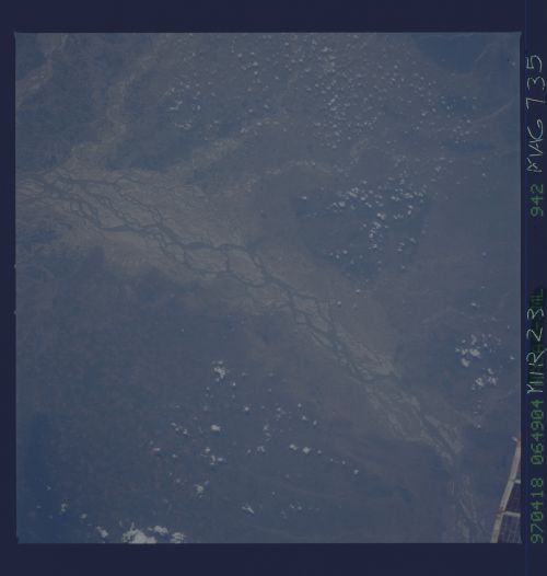
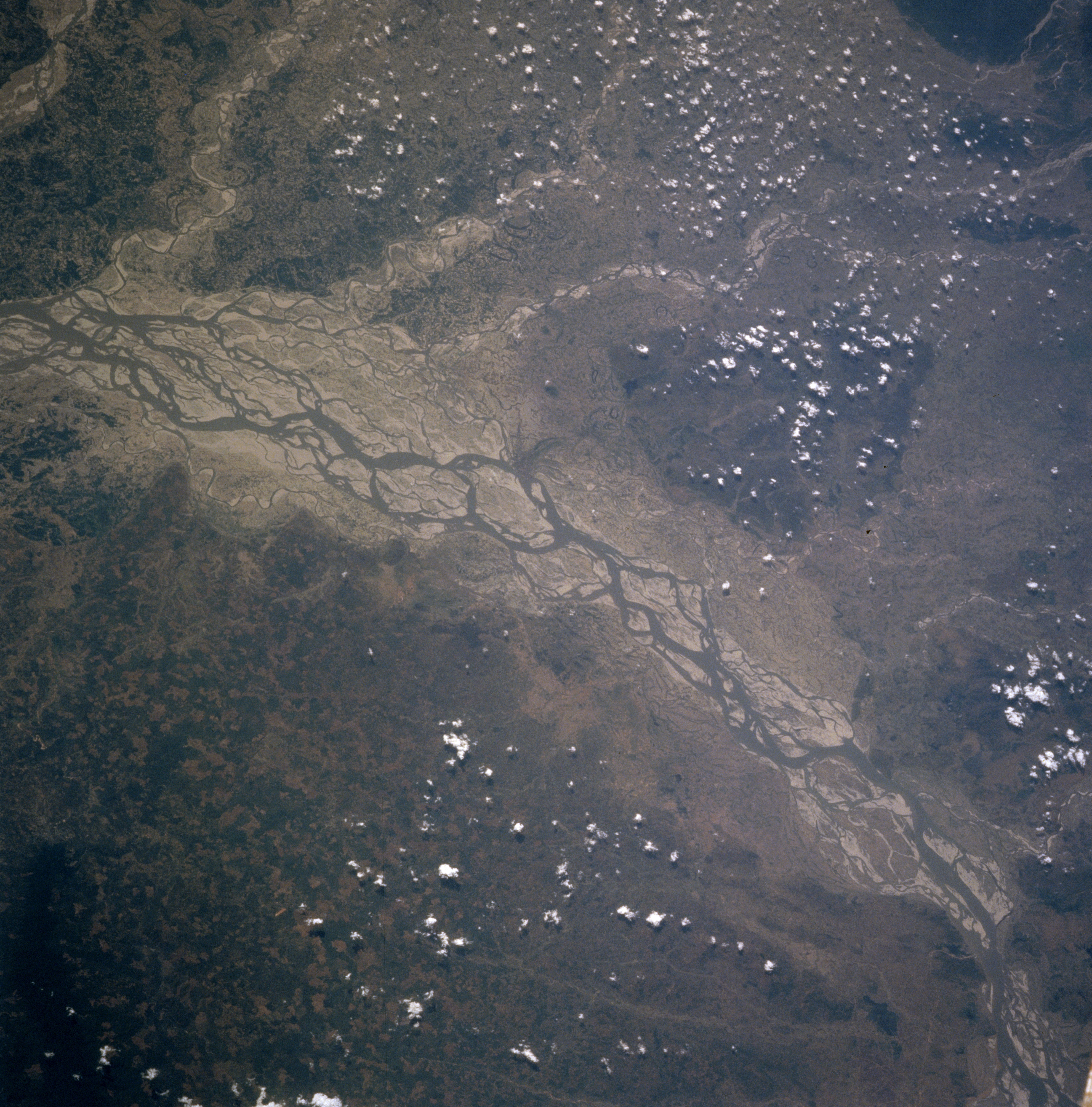
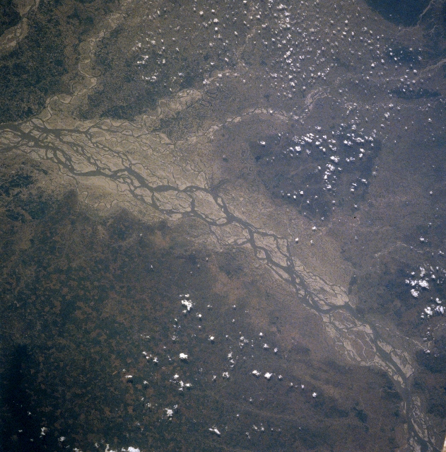
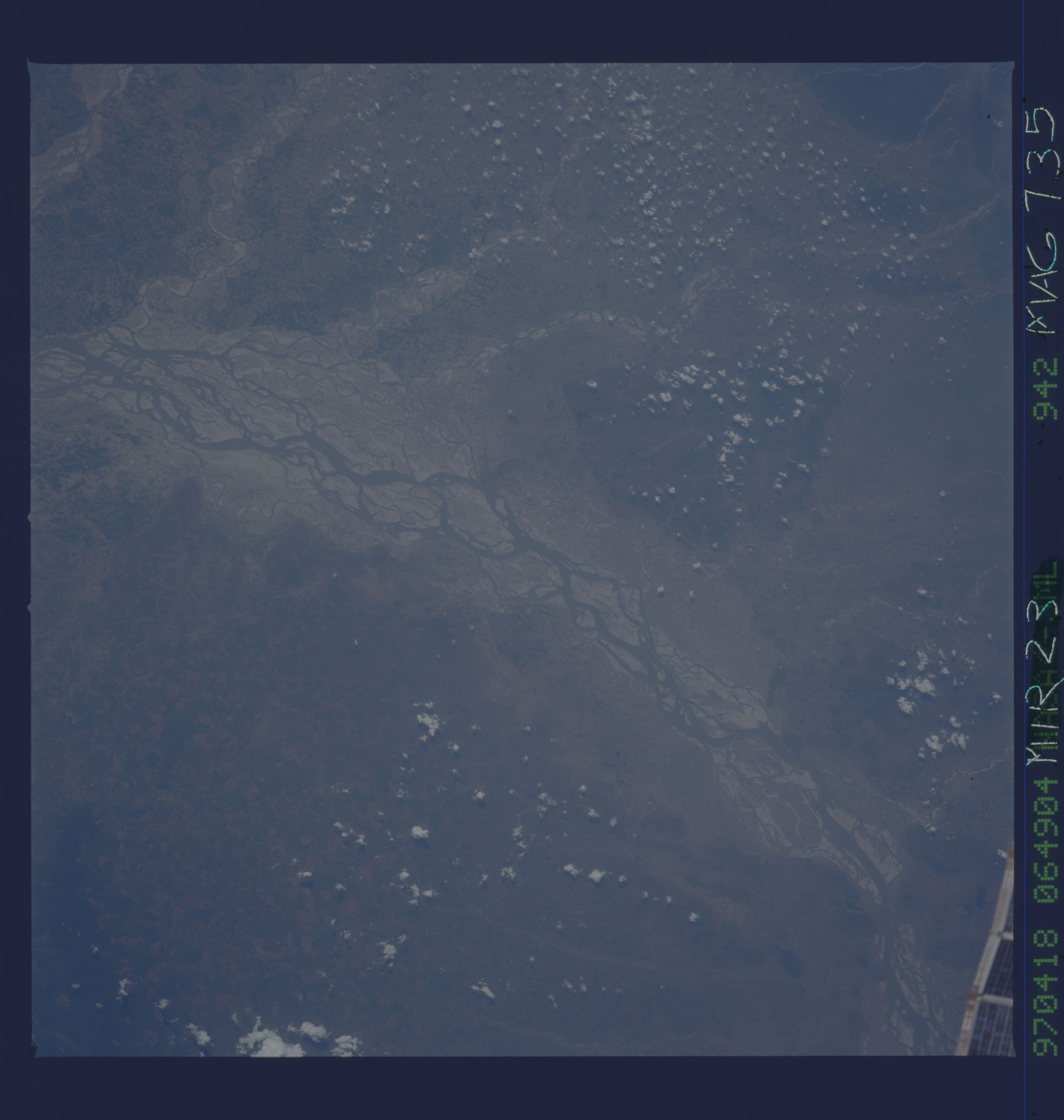
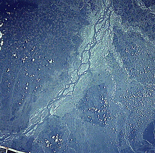
Image Caption: NM23-735-942 Brahmaputra River, India Winter-Spring 1997
The braided, multiple channels of the Brahmaputra River of northeast India and northern Bangladesh makes a significant course change (flowing west-bottom right to flowing south-left middle), as the river skirts the northwest end of the Khasi Hills (darker area, lower left). The image was acquired during the post-summer wet monsoon period, reflecting a river that has not received much runoff from the surrounding terrain for several months. The extensive floodplain, the braided channels, and the large, light-colored sand bars are all indications of low water conditions in the river. Even the tributary streams (meandering, thin dark lines) that drain the northern part of the basin from the front range of the Himalayas show extensive sandbars. This is another indication that runoff from the hills and mountains in Northeast India and Bhutan is minimal at this time of year. Darker areas are more heavily vegetated. A small piece of the Space Shuttle can be seen in the lower right corner of the image.
The braided, multiple channels of the Brahmaputra River of northeast India and northern Bangladesh makes a significant course change (flowing west-bottom right to flowing south-left middle), as the river skirts the northwest end of the Khasi Hills (darker area, lower left). The image was acquired during the post-summer wet monsoon period, reflecting a river that has not received much runoff from the surrounding terrain for several months. The extensive floodplain, the braided channels, and the large, light-colored sand bars are all indications of low water conditions in the river. Even the tributary streams (meandering, thin dark lines) that drain the northern part of the basin from the front range of the Himalayas show extensive sandbars. This is another indication that runoff from the hills and mountains in Northeast India and Bhutan is minimal at this time of year. Darker areas are more heavily vegetated. A small piece of the Space Shuttle can be seen in the lower right corner of the image.
