NM23-730-271

| NASA Photo ID | NM23-730-271 |
| Focal Length | 100mm |
| Date taken | 1997.04.17 |
| Time taken | 13:18:15 GMT |
Resolutions offered for this image:
5700 x 6000 pixels 500 x 526 pixels 4784 x 4736 pixels 578 x 585 pixels
5700 x 6000 pixels 500 x 526 pixels 4784 x 4736 pixels 578 x 585 pixels

Cloud masks available for this image:
Spacecraft nadir point: 15.1° N, 2.6° W
Photo center point: 14.5° N, 4.5° W
Photo center point by machine learning:
Photo center point: 14.5° N, 4.5° W
Photo center point by machine learning:
Nadir to Photo Center: West
Spacecraft Altitude: 211 nautical miles (391km)
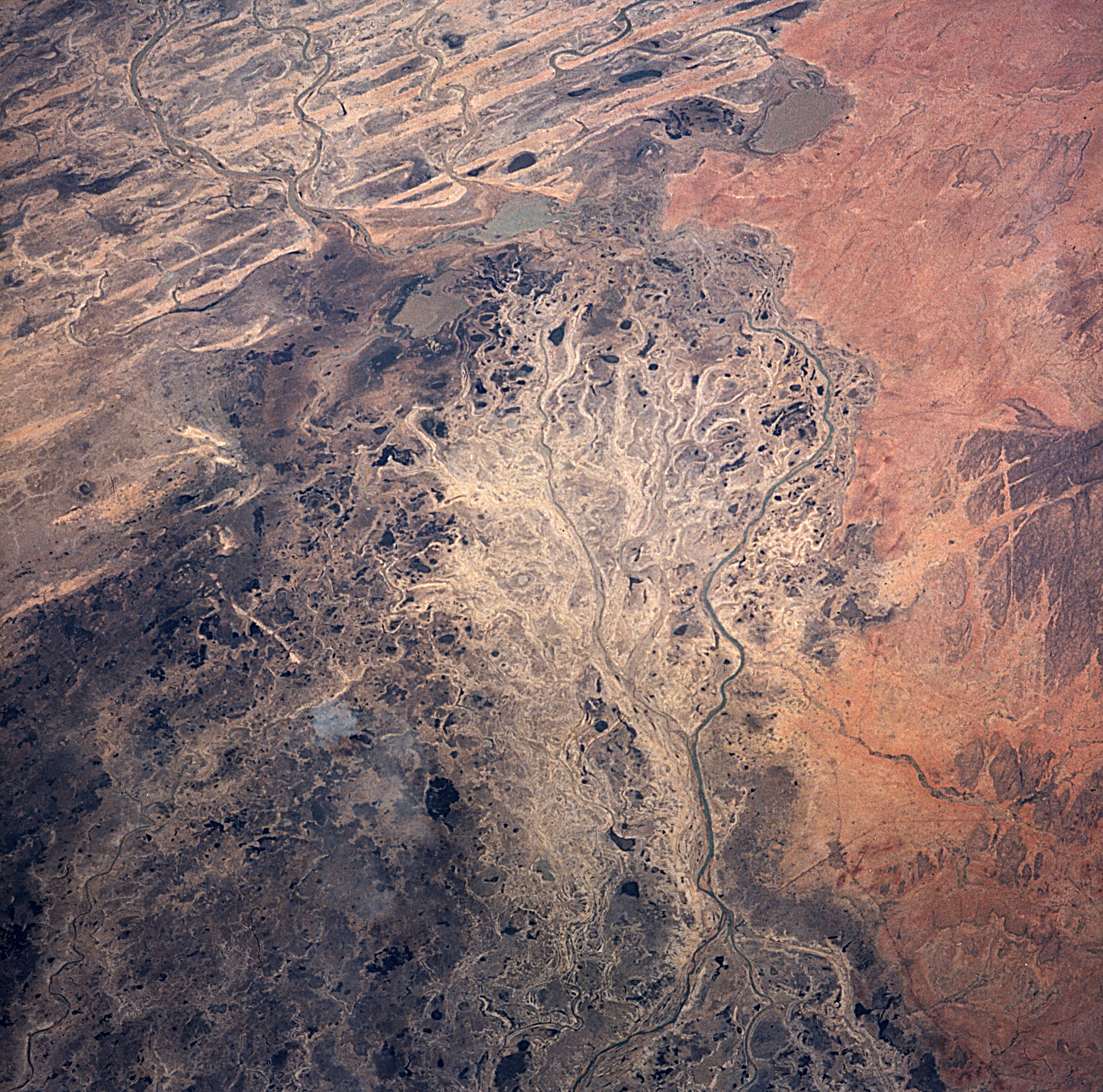
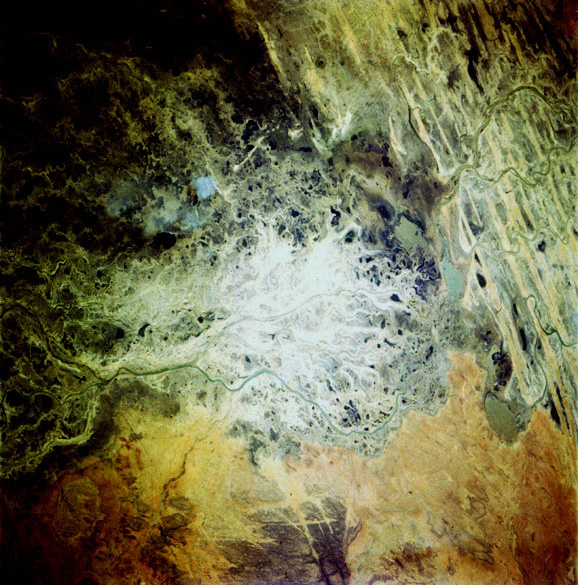
Country or Geographic Name: | MALI |
Features: | INLAND DELTA OF NIGER |
| Features Found Using Machine Learning: | |
Cloud Cover Percentage: | 0 (no clouds present) |
Sun Elevation Angle: | 73° |
Sun Azimuth: | 257° |
Camera: | Hasselblad |
Focal Length: | 100mm |
Camera Tilt: | 30 degrees |
Format: | 5046: Kodak, natural color positive, Lumiere 100/5046, ASA 100, standard base |
Film Exposure: | Normal |
| Additional Information | |
| Width | Height | Annotated | Cropped | Purpose | Links |
|---|---|---|---|---|---|
| 5700 pixels | 6000 pixels | No | No | Download Image | |
| 500 pixels | 526 pixels | No | No | Download Image | |
| 4784 pixels | 4736 pixels | Download Image | |||
| 578 pixels | 585 pixels | Download Image |
Download Packaged File
Download a Google Earth KML for this Image
View photo footprint information
Download a GeoTIFF for this photo
Image Caption: The Niger River inland delta, brown and dry by spring 1997.
