NM23-721-551
| NASA Photo ID | NM23-721-551 |
| Focal Length | 100mm |
| Date taken | 1997.04.03 |
| Time taken | GMT |
Resolutions offered for this image:
4096 x 4096 pixels 640 x 640 pixels 5700 x 6000 pixels 500 x 526 pixels 500 x 504 pixels
4096 x 4096 pixels 640 x 640 pixels 5700 x 6000 pixels 500 x 526 pixels 500 x 504 pixels
Cloud masks available for this image:
Spacecraft nadir point:
Photo center point: 13.0° S, 38.5° W
Photo center point by machine learning:
Photo center point: 13.0° S, 38.5° W
Photo center point by machine learning:
Nadir to Photo Center:
Spacecraft Altitude: nautical miles (0km)
Country or Geographic Name: | BRAZIL |
Features: | SALVADOR |
| Features Found Using Machine Learning: | |
Cloud Cover Percentage: | 5 (1-10)% |
Sun Elevation Angle: | ° |
Sun Azimuth: | ° |
Camera: | Hasselblad |
Focal Length: | 100mm |
Camera Tilt: | |
Format: | 5046: Kodak, natural color positive, Lumiere 100/5046, ASA 100, standard base |
Film Exposure: | Normal |
| Additional Information | |
| Width | Height | Annotated | Cropped | Purpose | Links |
|---|---|---|---|---|---|
| 4096 pixels | 4096 pixels | No | No | Earth From Space collection | Download Image |
| 640 pixels | 640 pixels | No | No | Earth From Space collection | Download Image |
| 5700 pixels | 6000 pixels | No | No | Download Image | |
| 500 pixels | 526 pixels | No | No | Download Image | |
| 500 pixels | 504 pixels | Earth From Space phase 2 | Download Image |
Download Packaged File
Download a Google Earth KML for this Image
View photo footprint information
Download a GeoTIFF for this photo
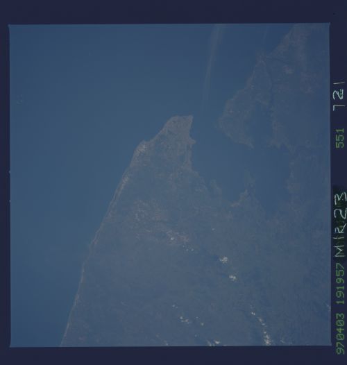
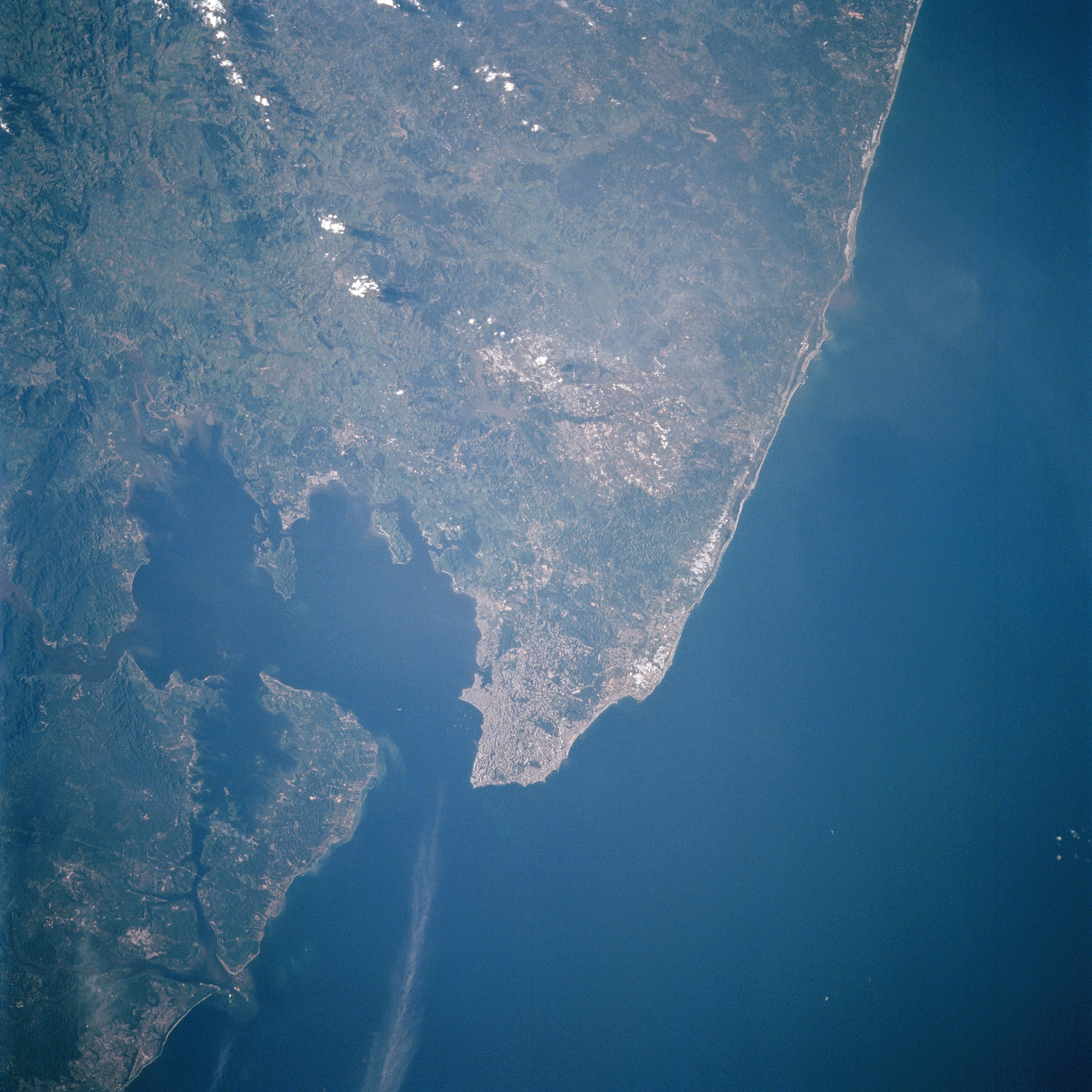
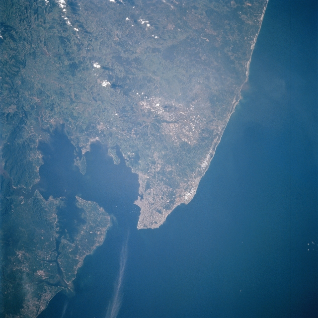
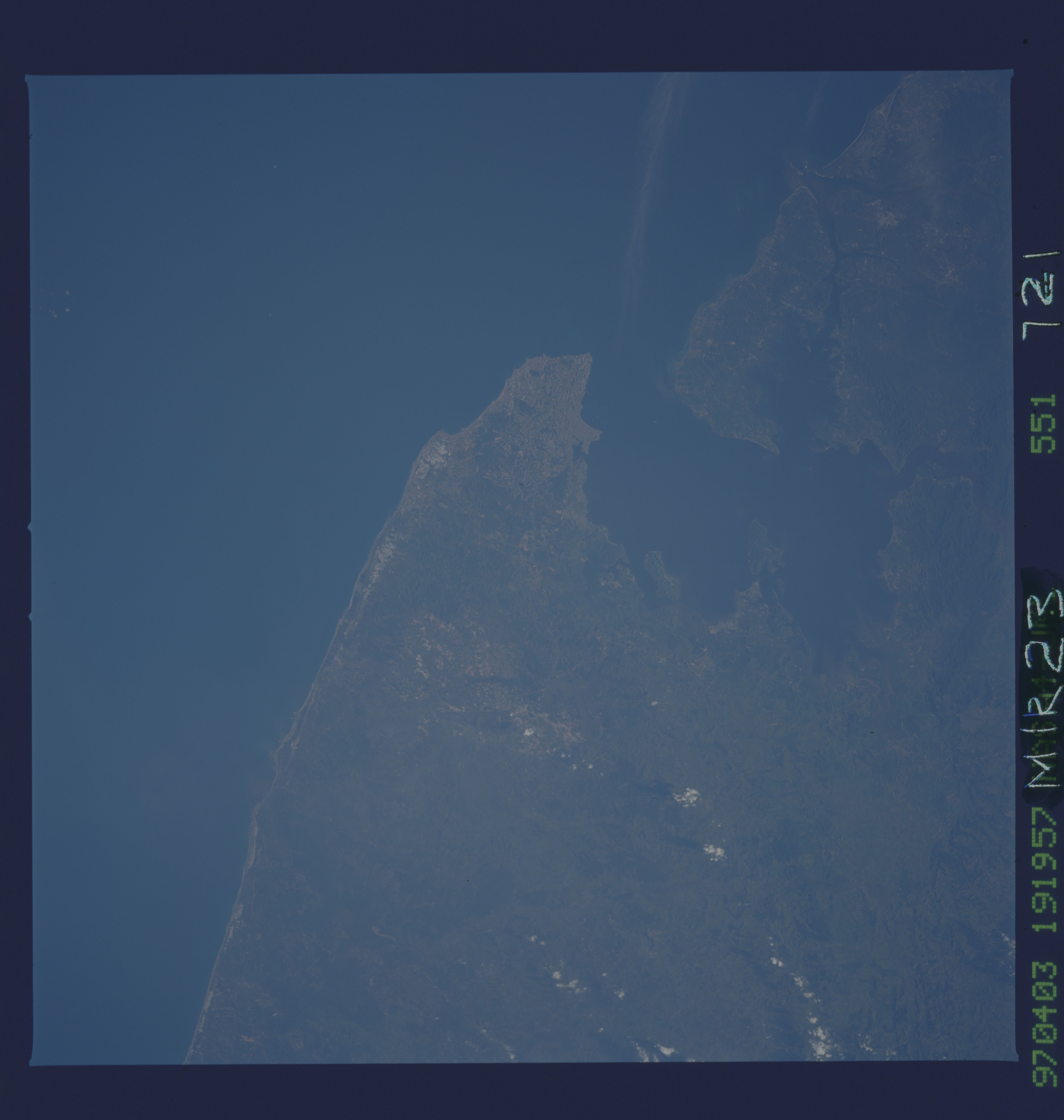
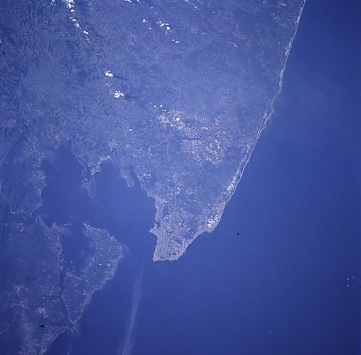
Image Caption: NM23-721-551 Salvador, All Saints Bay, Brazil Winter/Spring 1997
The first formally established settlement in Brazil, the city of Salvador, is located on the tip of the peninsula. All Saints Bay, an inlet of the Atlantic Ocean, provides a protected harbor to the city. Salvador is divided into an upper city, which is built along a cliff overlooking the bay, and a lower city, which extends from the foot of the cliff westward to the bay. The upper and lower cities are connected by elevators, cable cars, and graded roads. Salvador is the commercial center of the Reconcavo, a major agricultural area, and a major shipping center for the Cacao district to the south. Food processing is one of the leading industries in the city. Salvador is also a leading and fashionable tourist center. Because of an influx of black African slaves, the area is noted for its African heritage in music, dance, folk customs, and cuisine. The lighter tan-colored region to the north-northeast of Salvador is a major oil field.
The first formally established settlement in Brazil, the city of Salvador, is located on the tip of the peninsula. All Saints Bay, an inlet of the Atlantic Ocean, provides a protected harbor to the city. Salvador is divided into an upper city, which is built along a cliff overlooking the bay, and a lower city, which extends from the foot of the cliff westward to the bay. The upper and lower cities are connected by elevators, cable cars, and graded roads. Salvador is the commercial center of the Reconcavo, a major agricultural area, and a major shipping center for the Cacao district to the south. Food processing is one of the leading industries in the city. Salvador is also a leading and fashionable tourist center. Because of an influx of black African slaves, the area is noted for its African heritage in music, dance, folk customs, and cuisine. The lighter tan-colored region to the north-northeast of Salvador is a major oil field.
