NM23-719-448
| NASA Photo ID | NM23-719-448 |
| Focal Length | 100mm |
| Date taken | 1997.03.28 |
| Time taken | GMT |
Resolutions offered for this image:
4096 x 4080 pixels 640 x 637 pixels 5700 x 6000 pixels 500 x 526 pixels
4096 x 4080 pixels 640 x 637 pixels 5700 x 6000 pixels 500 x 526 pixels

Cloud masks available for this image:
Spacecraft nadir point:
Photo center point: 33.5° S, 59.5° W
Photo center point by machine learning:
Photo center point: 33.5° S, 59.5° W
Photo center point by machine learning:
Nadir to Photo Center: Southeast
Spacecraft Altitude: nautical miles (0km)
Country or Geographic Name: | ARGENTINA |
Features: | RIO PARANA, AGRICULTURE |
| Features Found Using Machine Learning: | |
Cloud Cover Percentage: | 0 (no clouds present) |
Sun Elevation Angle: | ° |
Sun Azimuth: | ° |
Camera: | Hasselblad |
Focal Length: | 100mm |
Camera Tilt: | Low Oblique |
Format: | 5046: Kodak, natural color positive, Lumiere 100/5046, ASA 100, standard base |
Film Exposure: | Normal |
| Additional Information | |
| Width | Height | Annotated | Cropped | Purpose | Links |
|---|---|---|---|---|---|
| 4096 pixels | 4080 pixels | No | No | Earth From Space collection | Download Image |
| 640 pixels | 637 pixels | No | No | Earth From Space collection | Download Image |
| 5700 pixels | 6000 pixels | No | No | Download Image | |
| 500 pixels | 526 pixels | No | No | Download Image |
Download Packaged File
Download a Google Earth KML for this Image
View photo footprint information
Download a GeoTIFF for this photo
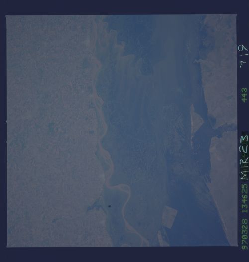
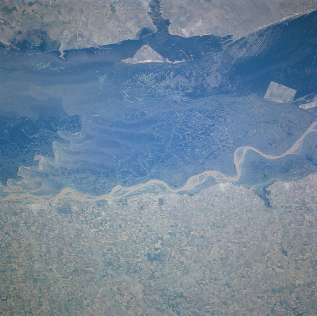
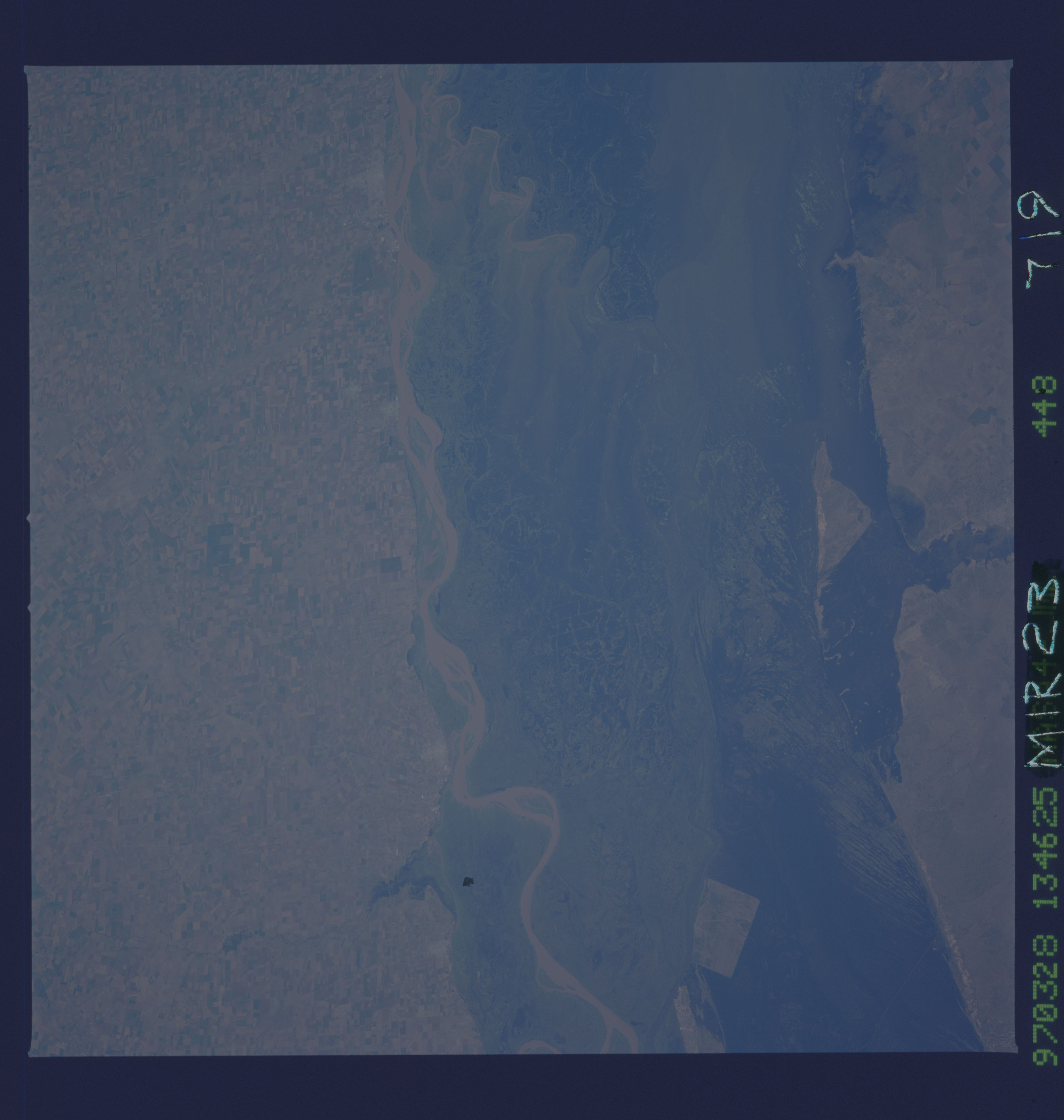
Image Caption: NM23-719-448 Rio Parana, Argentina Winter/Spring 1997
The Rio Parana forms a broad, swampy floodplain (dark swath) in northeastern Argentina, which extends from Corrientes (north, near the Paraguayan border) to the western end of the Rio de la Plata estuary. This section of the floodplain is midway between Rosario and Buenos Aires. The main channel of the river (winding, light-colored band at center of image) flows southeastward along a bluff or escarpment, known as the Barranca (100 to 150 feet/ 30 to 45 meters high). Within the floodplain is a secondary channel, as well as old meander scars and shifting sandbars that are typical of a braided river. Extensive agricultural fields (rectilinear pattern) are observed southwest of the Rio Parana. This is part of the Pampas region of Argentina, noted for sheep and cattle ranching, as well as for cultivation of corn (maize), wheat, and alfalfa. (Refer to NM23-719-442, NM23-719-444, and NM23-719-446 for other images of the Rio Parana in northeast Argentina).
The Rio Parana forms a broad, swampy floodplain (dark swath) in northeastern Argentina, which extends from Corrientes (north, near the Paraguayan border) to the western end of the Rio de la Plata estuary. This section of the floodplain is midway between Rosario and Buenos Aires. The main channel of the river (winding, light-colored band at center of image) flows southeastward along a bluff or escarpment, known as the Barranca (100 to 150 feet/ 30 to 45 meters high). Within the floodplain is a secondary channel, as well as old meander scars and shifting sandbars that are typical of a braided river. Extensive agricultural fields (rectilinear pattern) are observed southwest of the Rio Parana. This is part of the Pampas region of Argentina, noted for sheep and cattle ranching, as well as for cultivation of corn (maize), wheat, and alfalfa. (Refer to NM23-719-442, NM23-719-444, and NM23-719-446 for other images of the Rio Parana in northeast Argentina).
