NM23-719-444
| NASA Photo ID | NM23-719-444 |
| Focal Length | 100mm |
| Date taken | 1997.03.28 |
| Time taken | GMT |
Resolutions offered for this image:
4096 x 4072 pixels 640 x 636 pixels 5700 x 6000 pixels 500 x 526 pixels
4096 x 4072 pixels 640 x 636 pixels 5700 x 6000 pixels 500 x 526 pixels
Cloud masks available for this image:
Spacecraft nadir point:
Photo center point: 30.5° S, 59.5° W
Photo center point by machine learning:
Photo center point: 30.5° S, 59.5° W
Photo center point by machine learning:
Nadir to Photo Center: Southeast
Spacecraft Altitude: nautical miles (0km)
Country or Geographic Name: | ARGENTINA |
Features: | RIO PARANA, AGRICULTURE |
| Features Found Using Machine Learning: | |
Cloud Cover Percentage: | 0 (no clouds present) |
Sun Elevation Angle: | ° |
Sun Azimuth: | ° |
Camera: | Hasselblad |
Focal Length: | 100mm |
Camera Tilt: | Low Oblique |
Format: | 5046: Kodak, natural color positive, Lumiere 100/5046, ASA 100, standard base |
Film Exposure: | Normal |
| Additional Information | |
| Width | Height | Annotated | Cropped | Purpose | Links |
|---|---|---|---|---|---|
| 4096 pixels | 4072 pixels | No | No | Earth From Space collection | Download Image |
| 640 pixels | 636 pixels | No | No | Earth From Space collection | Download Image |
| 5700 pixels | 6000 pixels | No | No | Download Image | |
| 500 pixels | 526 pixels | No | No | Download Image |
Download Packaged File
Download a Google Earth KML for this Image
View photo footprint information
Download a GeoTIFF for this photo
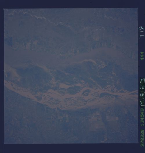
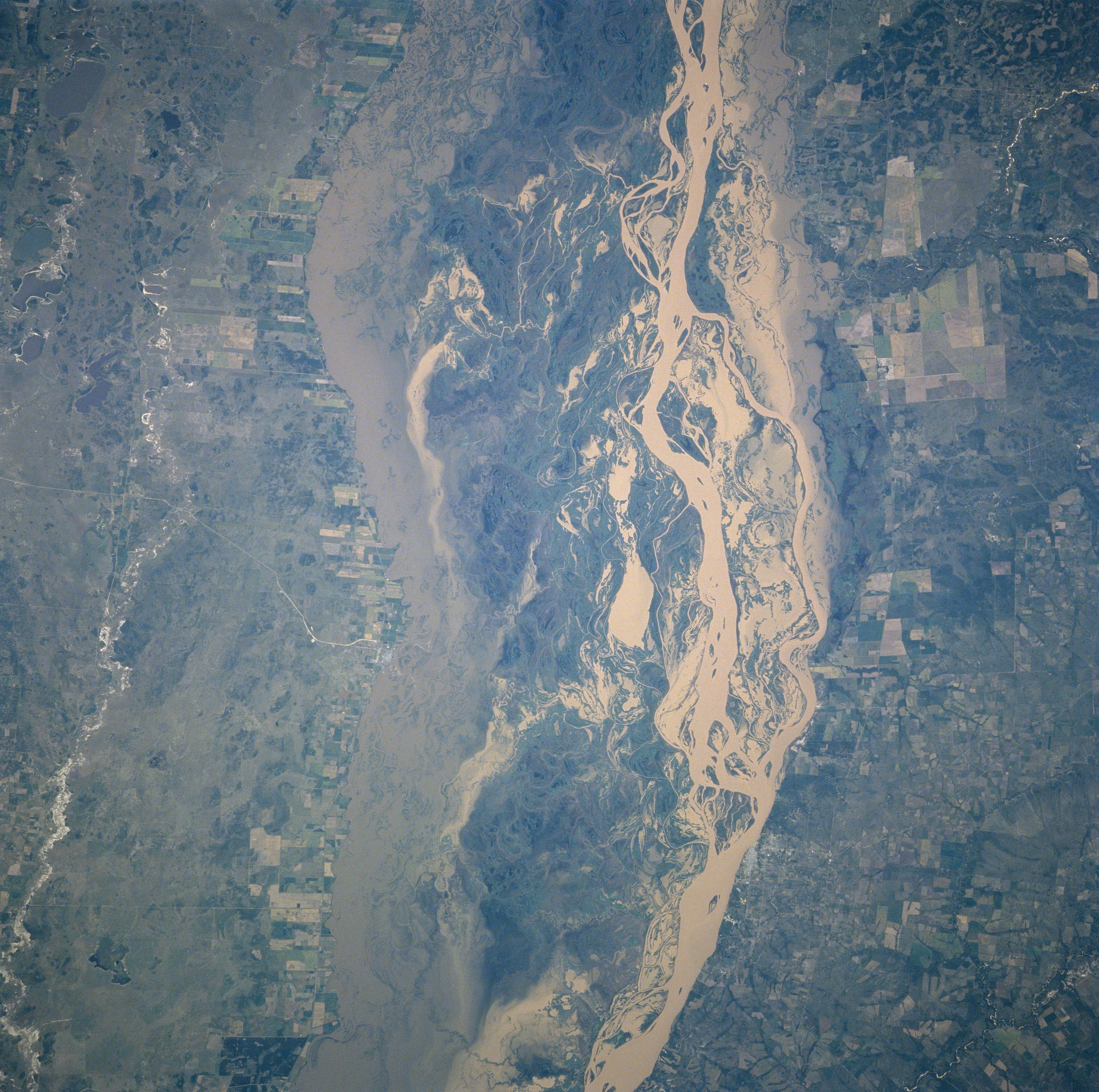
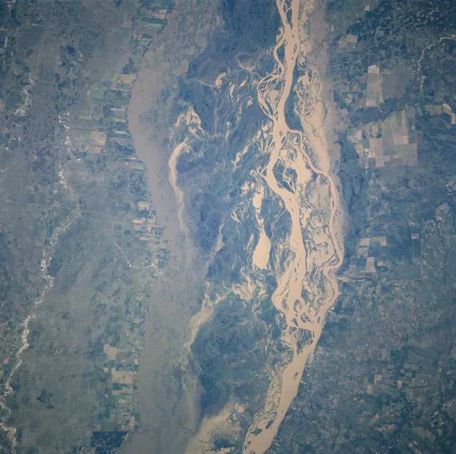
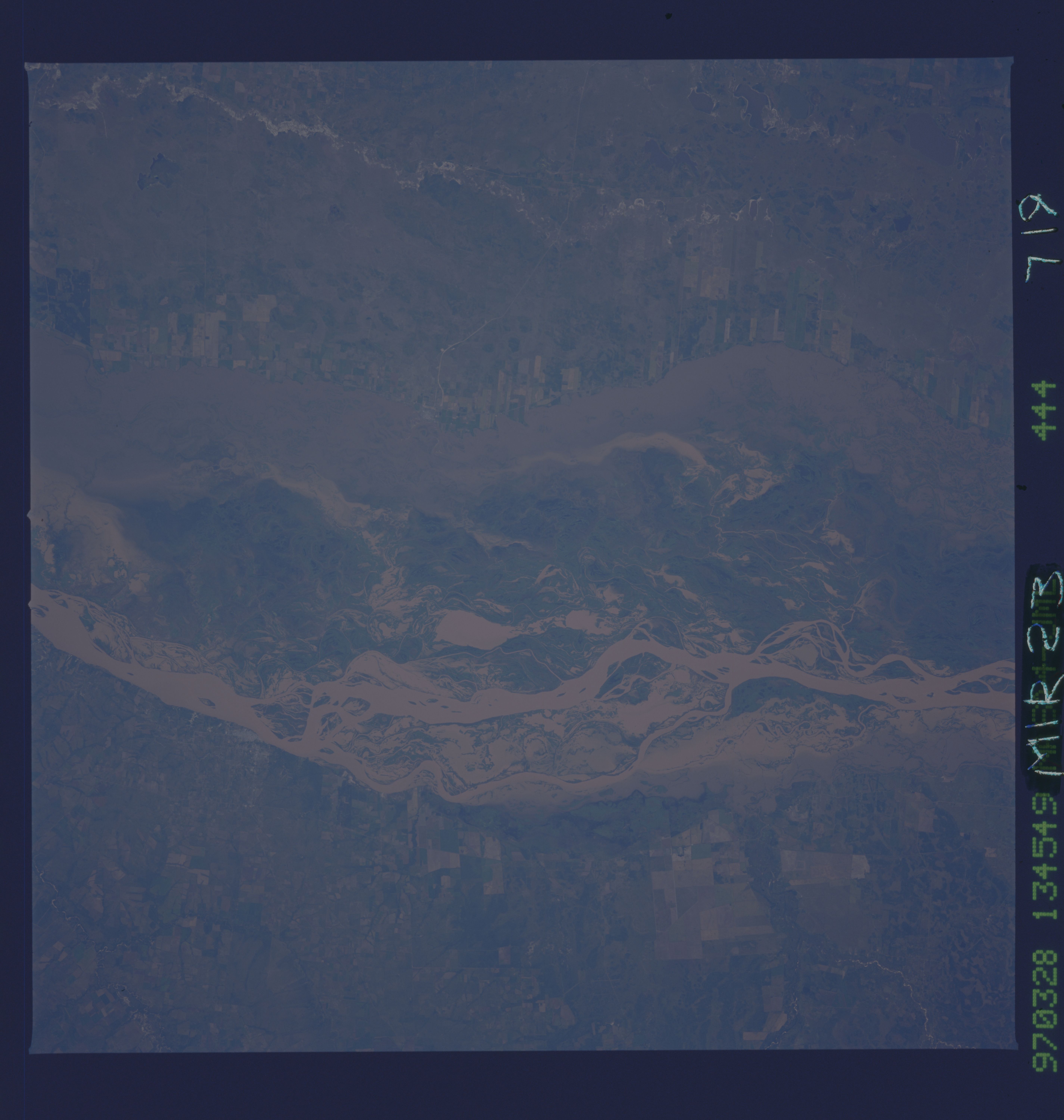
Image Caption: NM23-719-444 Rio Parana, Argentina Winter/Spring 1997
The east-west boundaries of the broad floodplain of the south flowing Rio Parana can be discerned on this near vertical view of the river in northeast Argentina. The major braided channels within the floodplain present a whiter-looking surface than the less turbulent, muddy water along the edges of the floodplain. The thin, light-colored linear features on the image are roads and the angular-looking field patterns on either side of the river's floodplain are cultivated fields used for agriculture. (Refer to NM23-719-442, NM23-719-446, and NM23-719-448 for other images and information about this section of the Rio Parana in northeast Argentina).
The east-west boundaries of the broad floodplain of the south flowing Rio Parana can be discerned on this near vertical view of the river in northeast Argentina. The major braided channels within the floodplain present a whiter-looking surface than the less turbulent, muddy water along the edges of the floodplain. The thin, light-colored linear features on the image are roads and the angular-looking field patterns on either side of the river's floodplain are cultivated fields used for agriculture. (Refer to NM23-719-442, NM23-719-446, and NM23-719-448 for other images and information about this section of the Rio Parana in northeast Argentina).
