NM23-719-439
| NASA Photo ID | NM23-719-439 |
| Focal Length | 100mm |
| Date taken | 1997.03.28 |
| Time taken | GMT |
Resolutions offered for this image:
4072 x 4096 pixels 636 x 640 pixels 5700 x 6000 pixels 500 x 526 pixels
4072 x 4096 pixels 636 x 640 pixels 5700 x 6000 pixels 500 x 526 pixels
Cloud masks available for this image:
Spacecraft nadir point:
Photo center point: 27.5° S, 64.5° W
Photo center point by machine learning:
Photo center point: 27.5° S, 64.5° W
Photo center point by machine learning:
Nadir to Photo Center: Southeast
Spacecraft Altitude: nautical miles (0km)
Country or Geographic Name: | ARGENTINA |
Features: | SANTIAGO DEL ESTERO |
| Features Found Using Machine Learning: | |
Cloud Cover Percentage: | 0 (no clouds present) |
Sun Elevation Angle: | ° |
Sun Azimuth: | ° |
Camera: | Hasselblad |
Focal Length: | 100mm |
Camera Tilt: | Low Oblique |
Format: | 5046: Kodak, natural color positive, Lumiere 100/5046, ASA 100, standard base |
Film Exposure: | Normal |
| Additional Information | |
| Width | Height | Annotated | Cropped | Purpose | Links |
|---|---|---|---|---|---|
| 4072 pixels | 4096 pixels | No | No | Earth From Space collection | Download Image |
| 636 pixels | 640 pixels | No | No | Earth From Space collection | Download Image |
| 5700 pixels | 6000 pixels | No | No | Download Image | |
| 500 pixels | 526 pixels | No | No | Download Image |
Download Packaged File
Download a Google Earth KML for this Image
View photo footprint information
Download a GeoTIFF for this photo
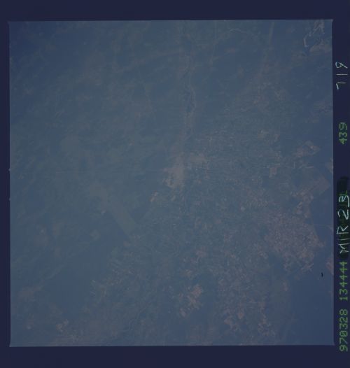
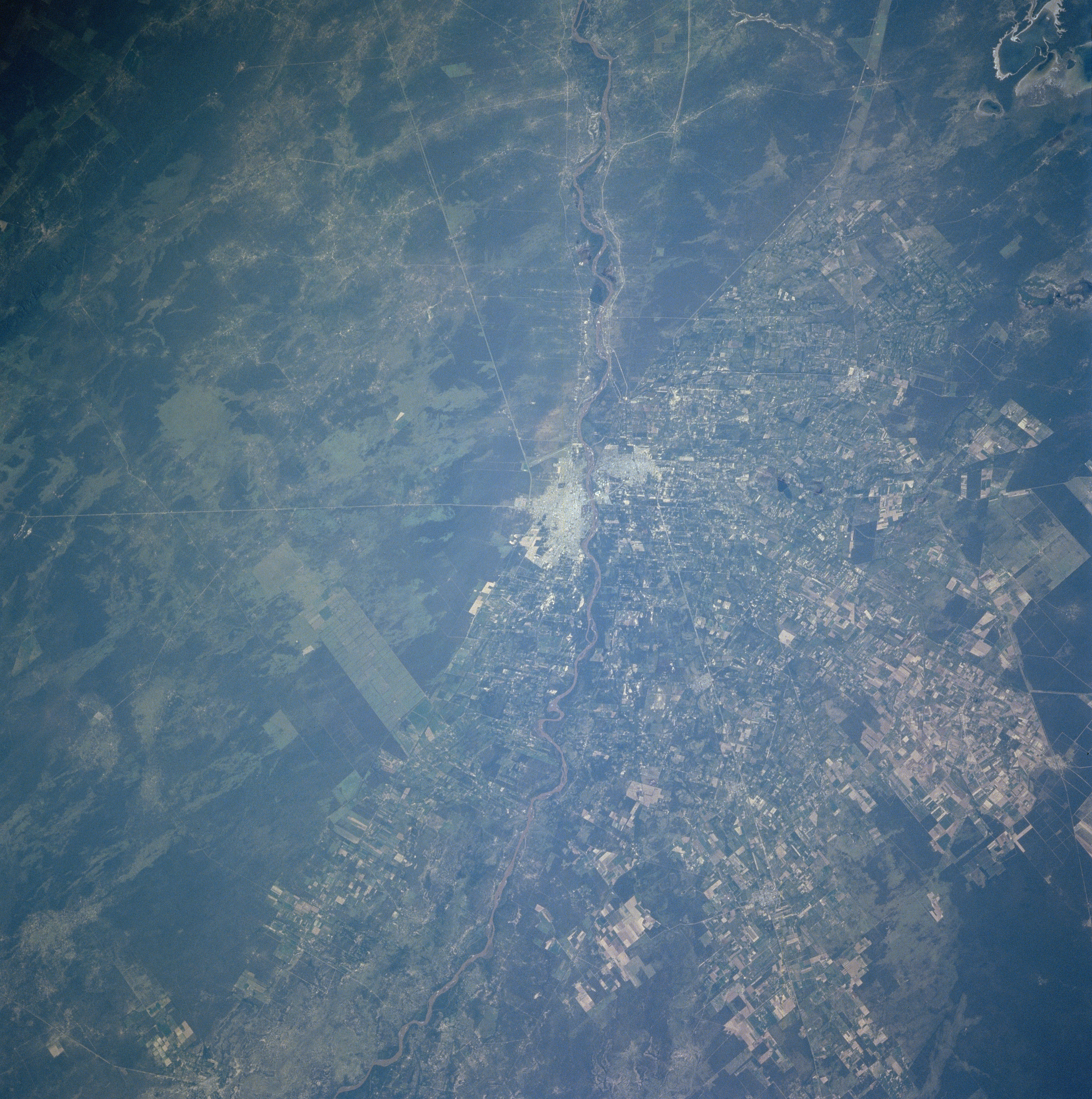
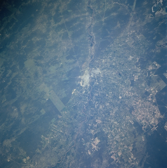
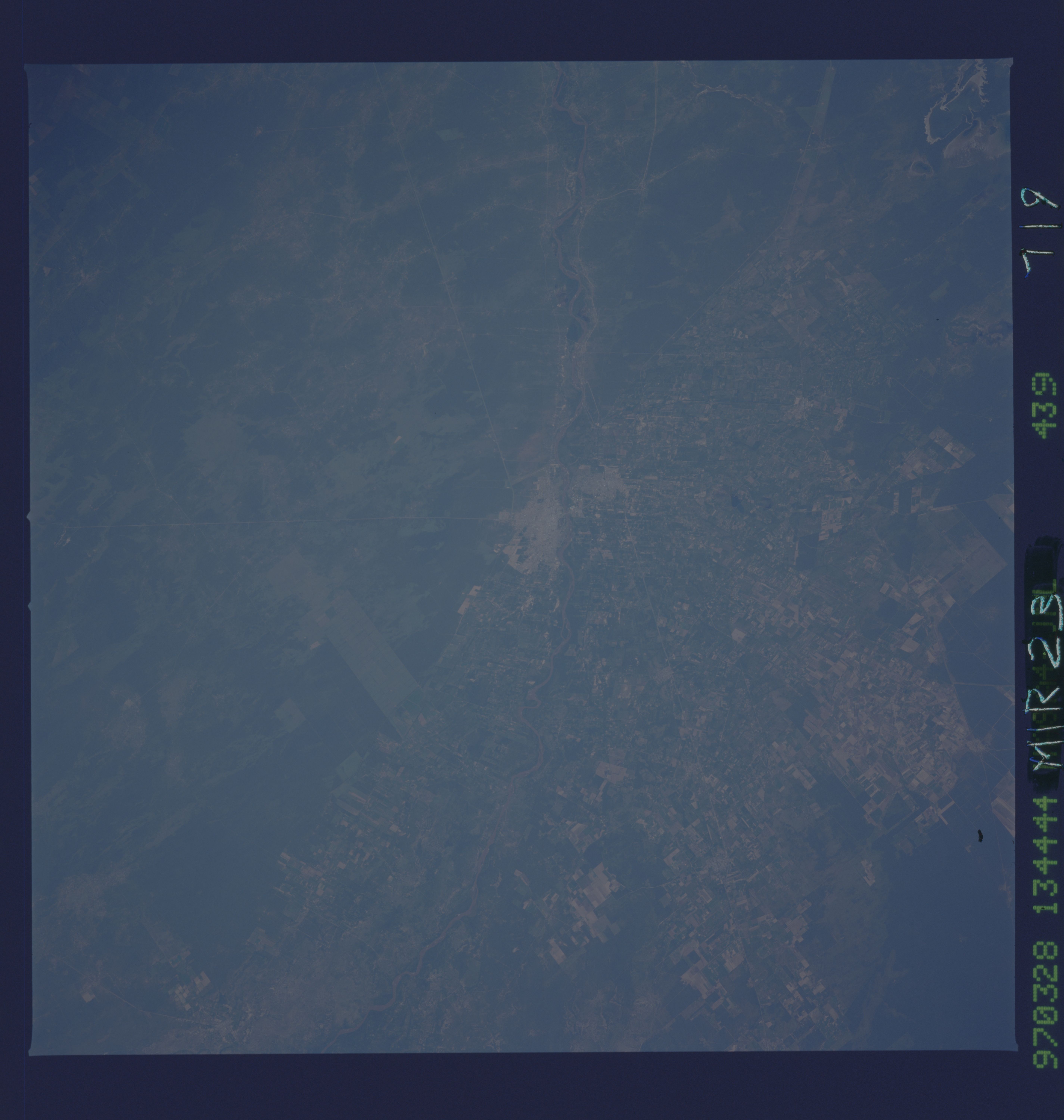
Image Caption: NM23-719-439 Santiago del Estero, Argentina Winter/Spring 1997
The city of Santiago del Estero, the oldest continuous settlement in Argentina, can be seen in this west-northwest-looking view. Located on the banks of the Dulce River, Santiago del Estero (estero means saltmarsh in Spanish) is a commercial center in a semi-arid region for agriculture (grain, cotton, and flax) and lumbering. The city is located to the north of the large Salinas Grandes (salt flats) of western Argentina. Just off the image at the top left and to the northwest of the city, the Hondo River Reservoir, a recreational lake, is a resort and vacation area for many people living in this region.
The city of Santiago del Estero, the oldest continuous settlement in Argentina, can be seen in this west-northwest-looking view. Located on the banks of the Dulce River, Santiago del Estero (estero means saltmarsh in Spanish) is a commercial center in a semi-arid region for agriculture (grain, cotton, and flax) and lumbering. The city is located to the north of the large Salinas Grandes (salt flats) of western Argentina. Just off the image at the top left and to the northwest of the city, the Hondo River Reservoir, a recreational lake, is a resort and vacation area for many people living in this region.
