NM23-716-395
| NASA Photo ID | NM23-716-395 |
| Focal Length | 250mm |
| Date taken | 1997.03.21 |
| Time taken | GMT |
Resolutions offered for this image:
4096 x 4064 pixels 640 x 635 pixels 5700 x 6000 pixels 500 x 526 pixels
4096 x 4064 pixels 640 x 635 pixels 5700 x 6000 pixels 500 x 526 pixels

Cloud masks available for this image:
Spacecraft nadir point:
Photo center point: 25.5° S, 55.0° W
Photo center point by machine learning:
Photo center point: 25.5° S, 55.0° W
Photo center point by machine learning:
Nadir to Photo Center: East
Spacecraft Altitude: nautical miles (0km)
Country or Geographic Name: | PARAGUAY |
Features: | RIO YGUAZU RESERVOIR |
| Features Found Using Machine Learning: | |
Cloud Cover Percentage: | 0 (no clouds present) |
Sun Elevation Angle: | ° |
Sun Azimuth: | ° |
Camera: | Hasselblad |
Focal Length: | 250mm |
Camera Tilt: | Low Oblique |
Format: | 5046: Kodak, natural color positive, Lumiere 100/5046, ASA 100, standard base |
Film Exposure: | Normal |
| Additional Information | |
| Width | Height | Annotated | Cropped | Purpose | Links |
|---|---|---|---|---|---|
| 4096 pixels | 4064 pixels | No | No | Earth From Space collection | Download Image |
| 640 pixels | 635 pixels | No | No | Earth From Space collection | Download Image |
| 5700 pixels | 6000 pixels | No | No | Download Image | |
| 500 pixels | 526 pixels | No | No | Download Image |
Download Packaged File
Download a Google Earth KML for this Image
View photo footprint information
Download a GeoTIFF for this photo
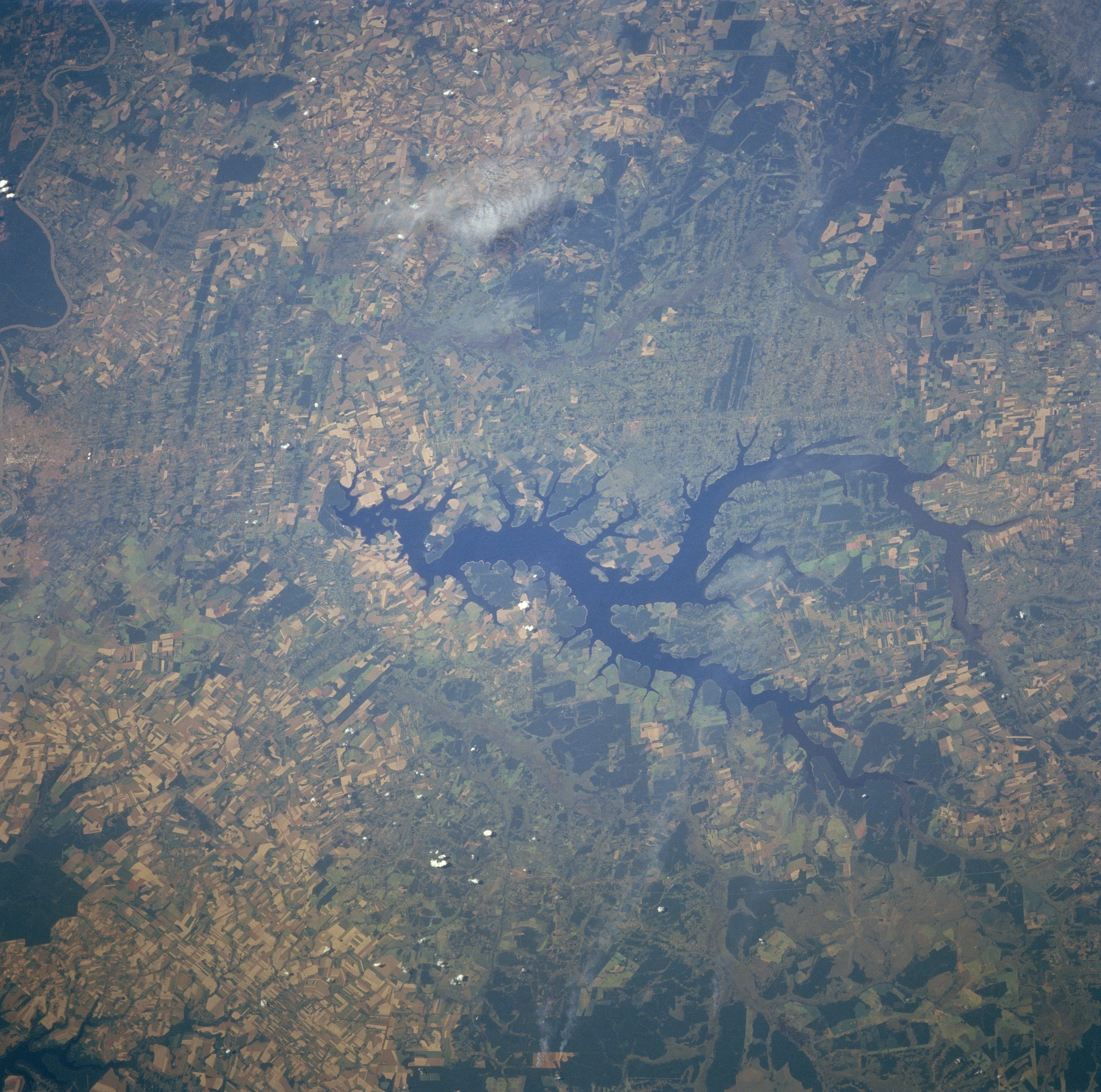
Image Caption: NM23-716-395 Yguazu River Reservoir, Paraguay Winter/Spring 1997
The light colors of the overall picture indicates that most of the landscape in this region of southeast Paraguay has been cleared of trees in favor of intensive agricultural activities. Most of the croplands are used to grow cotton and soybeans, while pasture grasses are used to raise cattle. This region of Paraguay, known as the Paranena, is a mixture of rolling hills, plateaus, and broad valleys. The dark, irregular shaped feature in the middle of the image is a reservoir created by building a dam on the Rio Yguazu (dam is on eastern end of the reservoir). Several small, forested areas are visible north and south of the Reservoir (uniform dark green patches). These forests occur mainly along the river valleys and wetlands of the Rio Monday (south) and Rio Acaray (north of the reservoir).
The light colors of the overall picture indicates that most of the landscape in this region of southeast Paraguay has been cleared of trees in favor of intensive agricultural activities. Most of the croplands are used to grow cotton and soybeans, while pasture grasses are used to raise cattle. This region of Paraguay, known as the Paranena, is a mixture of rolling hills, plateaus, and broad valleys. The dark, irregular shaped feature in the middle of the image is a reservoir created by building a dam on the Rio Yguazu (dam is on eastern end of the reservoir). Several small, forested areas are visible north and south of the Reservoir (uniform dark green patches). These forests occur mainly along the river valleys and wetlands of the Rio Monday (south) and Rio Acaray (north of the reservoir).
