NM23-707-423
| NASA Photo ID | NM23-707-423 |
| Focal Length | 100mm |
| Date taken | 1997.03.12 |
| Time taken | GMT |
Resolutions offered for this image:
4080 x 4096 pixels 637 x 640 pixels 5700 x 6000 pixels 500 x 526 pixels
4080 x 4096 pixels 637 x 640 pixels 5700 x 6000 pixels 500 x 526 pixels

Cloud masks available for this image:
Spacecraft nadir point:
Photo center point: 42.5° N, 19.0° E
Photo center point by machine learning:
Photo center point: 42.5° N, 19.0° E
Photo center point by machine learning:
Nadir to Photo Center:
Spacecraft Altitude: nautical miles (0km)
Country or Geographic Name: | FEDERAL REPUBLIC OF YUGOSLAVIA |
Features: | LAKE SCUTARI, ADRIATIC COAST |
| Features Found Using Machine Learning: | |
Cloud Cover Percentage: | 5 (1-10)% |
Sun Elevation Angle: | ° |
Sun Azimuth: | ° |
Camera: | Hasselblad |
Focal Length: | 100mm |
Camera Tilt: | |
Format: | 5046: Kodak, natural color positive, Lumiere 100/5046, ASA 100, standard base |
Film Exposure: | Normal |
| Additional Information | |
| Width | Height | Annotated | Cropped | Purpose | Links |
|---|---|---|---|---|---|
| 4080 pixels | 4096 pixels | No | No | Earth From Space collection | Download Image |
| 637 pixels | 640 pixels | No | No | Earth From Space collection | Download Image |
| 5700 pixels | 6000 pixels | No | No | Download Image | |
| 500 pixels | 526 pixels | No | No | Download Image |
Download Packaged File
Download a Google Earth KML for this Image
View photo footprint information
Download a GeoTIFF for this photo
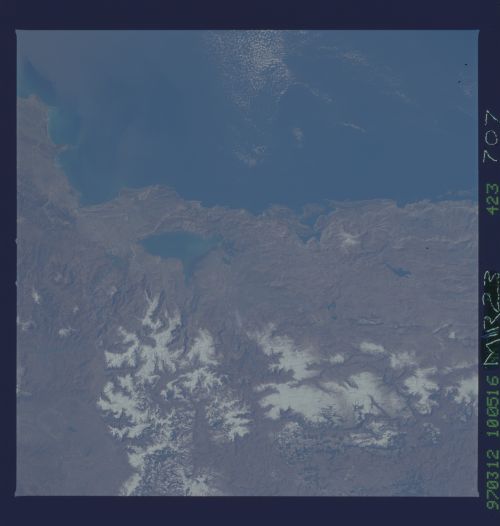
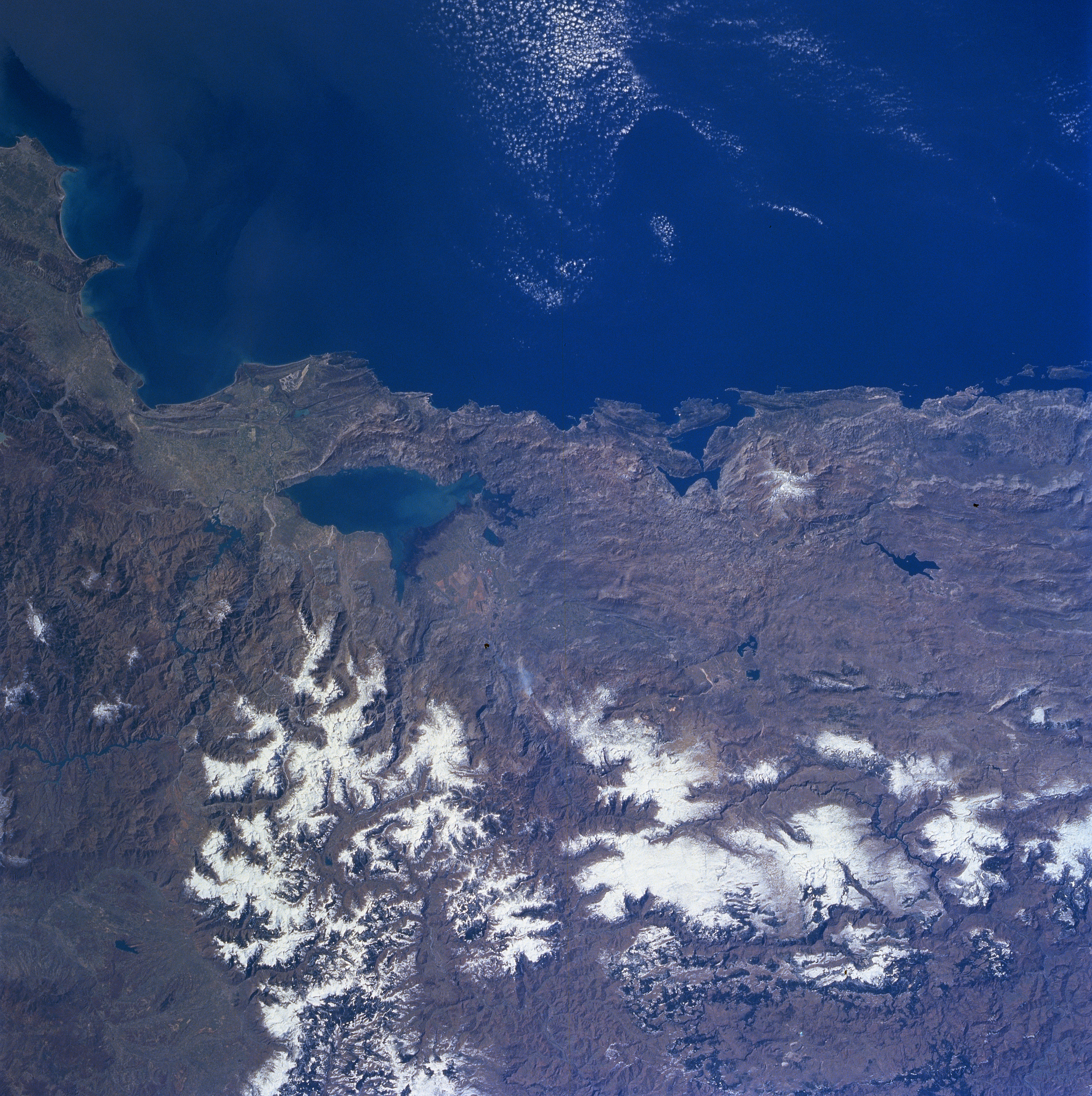
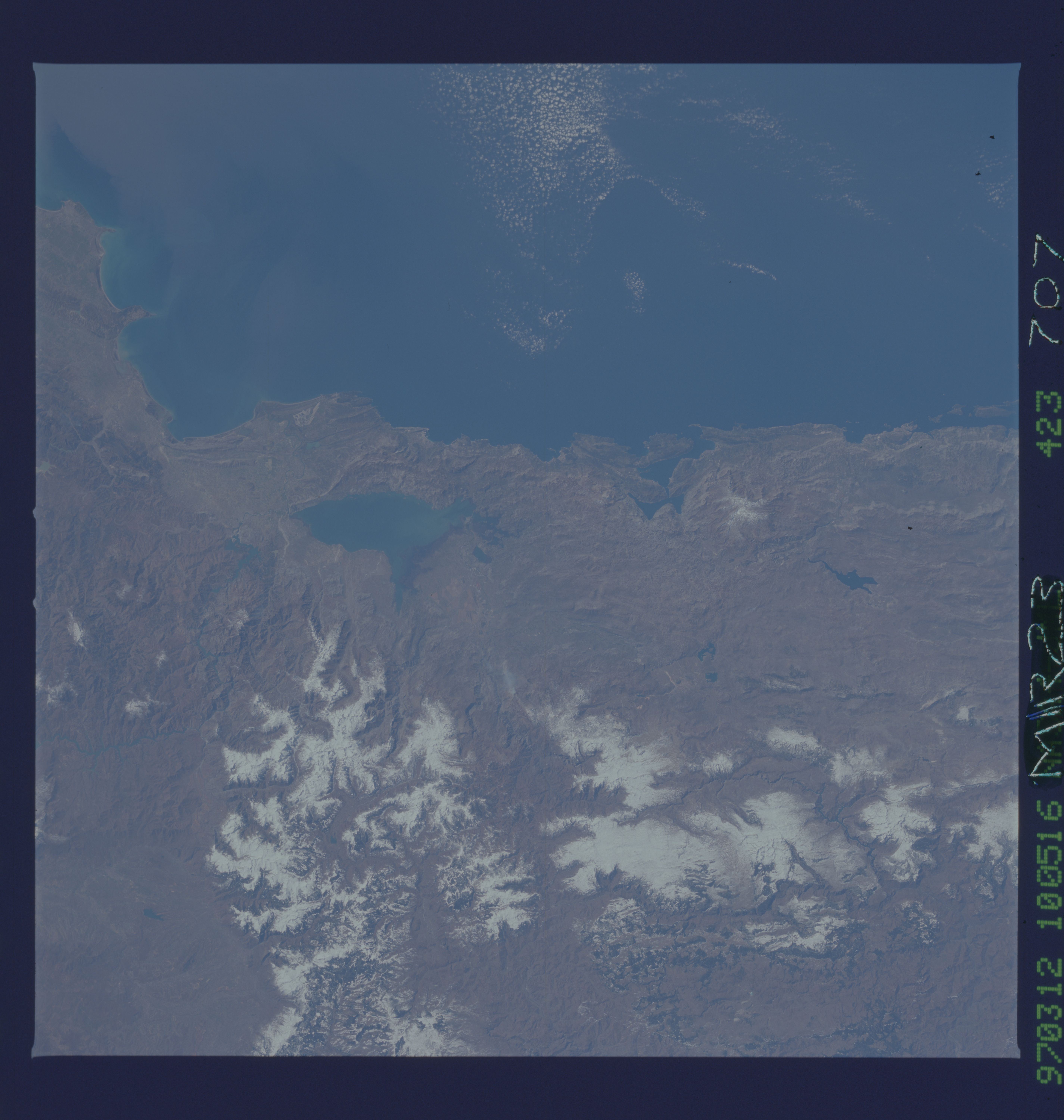
Image Caption: NM23-707-423 Lake Scutari, Dinaric Alps, Yugoslavia/Albania Winter/Spring 1997
Lake Scutari and the rugged terrain of southwestern Yugoslavia and northwestern Albania can be seen in this southwest-looking view. Situated on the border between Montenegro Province, Yugoslavia (right) and Albania (left), Lake Scutari is 25 miles (40 km) long and from 4 to 8 miles (6 to 13 km) wide. The lake's depth and area varies seasonally. Floods sometimes occur in the area surrounding Lake Scutari in the winter. Once an inlet of the Adriatic Sea, Lake Scutari is now separated from the sea by an alluvial isthmus. Lake Scutari is fed by the Morala River at its north end and is drained by the Buene River southeastward in Albania to the Drin River. The rugged Dinaric Alps dominate the coastline northwest of Lake Scutari. The Dinaric Alps are chiefly cracked limestone strata that form long valleys and contain topographical oddities such as caves and disappearing rivers. The Gulf of Tivatski is visible just to the right of the center of the image.
Lake Scutari and the rugged terrain of southwestern Yugoslavia and northwestern Albania can be seen in this southwest-looking view. Situated on the border between Montenegro Province, Yugoslavia (right) and Albania (left), Lake Scutari is 25 miles (40 km) long and from 4 to 8 miles (6 to 13 km) wide. The lake's depth and area varies seasonally. Floods sometimes occur in the area surrounding Lake Scutari in the winter. Once an inlet of the Adriatic Sea, Lake Scutari is now separated from the sea by an alluvial isthmus. Lake Scutari is fed by the Morala River at its north end and is drained by the Buene River southeastward in Albania to the Drin River. The rugged Dinaric Alps dominate the coastline northwest of Lake Scutari. The Dinaric Alps are chiefly cracked limestone strata that form long valleys and contain topographical oddities such as caves and disappearing rivers. The Gulf of Tivatski is visible just to the right of the center of the image.
