NM23-707-417
| NASA Photo ID | NM23-707-417 |
| Focal Length | 100mm |
| Date taken | 1997.03.12 |
| Time taken | GMT |
Resolutions offered for this image:
4096 x 4096 pixels 640 x 640 pixels 5700 x 6000 pixels 500 x 526 pixels
4096 x 4096 pixels 640 x 640 pixels 5700 x 6000 pixels 500 x 526 pixels

Cloud masks available for this image:
Spacecraft nadir point:
Photo center point: 42.5° N, 13.0° E
Photo center point by machine learning:
Photo center point: 42.5° N, 13.0° E
Photo center point by machine learning:
Nadir to Photo Center: East
Spacecraft Altitude: nautical miles (0km)
Country or Geographic Name: | ITALY |
Features: | APPENNINES |
| Features Found Using Machine Learning: | |
Cloud Cover Percentage: | 5 (1-10)% |
Sun Elevation Angle: | ° |
Sun Azimuth: | ° |
Camera: | Hasselblad |
Focal Length: | 100mm |
Camera Tilt: | Low Oblique |
Format: | 5046: Kodak, natural color positive, Lumiere 100/5046, ASA 100, standard base |
Film Exposure: | Normal |
| Additional Information | |
| Width | Height | Annotated | Cropped | Purpose | Links |
|---|---|---|---|---|---|
| 4096 pixels | 4096 pixels | No | No | Earth From Space collection | Download Image |
| 640 pixels | 640 pixels | No | No | Earth From Space collection | Download Image |
| 5700 pixels | 6000 pixels | No | No | Download Image | |
| 500 pixels | 526 pixels | No | No | Download Image |
Download Packaged File
Download a Google Earth KML for this Image
View photo footprint information
Download a GeoTIFF for this photo
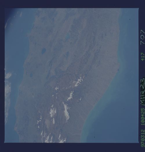
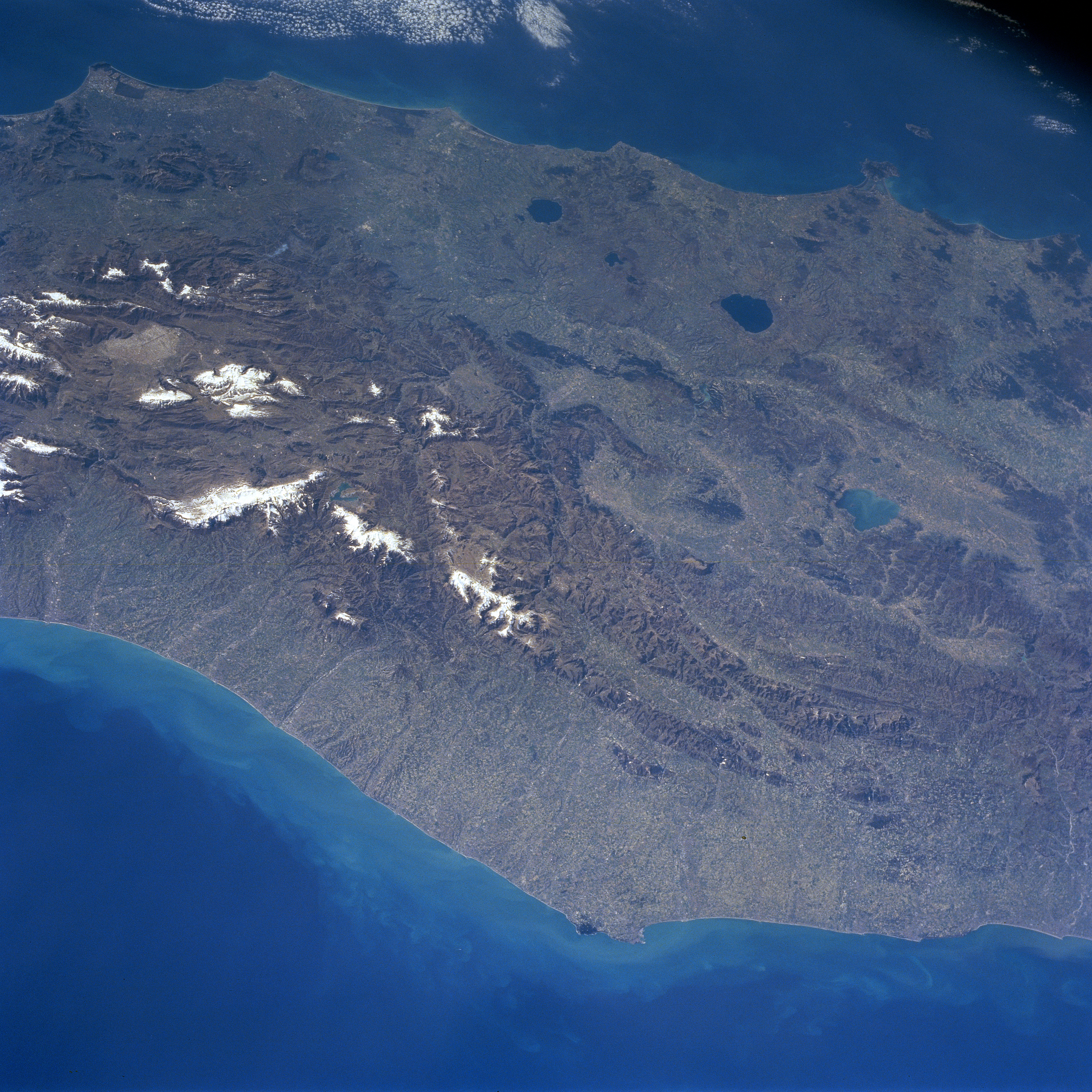
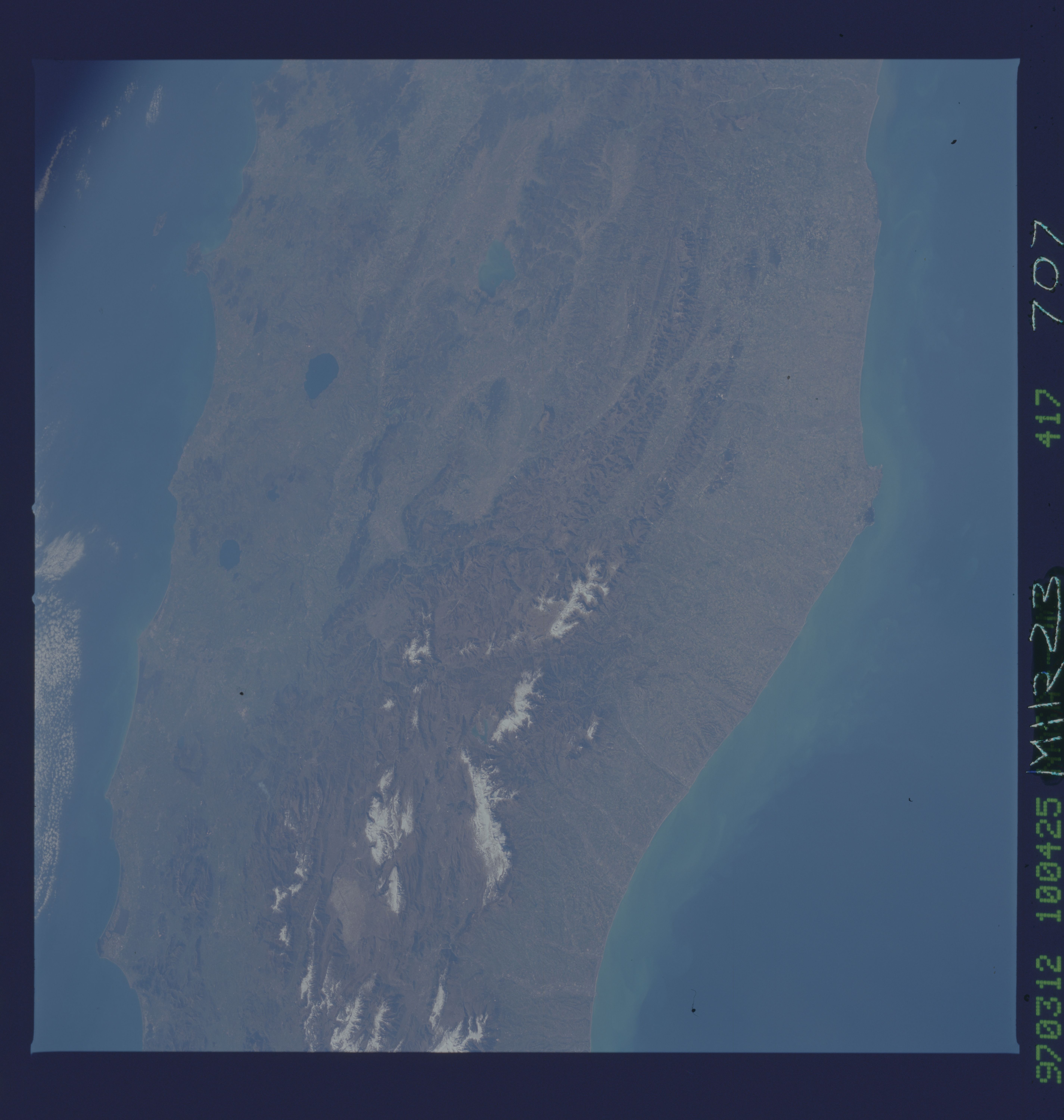
Image Caption: NM23-707-417 Appennine Mountains, Italy Winter/Spring 1997
A large region of central Italy is visible in this synoptic, southeast view that extends from the Adriatic Sea coast (bottom) to the Tyrrhenian Sea coast (top). Three major physiographic provinces are observed in this image: the drier, less inhabited, rocky limestone tablelands and narrow plains of the east coast (bottom); the central part of the Alpine Mountain system, known as the Appennine Mountains, that extend northwest-southeast along the spine of peninsular Italy; and the area west of the Appennines that is made up of hills and volcanic features. The dark, oval-shaped features (Lake Bolsena-largest and Lake Bracciano) are water-filled calderas. Lake Trasimeno (aqua colored feature) is also visible near the right (middle) margin of the scene. On the east side of this central part of the Italian Peninsula, the rivers are close together and flow swiftly in short parallel courses into the Adriatic Sea. The concentration of whitish features reveals the location of snow covered higher elevations of the Appennine Mountains, many exceeding 8000 feet (2440 meters) above sea level. Rome, the Eternal City, is located south of Lake Bracciano (near top center of the image) in the Tiber River Valley. Numerous passes and tunnels through the mountains facilitate ground traffic between the east-west coasts.
A large region of central Italy is visible in this synoptic, southeast view that extends from the Adriatic Sea coast (bottom) to the Tyrrhenian Sea coast (top). Three major physiographic provinces are observed in this image: the drier, less inhabited, rocky limestone tablelands and narrow plains of the east coast (bottom); the central part of the Alpine Mountain system, known as the Appennine Mountains, that extend northwest-southeast along the spine of peninsular Italy; and the area west of the Appennines that is made up of hills and volcanic features. The dark, oval-shaped features (Lake Bolsena-largest and Lake Bracciano) are water-filled calderas. Lake Trasimeno (aqua colored feature) is also visible near the right (middle) margin of the scene. On the east side of this central part of the Italian Peninsula, the rivers are close together and flow swiftly in short parallel courses into the Adriatic Sea. The concentration of whitish features reveals the location of snow covered higher elevations of the Appennine Mountains, many exceeding 8000 feet (2440 meters) above sea level. Rome, the Eternal City, is located south of Lake Bracciano (near top center of the image) in the Tiber River Valley. Numerous passes and tunnels through the mountains facilitate ground traffic between the east-west coasts.
