NM22-735-39
| NASA Photo ID | NM22-735-39 |
| Focal Length | 100mm |
| Date taken | 1996.11.16 |
| Time taken | 07:01:25 GMT |
Resolutions offered for this image:
4066 x 4078 pixels 638 x 639 pixels 5700 x 6000 pixels 500 x 526 pixels
4066 x 4078 pixels 638 x 639 pixels 5700 x 6000 pixels 500 x 526 pixels

Cloud masks available for this image:
Spacecraft nadir point: 39.9° N, 55.2° E
Photo center point: 41.0° N, 53.0° E
Photo center point by machine learning:
Photo center point: 41.0° N, 53.0° E
Photo center point by machine learning:
Nadir to Photo Center: Northwest
Spacecraft Altitude: 202 nautical miles (374km)
Country or Geographic Name: | TURKMENISTAN |
Features: | STRAIT OF KARA-BOGAZ GOL |
| Features Found Using Machine Learning: | |
Cloud Cover Percentage: | 0 (no clouds present) |
Sun Elevation Angle: | 30° |
Sun Azimuth: | 163° |
Camera: | Hasselblad |
Focal Length: | 100mm |
Camera Tilt: | 36 degrees |
Format: | 5046: Kodak, natural color positive, Lumiere 100/5046, ASA 100, standard base |
Film Exposure: | Normal |
| Additional Information | |
| Width | Height | Annotated | Cropped | Purpose | Links |
|---|---|---|---|---|---|
| 4066 pixels | 4078 pixels | No | No | Earth From Space collection | Download Image |
| 638 pixels | 639 pixels | No | No | Earth From Space collection | Download Image |
| 5700 pixels | 6000 pixels | No | No | Download Image | |
| 500 pixels | 526 pixels | No | No | Download Image |
Download Packaged File
Download a Google Earth KML for this Image
View photo footprint information
Download a GeoTIFF for this photo
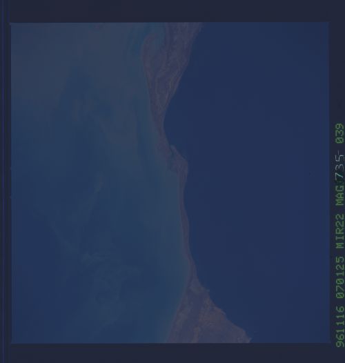
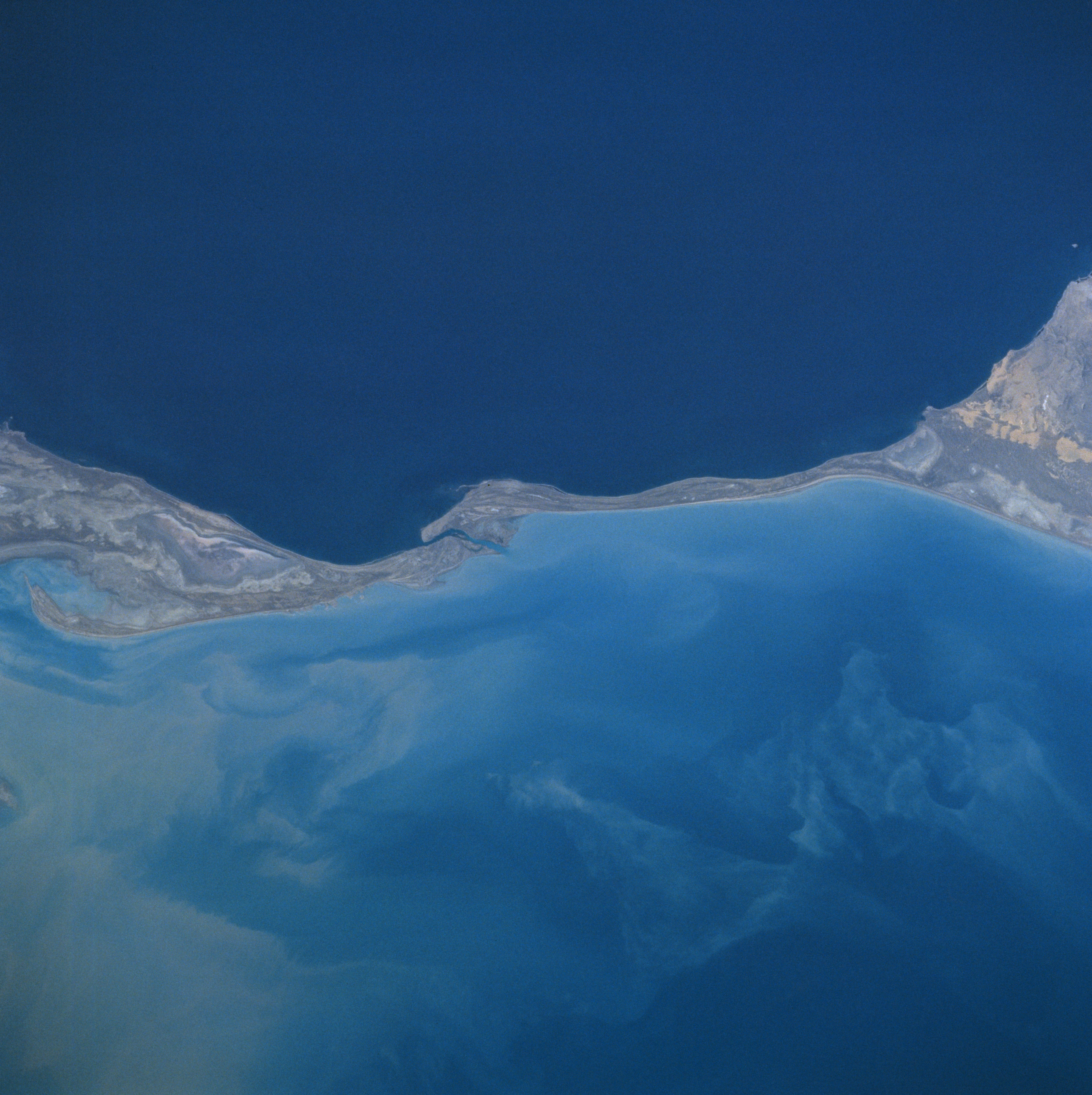
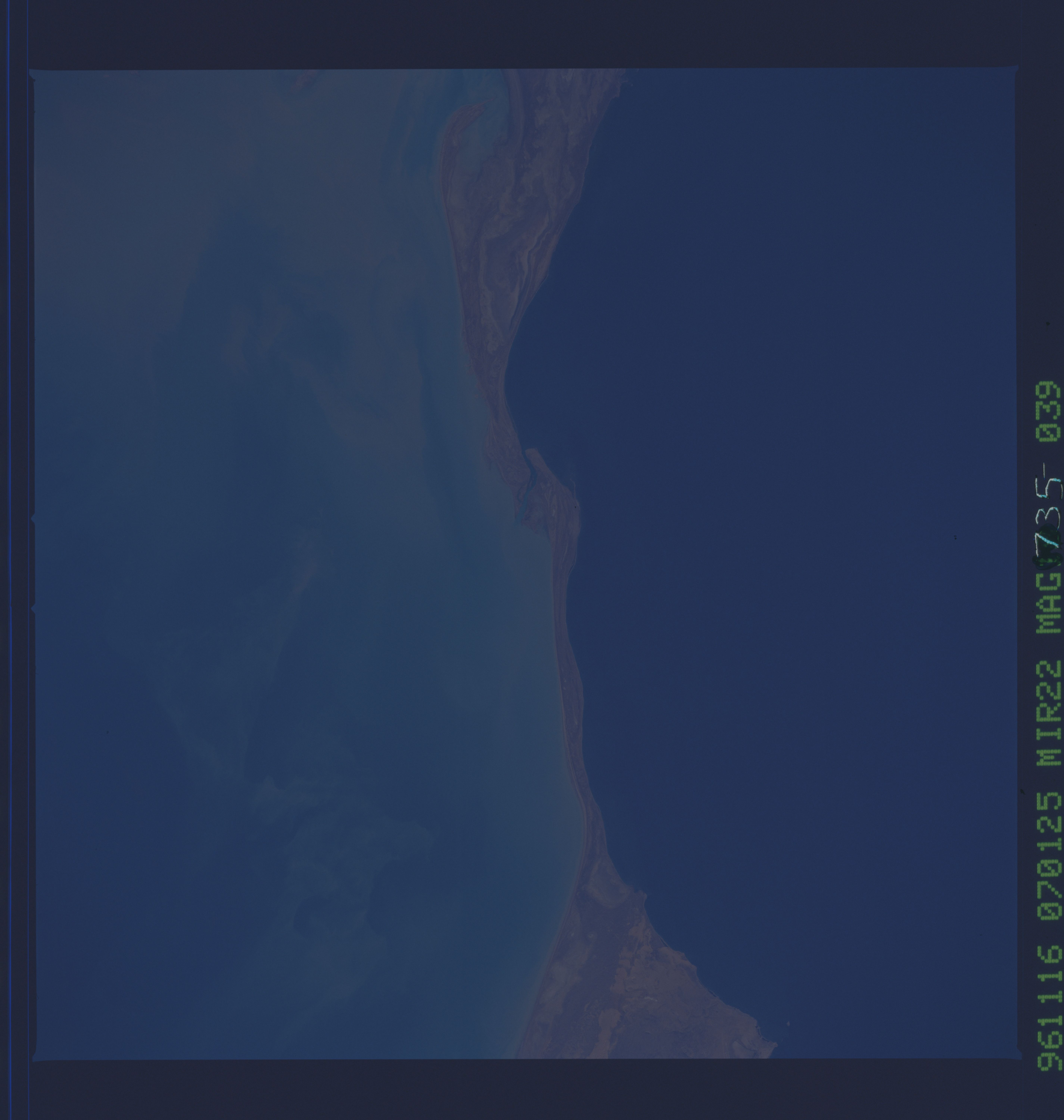
Image Caption: NM22-735-039 Kara-Bogaz-Gol Bay, Caspian Sea, Turkmenistan Fall 1996-Winter 1997
A long, low, sandy isthmus separates the Caspian Sea (upper portion of the image) and the Kara-Bogaz-Gol Bay (lower portion of the image) in this west-looking view. The Caspian Sea is the largest inland sea in the world and is one and one-half times the size of all five Great Lakes combined. The Caspian Sea's surface is 92 feet (28 meters) below sea level. The Kara-Bogaz-Gol Bay covers an area of 7000 square miles (18130 square km) or about the size of Lake Ontario. This shallow bay is no more than 33 feet (10 meters) deep, but is 102 feet (31 meters) below sea level. Since the bay is lower than the Caspian Sea, water rushes into the Kara-Bogaz-Gol through a narrow channel visible on the image just to the left of center. The shallow bay acts as a natural evaporating basin in this arid region, depositing salts along its shores.
A long, low, sandy isthmus separates the Caspian Sea (upper portion of the image) and the Kara-Bogaz-Gol Bay (lower portion of the image) in this west-looking view. The Caspian Sea is the largest inland sea in the world and is one and one-half times the size of all five Great Lakes combined. The Caspian Sea's surface is 92 feet (28 meters) below sea level. The Kara-Bogaz-Gol Bay covers an area of 7000 square miles (18130 square km) or about the size of Lake Ontario. This shallow bay is no more than 33 feet (10 meters) deep, but is 102 feet (31 meters) below sea level. Since the bay is lower than the Caspian Sea, water rushes into the Kara-Bogaz-Gol through a narrow channel visible on the image just to the left of center. The shallow bay acts as a natural evaporating basin in this arid region, depositing salts along its shores.
