NM22-726-99

| NASA Photo ID | NM22-726-99 |
| Focal Length | 250mm |
| Date taken | 1996.10.27 |
| Time taken | 16:58:59 GMT |

Cloud masks available for this image:
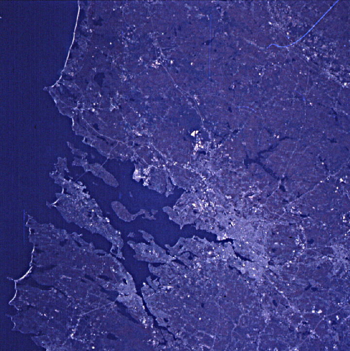
Spacecraft nadir point: 46.9° N, 57.9° W
Photo center point: 41.5° N, 71.5° W
Photo center point by machine learning:
Photo center point: 41.5° N, 71.5° W
Photo center point by machine learning:
Nadir to Photo Center: West
Spacecraft Altitude: 202 nautical miles (374km)
Country or Geographic Name: | USA-RHODE ISLAND |
Features: | PROVIDENCE, COAST |
| Features Found Using Machine Learning: | |
Cloud Cover Percentage: | 0 (no clouds present) |
Sun Elevation Angle: | 27° |
Sun Azimuth: | 203° |
Camera: | Hasselblad |
Focal Length: | 250mm |
Camera Tilt: | Low Oblique |
Format: | 5046: Kodak, natural color positive, Lumiere 100/5046, ASA 100, standard base |
Film Exposure: | Under Exposed |
| Additional Information | |
| Width | Height | Annotated | Cropped | Purpose | Links |
|---|---|---|---|---|---|
| 720 pixels | 722 pixels | No | No | Cities collection | Download Image |
| 5700 pixels | 6000 pixels | No | No | Download Image | |
| 500 pixels | 526 pixels | No | No | Download Image |
Download Packaged File
Download a Google Earth KML for this Image
View photo footprint information
Download a GeoTIFF for this photo
Image Caption: none
