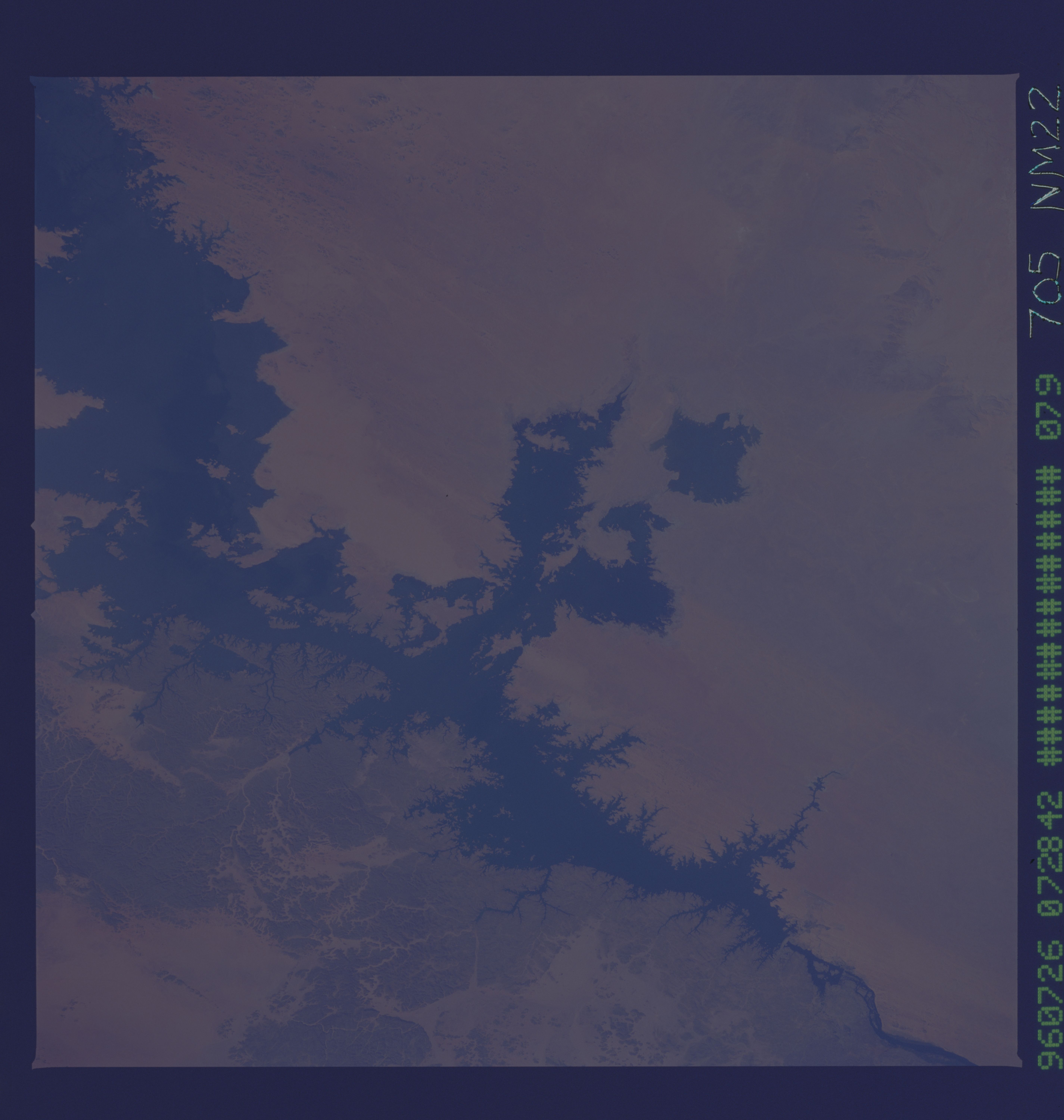
NM22-705-79

| NASA Photo ID | NM22-705-79 |
| Focal Length | 250mm |
| Date taken | 1996.07.26 |
| Time taken | 07:28:42 GMT |
Resolutions offered for this image:
5700 x 6000 pixels 500 x 526 pixels 2614 x 2609 pixels 960 x 960 pixels 585 x 575 pixels 585 x 575 pixels 600 x 590 pixels 632 x 633 pixels
5700 x 6000 pixels 500 x 526 pixels 2614 x 2609 pixels 960 x 960 pixels 585 x 575 pixels 585 x 575 pixels 600 x 590 pixels 632 x 633 pixels


Cloud masks available for this image:
Spacecraft nadir point: 24.3° N, 28.2° E
Photo center point: 23.5° N, 32.5° E
Photo center point by machine learning:
Photo center point: 23.5° N, 32.5° E
Photo center point by machine learning:
Nadir to Photo Center: East
Spacecraft Altitude: 209 nautical miles (387km)
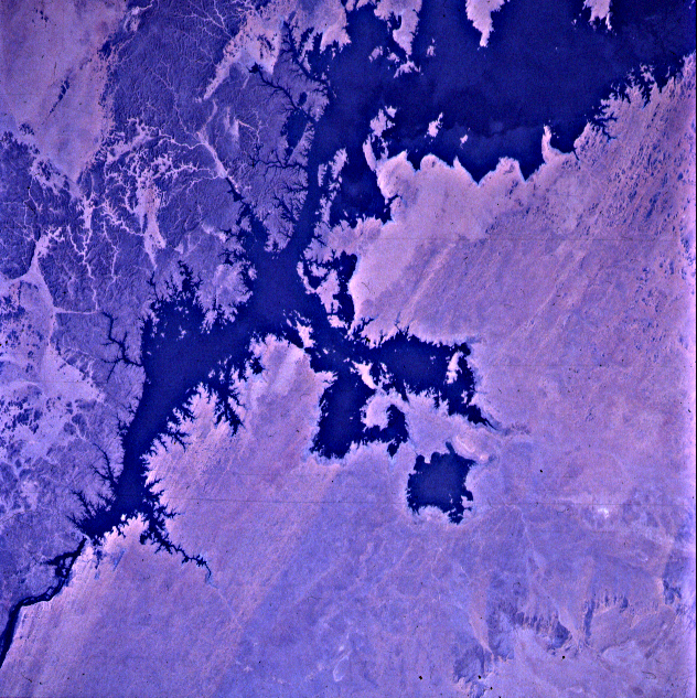
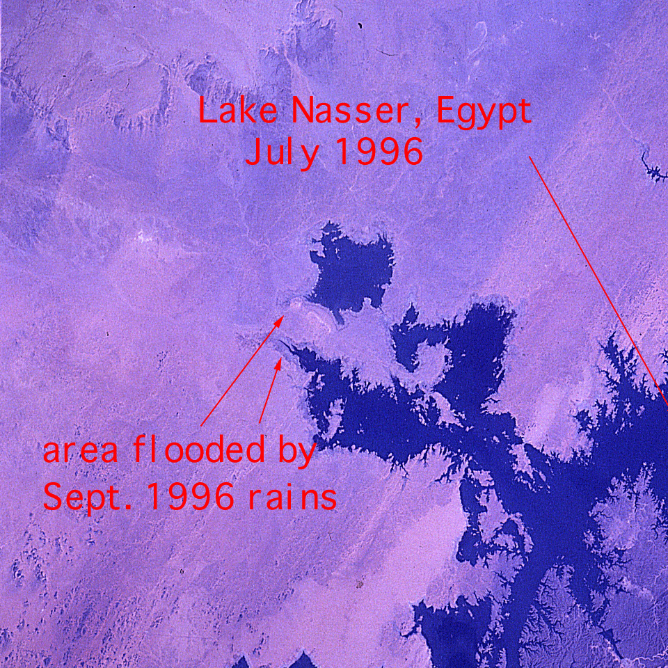
Country or Geographic Name: | EGYPT |
Features: | NILE RIVER, LAKE NASSER |
| Features Found Using Machine Learning: | |
Cloud Cover Percentage: | 0 (no clouds present) |
Sun Elevation Angle: | 52° |
Sun Azimuth: | 89° |
Camera: | Hasselblad |
Focal Length: | 250mm |
Camera Tilt: | 52 degrees |
Format: | 5046: Kodak, natural color positive, Lumiere 100/5046, ASA 100, standard base |
Film Exposure: | Normal |
| Additional Information | |
| Width | Height | Annotated | Cropped | Purpose | Links |
|---|---|---|---|---|---|
| 5700 pixels | 6000 pixels | No | No | Download Image | |
| 500 pixels | 526 pixels | No | No | Download Image | |
| 2614 pixels | 2609 pixels | No | No | Download Image | |
| 960 pixels | 960 pixels | Yes | No | Download Image | |
| 585 pixels | 575 pixels | Download Image | |||
| 585 pixels | 575 pixels | Download Image | |||
| 600 pixels | 590 pixels | Download Image | |||
| 632 pixels | 633 pixels | Download Image |
Download Packaged File
Download a Google Earth KML for this Image
View photo footprint information
Download a GeoTIFF for this photo
Image Caption: none
