NM22-705-16
| NASA Photo ID | NM22-705-16 |
| Focal Length | 250mm |
| Date taken | 1996.07.25 |
| Time taken | 08:22:57 GMT |
Resolutions offered for this image:
4000 x 4000 pixels 788 x 797 pixels 5700 x 6000 pixels 4000 x 4000 pixels 500 x 526 pixels 768 x 768 pixels
4000 x 4000 pixels 788 x 797 pixels 5700 x 6000 pixels 4000 x 4000 pixels 500 x 526 pixels 768 x 768 pixels


Cloud masks available for this image:
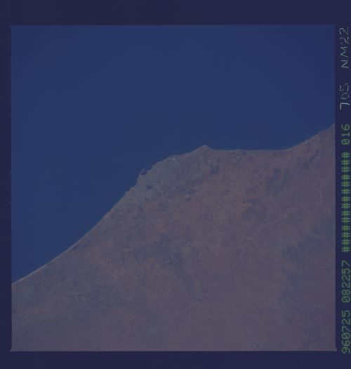
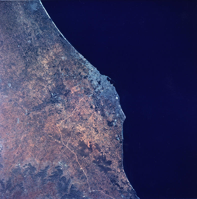
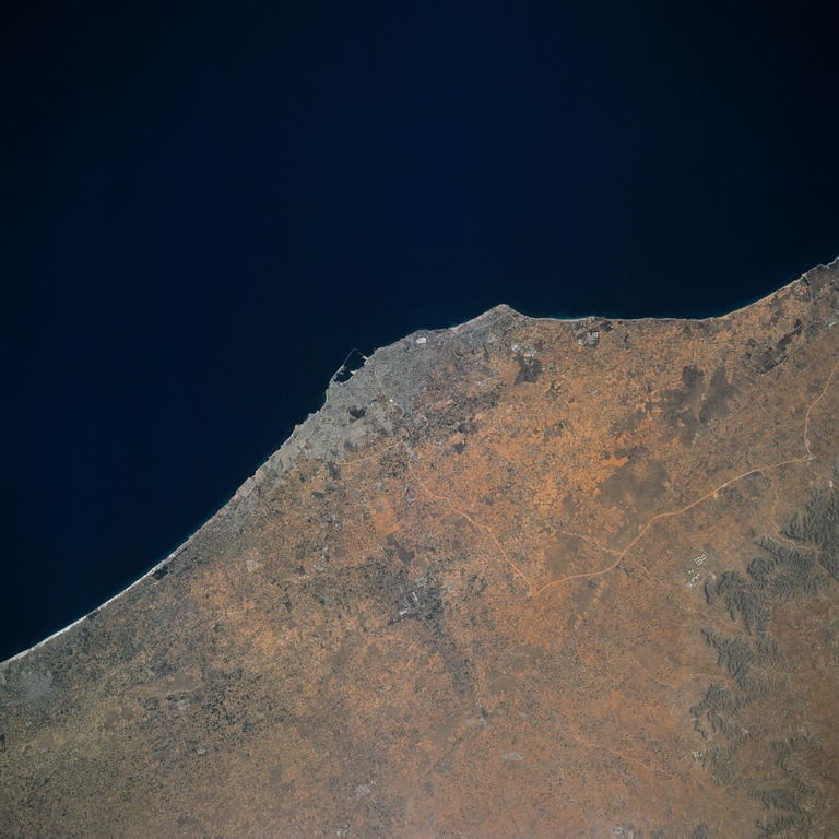
Spacecraft nadir point: 33.8° N, 9.6° E
Photo center point: 33.0° N, 13.0° E
Photo center point by machine learning:
Photo center point: 33.0° N, 13.0° E
Photo center point by machine learning:
Nadir to Photo Center: East
Spacecraft Altitude: 208 nautical miles (385km)
Country or Geographic Name: | LIBYA |
Features: | TRIPOLI, MED. COAST |
| Features Found Using Machine Learning: | |
Cloud Cover Percentage: | 0 (no clouds present) |
Sun Elevation Angle: | 47° |
Sun Azimuth: | 97° |
Camera: | Hasselblad |
Focal Length: | 250mm |
Camera Tilt: | 45 degrees |
Format: | 5046: Kodak, natural color positive, Lumiere 100/5046, ASA 100, standard base |
Film Exposure: | Normal |
| Additional Information | |
| Width | Height | Annotated | Cropped | Purpose | Links |
|---|---|---|---|---|---|
| 4000 pixels | 4000 pixels | Cities collection | Download Image | ||
| 788 pixels | 797 pixels | No | No | Cities collection | Download Image |
| 5700 pixels | 6000 pixels | No | No | Download Image | |
| 4000 pixels | 4000 pixels | No | No | Scientist Request | Download Image |
| 500 pixels | 526 pixels | No | No | Download Image | |
| 768 pixels | 768 pixels | No | No | Scientist Request | Download Image |
Download Packaged File
Download a Google Earth KML for this Image
View photo footprint information
Download a GeoTIFF for this photo
Image Caption: none
