NM21-765-84
| NASA Photo ID | NM21-765-84 |
| Focal Length | 250mm |
| Date taken | 1996.07.03 |
| Time taken | 18:22:06 GMT |


Cloud masks available for this image:
Spacecraft nadir point: 35.7° N, 121.7° W
Photo center point: 37.5° N, 122.0° W
Photo center point by machine learning:
Photo center point: 37.5° N, 122.0° W
Photo center point by machine learning:
Nadir to Photo Center: North
Spacecraft Altitude: 209 nautical miles (387km)
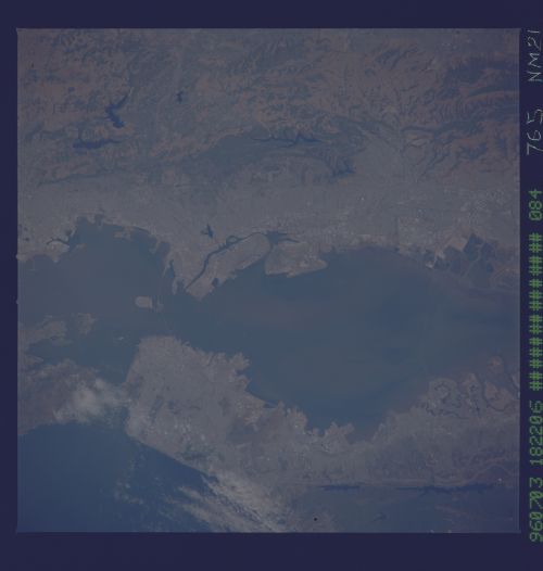
Country or Geographic Name: | USA-CALIFORNIA |
Features: | SAN FRANCISCO, BAY, WAKES |
| Features Found Using Machine Learning: | |
Cloud Cover Percentage: | 5 (1-10)% |
Sun Elevation Angle: | 63° |
Sun Azimuth: | 110° |
Camera: | Hasselblad |
Focal Length: | 250mm |
Camera Tilt: | 28 degrees |
Format: | 5046: Kodak, natural color positive, Lumiere 100/5046, ASA 100, standard base |
Film Exposure: | Normal |
| Additional Information | |
| Width | Height | Annotated | Cropped | Purpose | Links |
|---|---|---|---|---|---|
| 5700 pixels | 6000 pixels | No | No | Download Image | |
| 500 pixels | 526 pixels | No | No | Download Image | |
| 2590 pixels | 2538 pixels | Download Image |
Download Packaged File
Download a Google Earth KML for this Image
View photo footprint information
Download a GeoTIFF for this photo
Image Caption: San Francisco and San Francisco Bay -- detailed view of the city. The Golden Gate bridge is obscured by clouds, but the Bay Bridge can be seen. Oakland is on the east side of the bay.
