NM21-765-16
| NASA Photo ID | NM21-765-16 |
| Focal Length | 250mm |
| Date taken | 1996.07.03 |
| Time taken | 16:48:57 GMT |
Resolutions offered for this image:
3790 x 3904 pixels 621 x 639 pixels 5700 x 6000 pixels 500 x 526 pixels
3790 x 3904 pixels 621 x 639 pixels 5700 x 6000 pixels 500 x 526 pixels


Cloud masks available for this image:
Spacecraft nadir point: 33.5° N, 101.0° W
Photo center point: 35.0° N, 102.0° W
Photo center point by machine learning:
Photo center point: 35.0° N, 102.0° W
Photo center point by machine learning:
Nadir to Photo Center: Northwest
Spacecraft Altitude: 209 nautical miles (387km)
Camera: | Hasselblad |
Focal Length: | 250mm |
Camera Tilt: | 27 degrees |
Format: | 5046: Kodak, natural color positive, Lumiere 100/5046, ASA 100, standard base |
Film Exposure: | Normal |
| Additional Information | |
| Width | Height | Annotated | Cropped | Purpose | Links |
|---|---|---|---|---|---|
| 3790 pixels | 3904 pixels | No | No | Earth From Space collection | Download Image |
| 621 pixels | 639 pixels | No | No | Earth From Space collection | Download Image |
| 5700 pixels | 6000 pixels | No | No | Download Image | |
| 500 pixels | 526 pixels | No | No | Download Image |
Download Packaged File
Download a Google Earth KML for this Image
View photo footprint information
Download a GeoTIFF for this photo
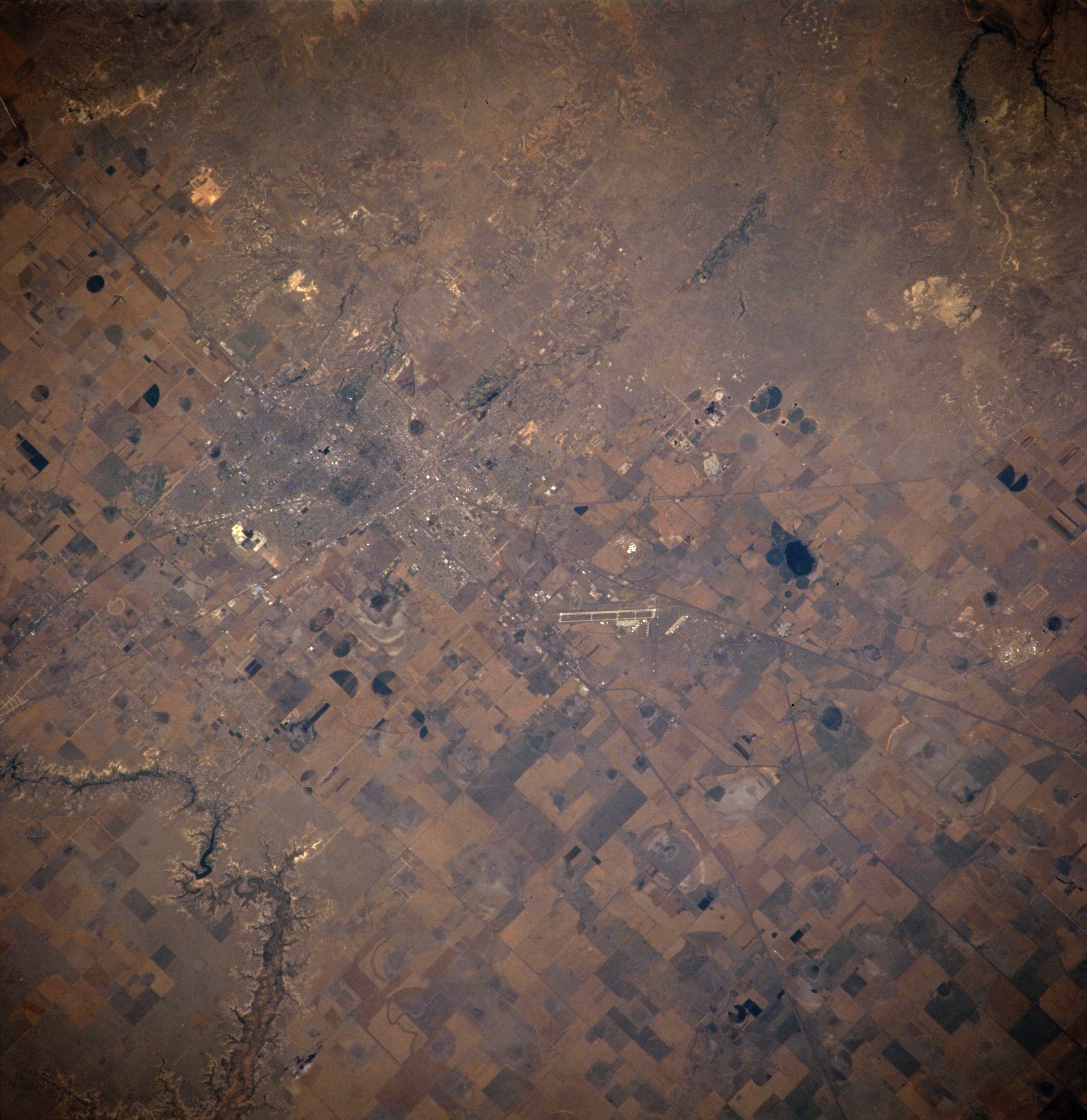
Image Caption: NM21-765-016 Amarillo, Texas, U.S.A Spring 1996
Visible in this photograph is some of the urban infrastructure--airport, highways, street patterns, central business district--of Amarillo, the largest city in the Texas panhandle. The only deviation from the flat and featureless Texas high plains is the southeast-flowing Prairie Dog Town Fork of the Red River, which has created picturesque Palo Duro Canyon. The majority of fluvial erosion occurred during a much wetter geological time; however, erosion still results from downpours in this semiarid climate. Most of the countryside surrounding Amarillo, except for the north and northwest, evidences widespread agriculture.
Visible in this photograph is some of the urban infrastructure--airport, highways, street patterns, central business district--of Amarillo, the largest city in the Texas panhandle. The only deviation from the flat and featureless Texas high plains is the southeast-flowing Prairie Dog Town Fork of the Red River, which has created picturesque Palo Duro Canyon. The majority of fluvial erosion occurred during a much wetter geological time; however, erosion still results from downpours in this semiarid climate. Most of the countryside surrounding Amarillo, except for the north and northwest, evidences widespread agriculture.
