NM21-763-35
| NASA Photo ID | NM21-763-35 |
| Focal Length | 250mm |
| Date taken | 1996.06.29 |
| Time taken | 18:59:25 GMT |
Resolutions offered for this image:
787 x 792 pixels 3904 x 3904 pixels 639 x 639 pixels 5700 x 6000 pixels 500 x 526 pixels
787 x 792 pixels 3904 x 3904 pixels 639 x 639 pixels 5700 x 6000 pixels 500 x 526 pixels

Cloud masks available for this image:
Spacecraft nadir point: 41.8° N, 96.7° W
Photo center point: 41.5° N, 94.0° W
Photo center point by machine learning:
Photo center point: 41.5° N, 94.0° W
Photo center point by machine learning:
Nadir to Photo Center: East
Spacecraft Altitude: 208 nautical miles (385km)
Country or Geographic Name: | USA-IOWA |
Features: | DES MOINES, R., RES., ROADS |
| Features Found Using Machine Learning: | |
Cloud Cover Percentage: | 0 (no clouds present) |
Sun Elevation Angle: | 71° |
Sun Azimuth: | 200° |
Camera: | Hasselblad |
Focal Length: | 250mm |
Camera Tilt: | 38 degrees |
Format: | 5046: Kodak, natural color positive, Lumiere 100/5046, ASA 100, standard base |
Film Exposure: | Normal |
| Additional Information | |
| Width | Height | Annotated | Cropped | Purpose | Links |
|---|---|---|---|---|---|
| 787 pixels | 792 pixels | No | No | Cities collection | Download Image |
| 3904 pixels | 3904 pixels | No | No | Earth From Space collection | Download Image |
| 639 pixels | 639 pixels | No | No | Earth From Space collection | Download Image |
| 5700 pixels | 6000 pixels | No | No | Download Image | |
| 500 pixels | 526 pixels | No | No | Download Image |
Download Packaged File
Download a Google Earth KML for this Image
View photo footprint information
Download a GeoTIFF for this photo
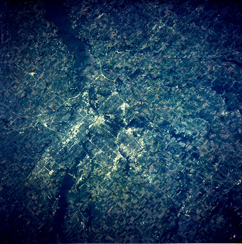
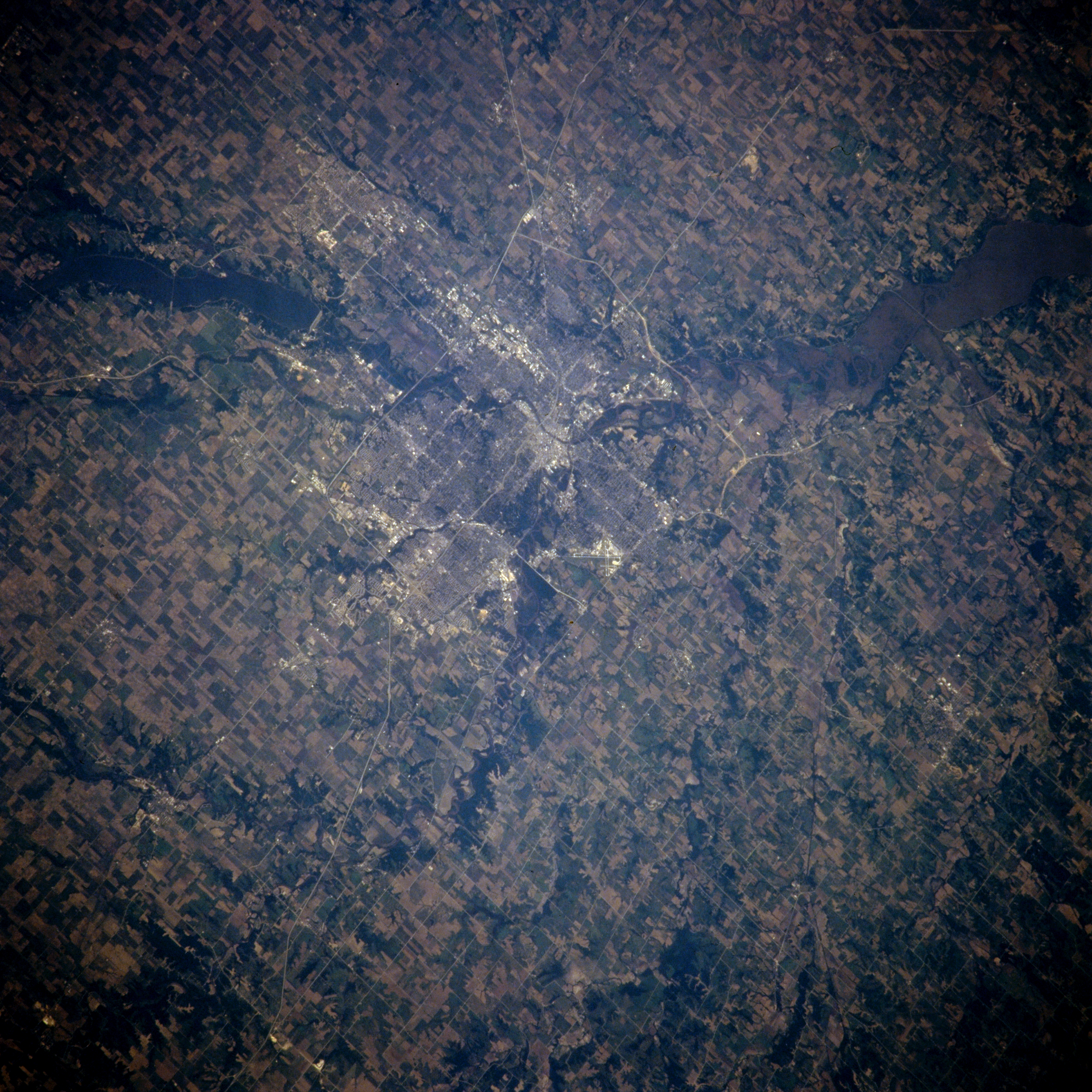
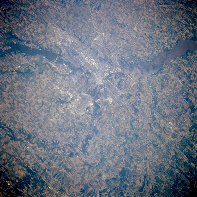
Image Caption: NM21-763-035 Des Moines, Iowa, U.S.A. Winter 1995-1996
Surrounded by agricultural field patterns in this northeast-looking, low-oblique photograph is Des Moines, the capital of Iowa, the state with 25 percent of the highest grade topsoil in the United States. More than 90 percent of Iowa is devoted to agriculture; only California ranks ahead of Iowa in cash farm income. Des Moines, situated at the junction of the Des Moines and Raccoon Rivers, is an important industrial and transportation center in the heart of the U.S. corn belt and coal mining region and is the location of the home offices of numerous insurance companies. Des Moines, home of the first U. S. Women's Army Corp Training Center that opened in 1942, was devastated by floods in 1954 and 1993. Dams and reservoirs built on the Des Moines River after 1954 provide flood control relief. Two reservoirs are visible--Saylorville north-northwest of the city and sediment-laden Red Rock to the east-southeast.
Surrounded by agricultural field patterns in this northeast-looking, low-oblique photograph is Des Moines, the capital of Iowa, the state with 25 percent of the highest grade topsoil in the United States. More than 90 percent of Iowa is devoted to agriculture; only California ranks ahead of Iowa in cash farm income. Des Moines, situated at the junction of the Des Moines and Raccoon Rivers, is an important industrial and transportation center in the heart of the U.S. corn belt and coal mining region and is the location of the home offices of numerous insurance companies. Des Moines, home of the first U. S. Women's Army Corp Training Center that opened in 1942, was devastated by floods in 1954 and 1993. Dams and reservoirs built on the Des Moines River after 1954 provide flood control relief. Two reservoirs are visible--Saylorville north-northwest of the city and sediment-laden Red Rock to the east-southeast.
