NM21-757-53
| NASA Photo ID | NM21-757-53 |
| Focal Length | 100mm |
| Date taken | 1996.06.21 |
| Time taken | 12:24:42 GMT |

Cloud masks available for this image:
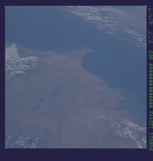
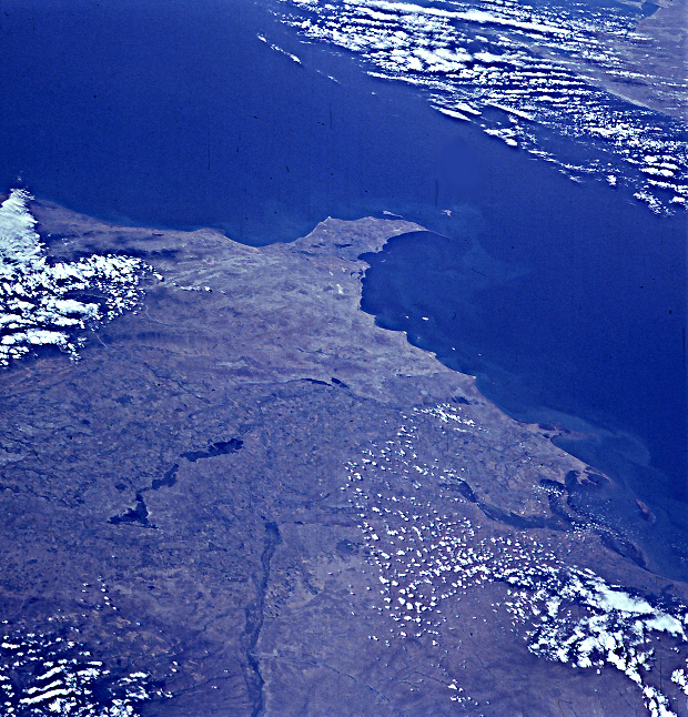
Spacecraft nadir point: 37.4° N, 44.0° E
Photo center point: 40.0° N, 49.0° E
Photo center point by machine learning:
Photo center point: 40.0° N, 49.0° E
Photo center point by machine learning:
Nadir to Photo Center: Northeast
Spacecraft Altitude: 208 nautical miles (385km)
Country or Geographic Name: | AZERBAIJAN |
Features: | APSHEONSKIY PEN., CASPIAN |
| Features Found Using Machine Learning: | |
Cloud Cover Percentage: | 30 (26-50)% |
Sun Elevation Angle: | 46° |
Sun Azimuth: | 266° |
Camera: | Hasselblad |
Focal Length: | 100mm |
Camera Tilt: | Low Oblique |
Format: | 5046: Kodak, natural color positive, Lumiere 100/5046, ASA 100, standard base |
Film Exposure: | Normal |
| Additional Information | |
| Width | Height | Annotated | Cropped | Purpose | Links |
|---|---|---|---|---|---|
| 5700 pixels | 6000 pixels | No | No | Download Image | |
| 500 pixels | 526 pixels | No | No | Download Image | |
| 620 pixels | 646 pixels | Earth From Space phase 2 | Download Image |
Download Packaged File
Download a Google Earth KML for this Image
View photo footprint information
Download a GeoTIFF for this photo
Image Caption: none
