NM21-745-69
| NASA Photo ID | NM21-745-69 |
| Focal Length | 100mm |
| Date taken | 1996.05.13 |
| Time taken | GMT |

Cloud masks available for this image:
Spacecraft nadir point:
Photo center point: 51.0° N, 80.0° W
Photo center point by machine learning:
Photo center point: 51.0° N, 80.0° W
Photo center point by machine learning:
Nadir to Photo Center: North
Spacecraft Altitude: nautical miles (0km)
Country or Geographic Name: | CANADA-O |
Features: | HUDSON BAY, HARRICANA R. |
| Features Found Using Machine Learning: | |
Cloud Cover Percentage: | 0 (no clouds present) |
Sun Elevation Angle: | ° |
Sun Azimuth: | ° |
Camera: | Hasselblad |
Focal Length: | 100mm |
Camera Tilt: | Low Oblique |
Format: | 5046: Kodak, natural color positive, Lumiere 100/5046, ASA 100, standard base |
Film Exposure: | Normal |
| Additional Information | |
| Width | Height | Annotated | Cropped | Purpose | Links |
|---|---|---|---|---|---|
| 5700 pixels | 6000 pixels | No | No | Download Image | |
| 500 pixels | 526 pixels | No | No | Download Image | |
| 639 pixels | 652 pixels | Yes | No | Download Image |
Download Packaged File
Download a Google Earth KML for this Image
View photo footprint information
Download a GeoTIFF for this photo
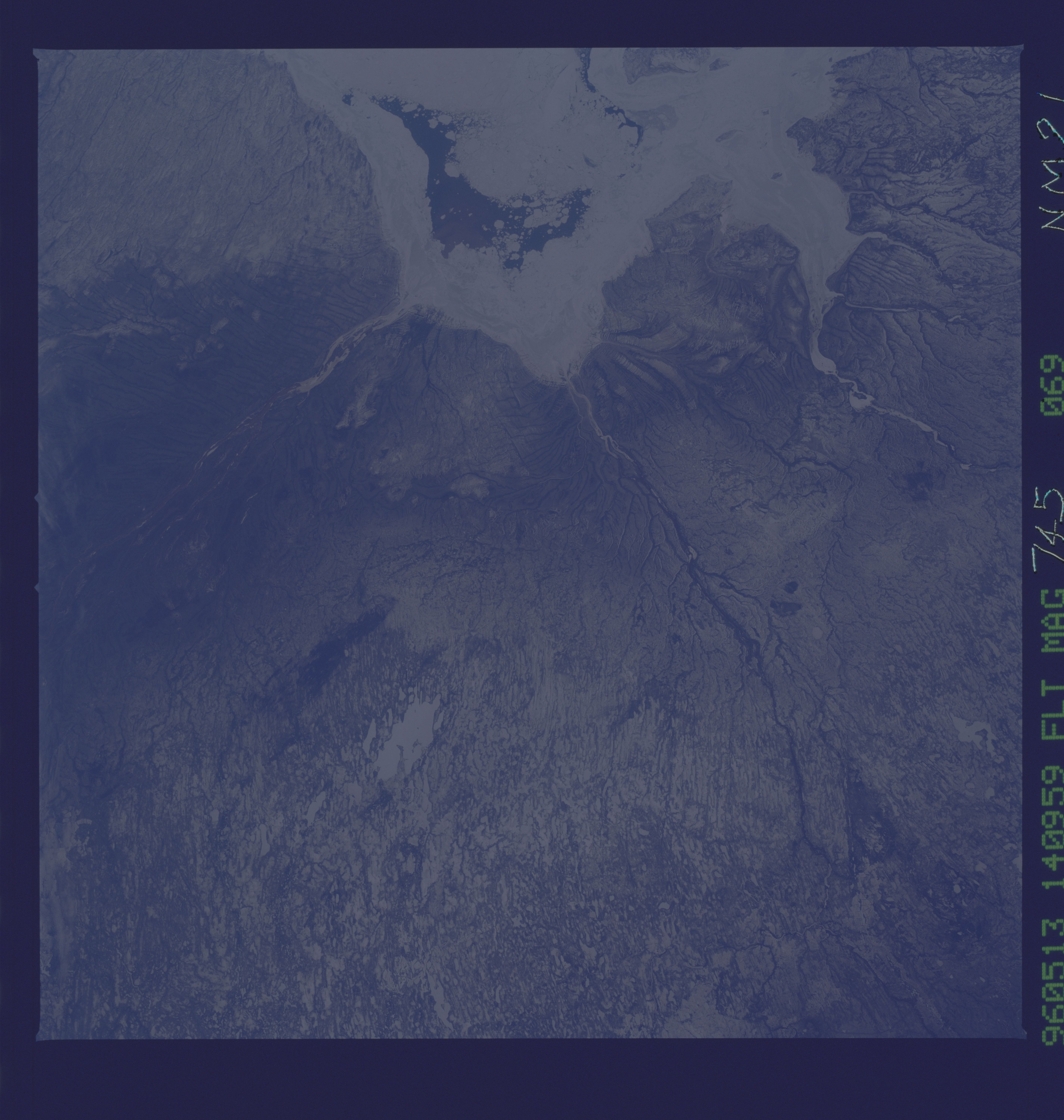
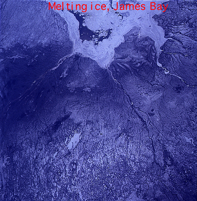
Image Caption: One of the prime goals of our NASA-Mir imagery is to document seasonal changes on the Earth's surface. This view, taken in mid-May, 1996, looks north across Ontario, Canada to the still ice-covered Hudson Bay. The dark blue water in the middle of the scene shows that the ice pack is beginning to break up in late spring, but ice remains in the bay until early July.
