NASA7-723-63
| NASA Photo ID | NASA7-723-63 |
| Focal Length | 250mm |
| Date taken | 1998.05.12 |
| Time taken | GMT |
Resolutions offered for this image:
4042 x 4042 pixels 640 x 640 pixels 4400 x 4600 pixels 492 x 515 pixels 510 x 501 pixels 479 x 479 pixels
4042 x 4042 pixels 640 x 640 pixels 4400 x 4600 pixels 492 x 515 pixels 510 x 501 pixels 479 x 479 pixels

Cloud masks available for this image:
Spacecraft nadir point:
Photo center point: 37.5° N, 100.0° W
Photo center point by machine learning:
Photo center point: 37.5° N, 100.0° W
Photo center point by machine learning:
Nadir to Photo Center:
Spacecraft Altitude: nautical miles (0km)
Country or Geographic Name: | USA-KANSAS |
Features: | DODGE CITY, ARKANSAS R. |
| Features Found Using Machine Learning: | |
Cloud Cover Percentage: | 0 (no clouds present) |
Sun Elevation Angle: | ° |
Sun Azimuth: | ° |
Camera: | Hasselblad |
Focal Length: | 250mm |
Camera Tilt: | Low Oblique |
Format: | 5069: Kodak Elite 100S, E6 Reversal, Replaces Lumiere, Warmer in tone vs. Lumiere |
Film Exposure: | Normal |
| Additional Information | |
| Width | Height | Annotated | Cropped | Purpose | Links |
|---|---|---|---|---|---|
| 4042 pixels | 4042 pixels | No | No | Earth From Space collection | Download Image |
| 640 pixels | 640 pixels | No | No | Earth From Space collection | Download Image |
| 4400 pixels | 4600 pixels | No | No | Download Image | |
| 492 pixels | 515 pixels | No | No | Download Image | |
| 510 pixels | 501 pixels | No | No | Download Image | |
| 479 pixels | 479 pixels | Download Image |
Download Packaged File
Download a Google Earth KML for this Image
View photo footprint information
Download a GeoTIFF for this photo
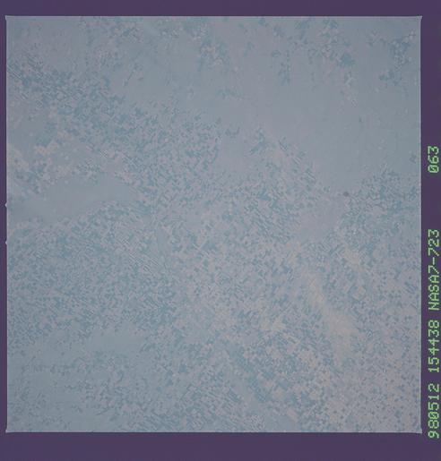
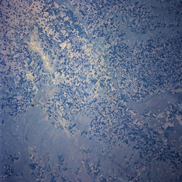
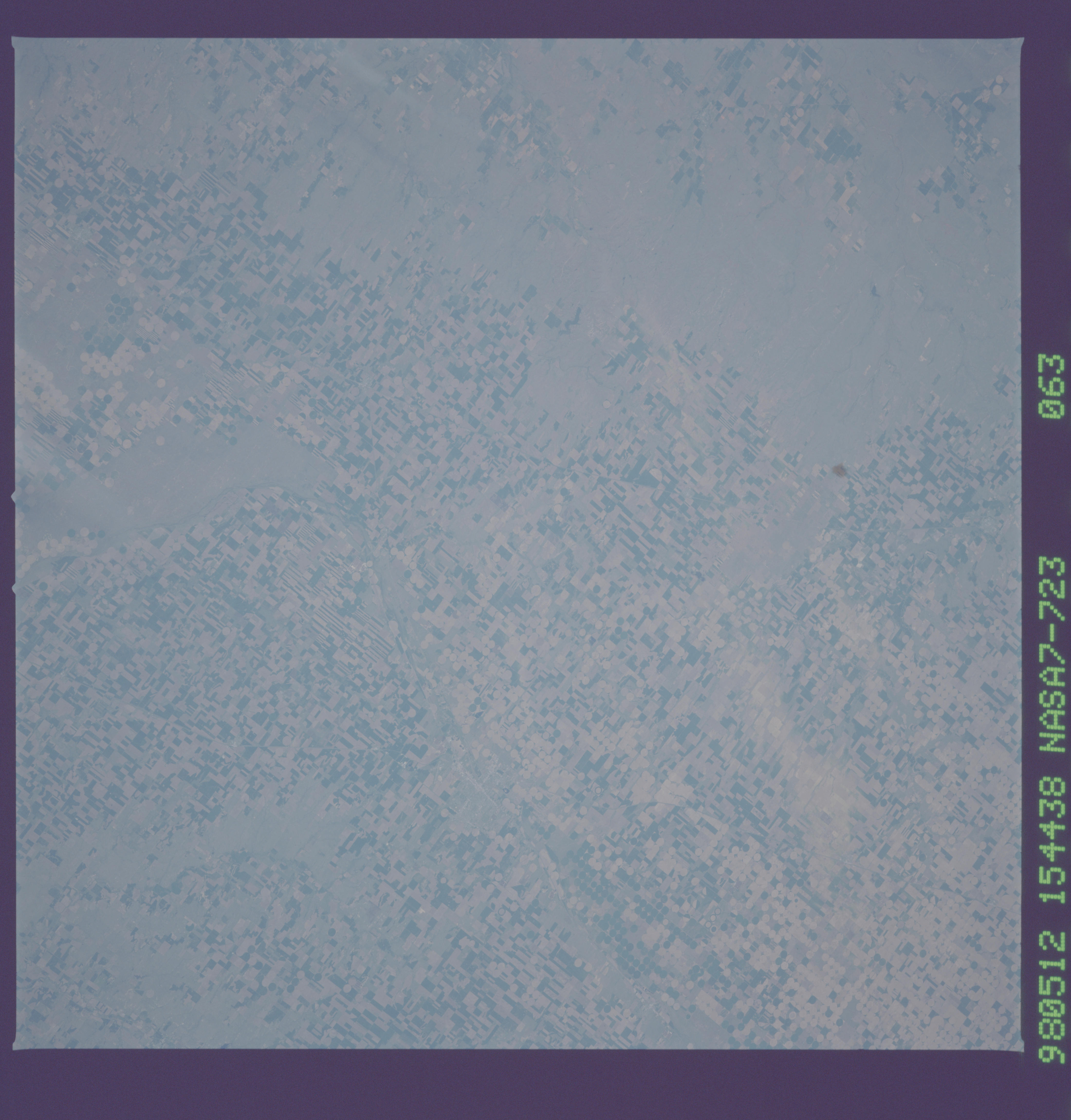
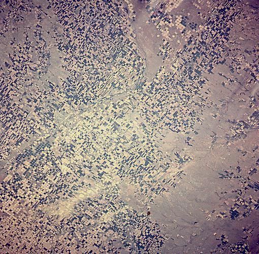
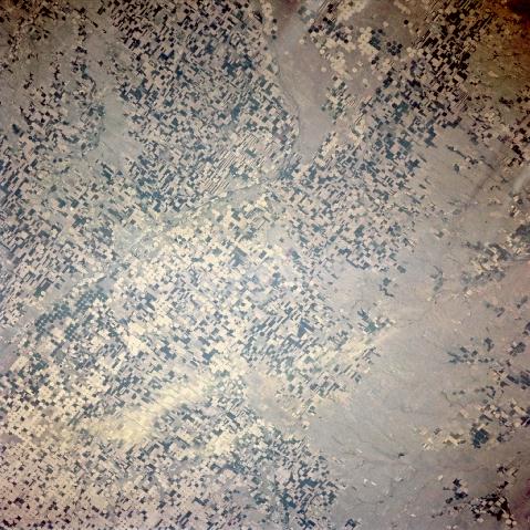
Image Caption: NASA7-723-063 Dodge City Area, Kansas Spring, 1998
Located in the Great Plains of southwestern Kansas, Dodge City (an area of finer texture situated midway between the center and left center of the image) is discernible in this northeast-looking low-oblique view. Situated on the Arkansas River, Dodge City is a wheat and livestock distribution center. The city also produces agricultural implements and supplies in this mostly agriculture-based region. Dodge City was laid out as a railroad livestock shipping railhead in 1872 for the Santa Fe Railroad. The city flourished and become a wild and rowdy cow town. Some of its most famous residents were Wyatt Earp and Bat Masterson. Dodge City, as seen on the image, is surrounded by agricultural fields, including many circular central pivot-irrigation fields. Different colors in the fields represent different crops and different stages of planting. The Ogalala Acquifer supplies most of the underground water used to irrigate crops in the Dodge City area.
Located in the Great Plains of southwestern Kansas, Dodge City (an area of finer texture situated midway between the center and left center of the image) is discernible in this northeast-looking low-oblique view. Situated on the Arkansas River, Dodge City is a wheat and livestock distribution center. The city also produces agricultural implements and supplies in this mostly agriculture-based region. Dodge City was laid out as a railroad livestock shipping railhead in 1872 for the Santa Fe Railroad. The city flourished and become a wild and rowdy cow town. Some of its most famous residents were Wyatt Earp and Bat Masterson. Dodge City, as seen on the image, is surrounded by agricultural fields, including many circular central pivot-irrigation fields. Different colors in the fields represent different crops and different stages of planting. The Ogalala Acquifer supplies most of the underground water used to irrigate crops in the Dodge City area.
