NASA7-711-62
| NASA Photo ID | NASA7-711-62 |
| Focal Length | 100mm |
| Date taken | 1998.03.13 |
| Time taken | GMT |
Resolutions offered for this image:
4091 x 4056 pixels 640 x 634 pixels 4400 x 4600 pixels 492 x 515 pixels 1279 x 1269 pixels 517 x 508 pixels
4091 x 4056 pixels 640 x 634 pixels 4400 x 4600 pixels 492 x 515 pixels 1279 x 1269 pixels 517 x 508 pixels

Cloud masks available for this image:
Spacecraft nadir point:
Photo center point: 32.5° S, 115.0° E
Photo center point by machine learning:
Photo center point: 32.5° S, 115.0° E
Photo center point by machine learning:
Nadir to Photo Center:
Spacecraft Altitude: nautical miles (0km)
Camera: | Hasselblad |
Focal Length: | 100mm |
Camera Tilt: | Low Oblique |
Format: | 5069: Kodak Elite 100S, E6 Reversal, Replaces Lumiere, Warmer in tone vs. Lumiere |
Film Exposure: | Normal |
| Additional Information | |
| Width | Height | Annotated | Cropped | Purpose | Links |
|---|---|---|---|---|---|
| 4091 pixels | 4056 pixels | No | No | Earth From Space collection | Download Image |
| 640 pixels | 634 pixels | No | No | Earth From Space collection | Download Image |
| 4400 pixels | 4600 pixels | No | No | Download Image | |
| 492 pixels | 515 pixels | No | No | Download Image | |
| 1279 pixels | 1269 pixels | No | No | Download Image | |
| 517 pixels | 508 pixels | Download Image |
Download Packaged File
Download a Google Earth KML for this Image
View photo footprint information
Download a GeoTIFF for this photo
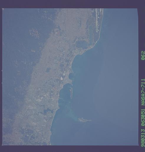
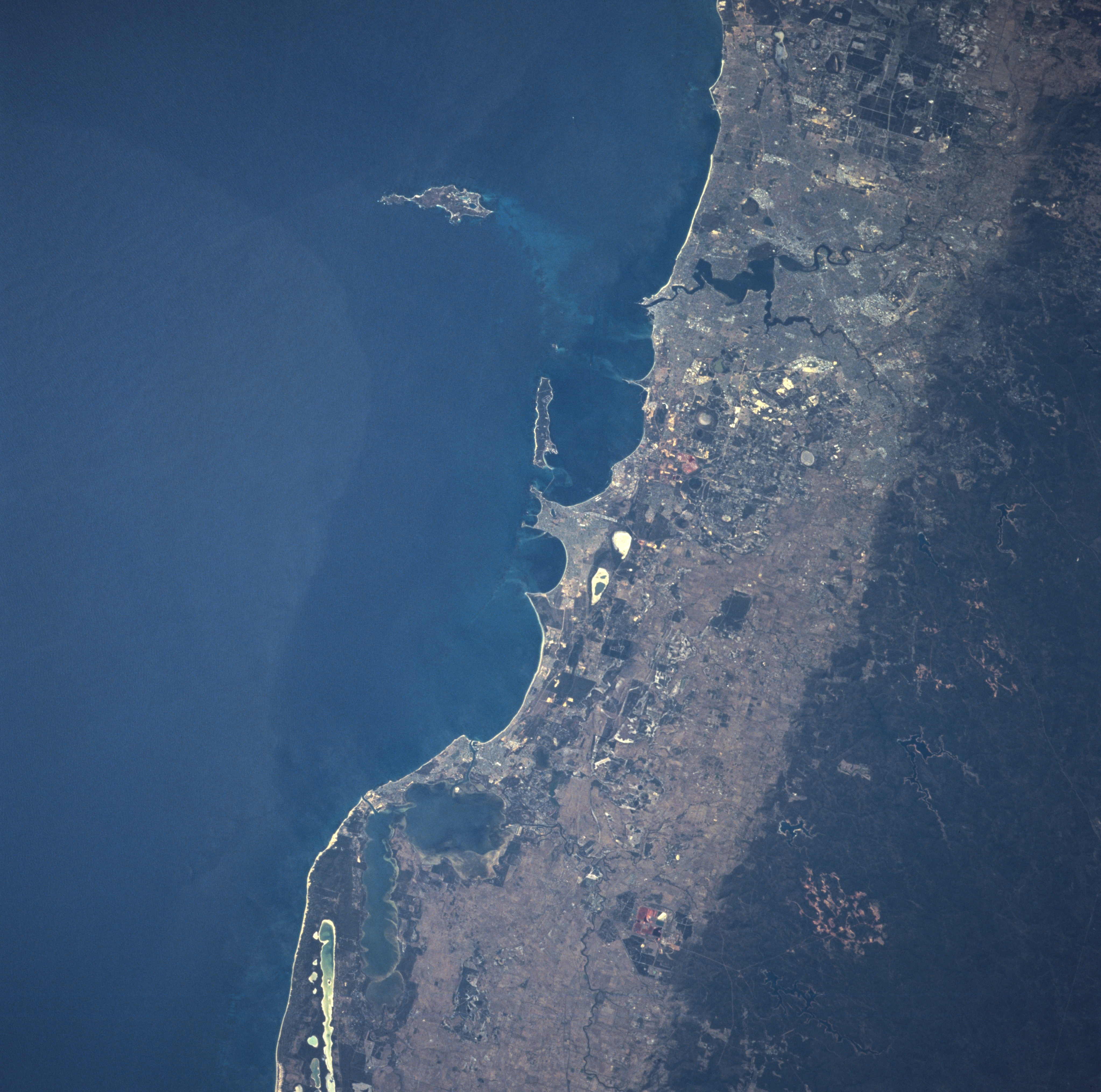
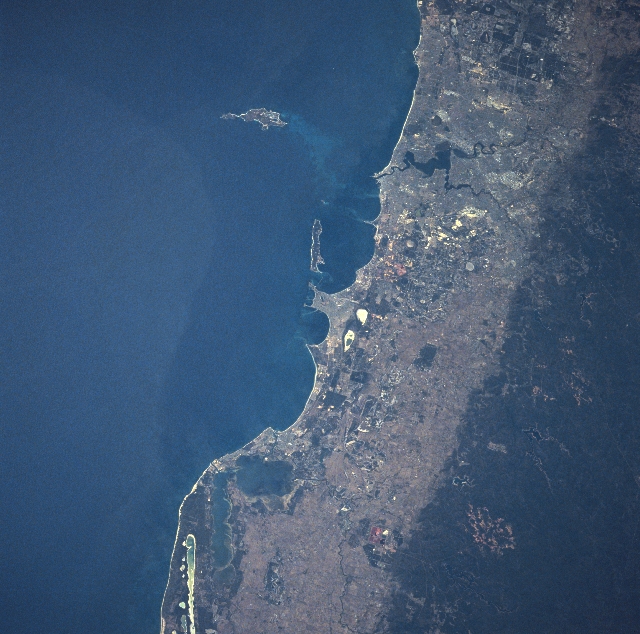
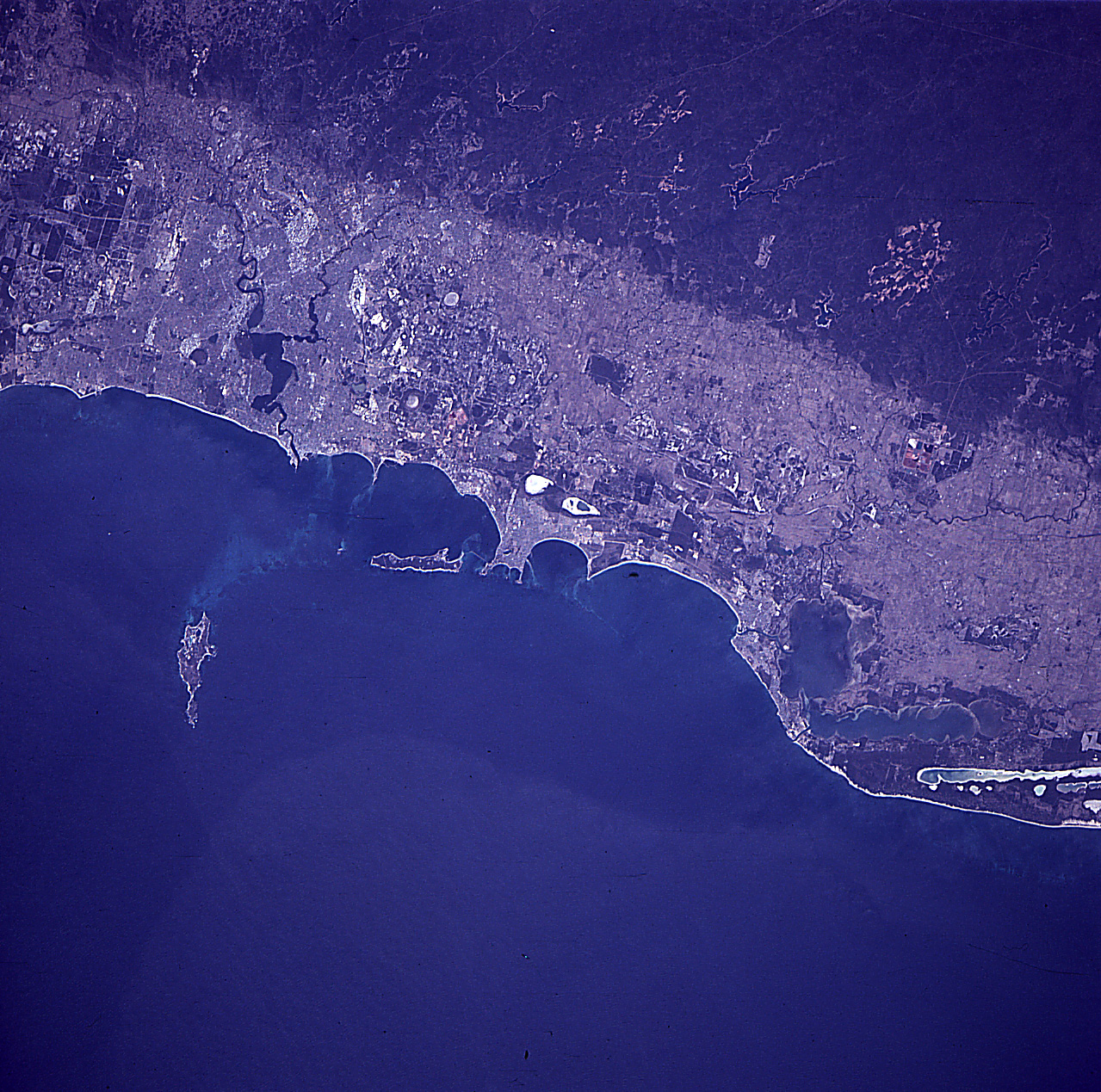
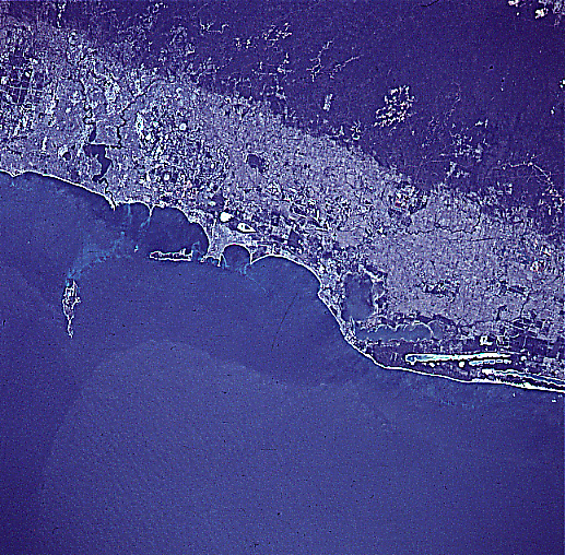
Image Caption: NASA7-711-062 Perth Area, Western Australia, Australia Winter/Spring 1998
The dramatic color change in this image that includes the metropolitan Perth area of Western Australia is the result of an abrupt elevation difference from the undulating coastal plains (lighter landscape) to the low range of mountains, known as the Darling Range. The darker terrain that parallels the coastline is a faulted zone along the western edge of the Great Plateau in Western Australia. The wooded, low mountains range in elevation from 800 feet to 1000 feet (250 meters to 300 meters) above sea level. A few of the higher peaks exceed 1700 feet (518 meters). Several reservoirs (dark, irregular-shaped features) are scattered throughout the Darling Range. The central business district of Perth, Western Australia's capital and largest city (population over 1.3 million), is visible immediately north of junction where the Swan River (thin, meandering dark line) enters Melville Water (larger dark bay slightly above and right of center). The Canning River is also visible as it enters the southeast side of Melville Water. Rottnest and Garden Islands (elongated islands) are observed just off of the coast in the Indian Ocean.
The dramatic color change in this image that includes the metropolitan Perth area of Western Australia is the result of an abrupt elevation difference from the undulating coastal plains (lighter landscape) to the low range of mountains, known as the Darling Range. The darker terrain that parallels the coastline is a faulted zone along the western edge of the Great Plateau in Western Australia. The wooded, low mountains range in elevation from 800 feet to 1000 feet (250 meters to 300 meters) above sea level. A few of the higher peaks exceed 1700 feet (518 meters). Several reservoirs (dark, irregular-shaped features) are scattered throughout the Darling Range. The central business district of Perth, Western Australia's capital and largest city (population over 1.3 million), is visible immediately north of junction where the Swan River (thin, meandering dark line) enters Melville Water (larger dark bay slightly above and right of center). The Canning River is also visible as it enters the southeast side of Melville Water. Rottnest and Garden Islands (elongated islands) are observed just off of the coast in the Indian Ocean.
