NASA7-709-78
| NASA Photo ID | NASA7-709-78 |
| Focal Length | 250mm |
| Date taken | 1998.03.09 |
| Time taken | GMT |
Resolutions offered for this image:
4044 x 4079 pixels 634 x 639 pixels 4400 x 4600 pixels 492 x 515 pixels 1314 x 1295 pixels 500 x 500 pixels
4044 x 4079 pixels 634 x 639 pixels 4400 x 4600 pixels 492 x 515 pixels 1314 x 1295 pixels 500 x 500 pixels
Cloud masks available for this image:
Spacecraft nadir point:
Photo center point: 35.0° S, 138.5° E
Photo center point by machine learning:
Photo center point: 35.0° S, 138.5° E
Photo center point by machine learning:
Nadir to Photo Center:
Spacecraft Altitude: nautical miles (0km)
Country or Geographic Name: | AUSTRALIA-SA |
Features: | ADELAIDE, GULF ST. VINCENT |
| Features Found Using Machine Learning: | |
Cloud Cover Percentage: | 0 (no clouds present) |
Sun Elevation Angle: | ° |
Sun Azimuth: | ° |
Camera: | Hasselblad |
Focal Length: | 250mm |
Camera Tilt: | Low Oblique |
Format: | 5069: Kodak Elite 100S, E6 Reversal, Replaces Lumiere, Warmer in tone vs. Lumiere |
Film Exposure: | Normal |
| Additional Information | |
| Width | Height | Annotated | Cropped | Purpose | Links |
|---|---|---|---|---|---|
| 4044 pixels | 4079 pixels | No | No | Earth From Space collection | Download Image |
| 634 pixels | 639 pixels | No | No | Earth From Space collection | Download Image |
| 4400 pixels | 4600 pixels | No | No | Download Image | |
| 492 pixels | 515 pixels | No | No | Download Image | |
| 1314 pixels | 1295 pixels | No | No | Download Image | |
| 500 pixels | 500 pixels | Download Image |
Download Packaged File
Download a Google Earth KML for this Image
View photo footprint information
Download a GeoTIFF for this photo
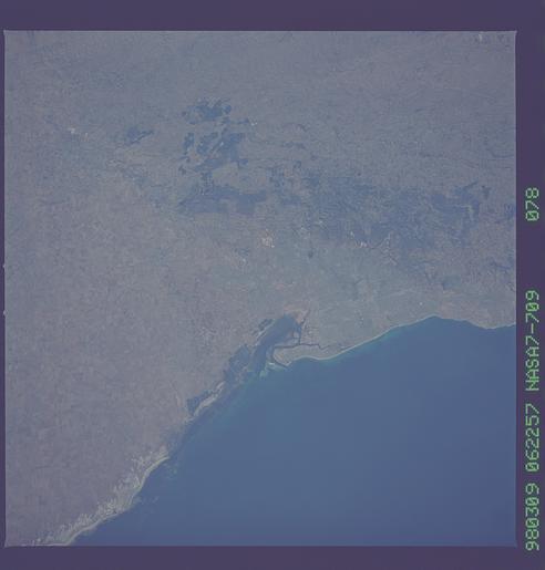
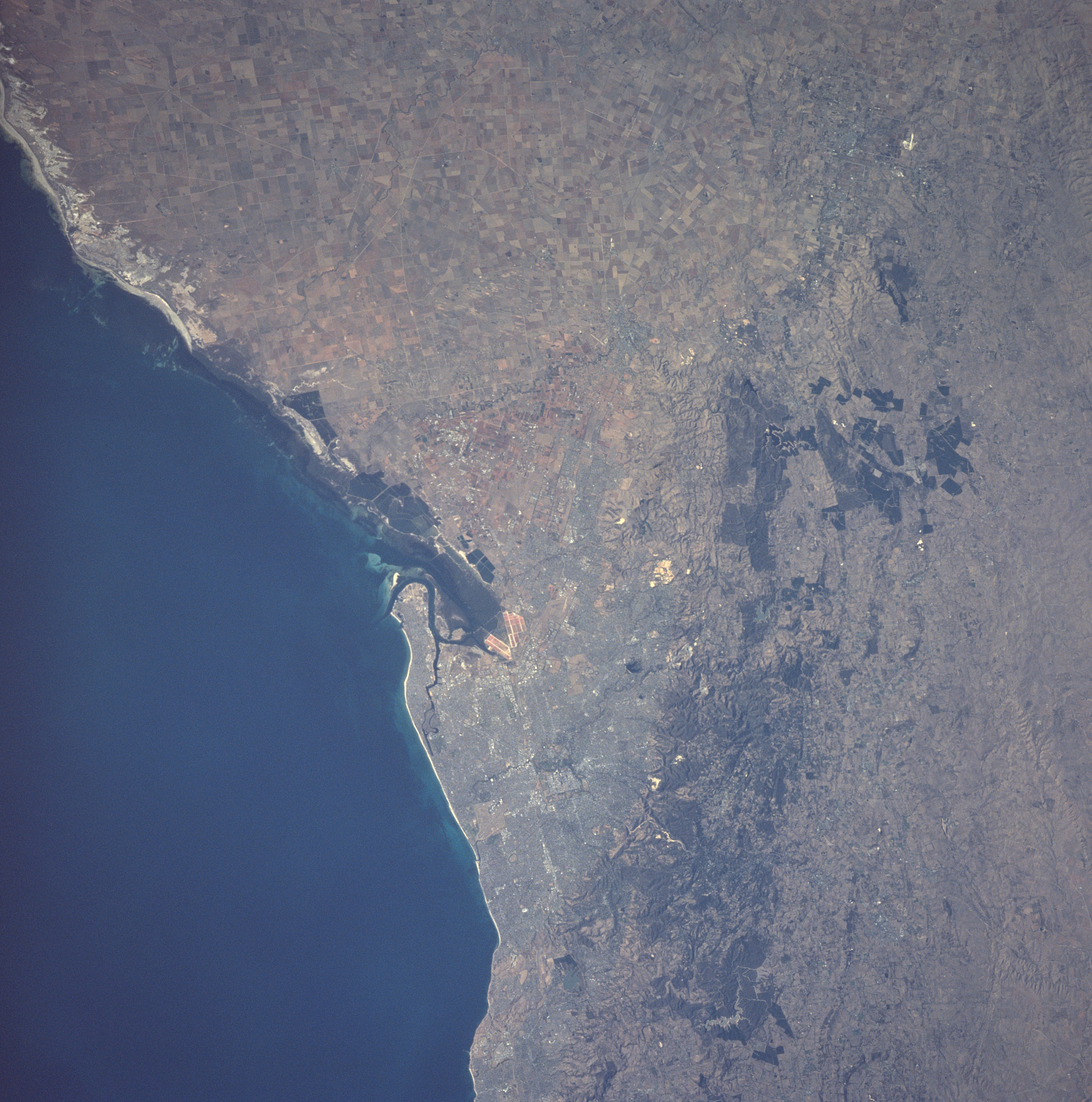
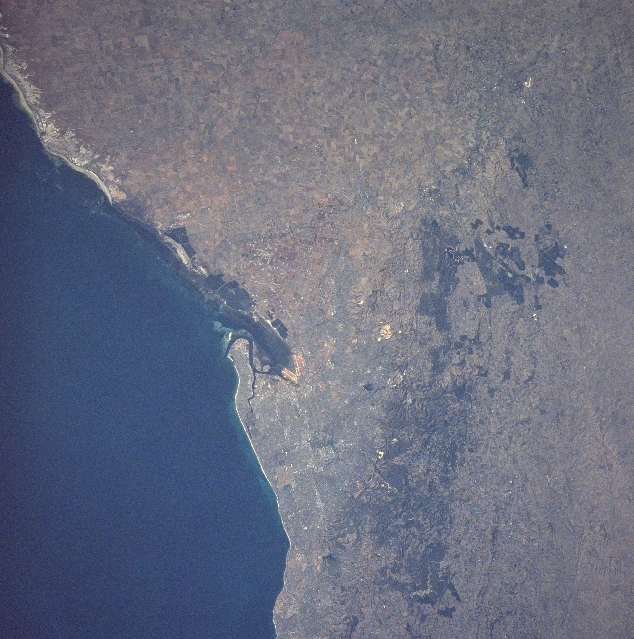
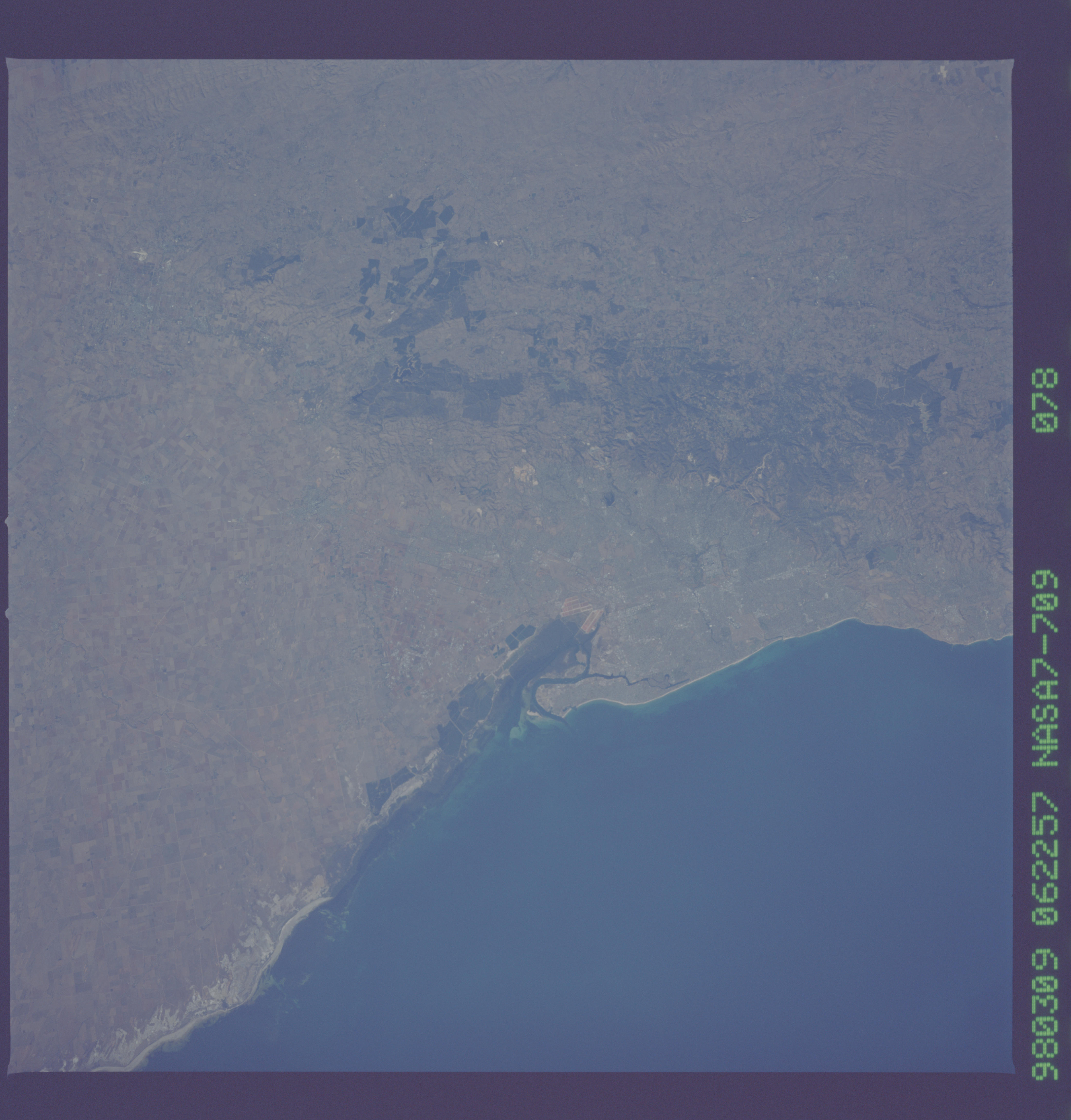
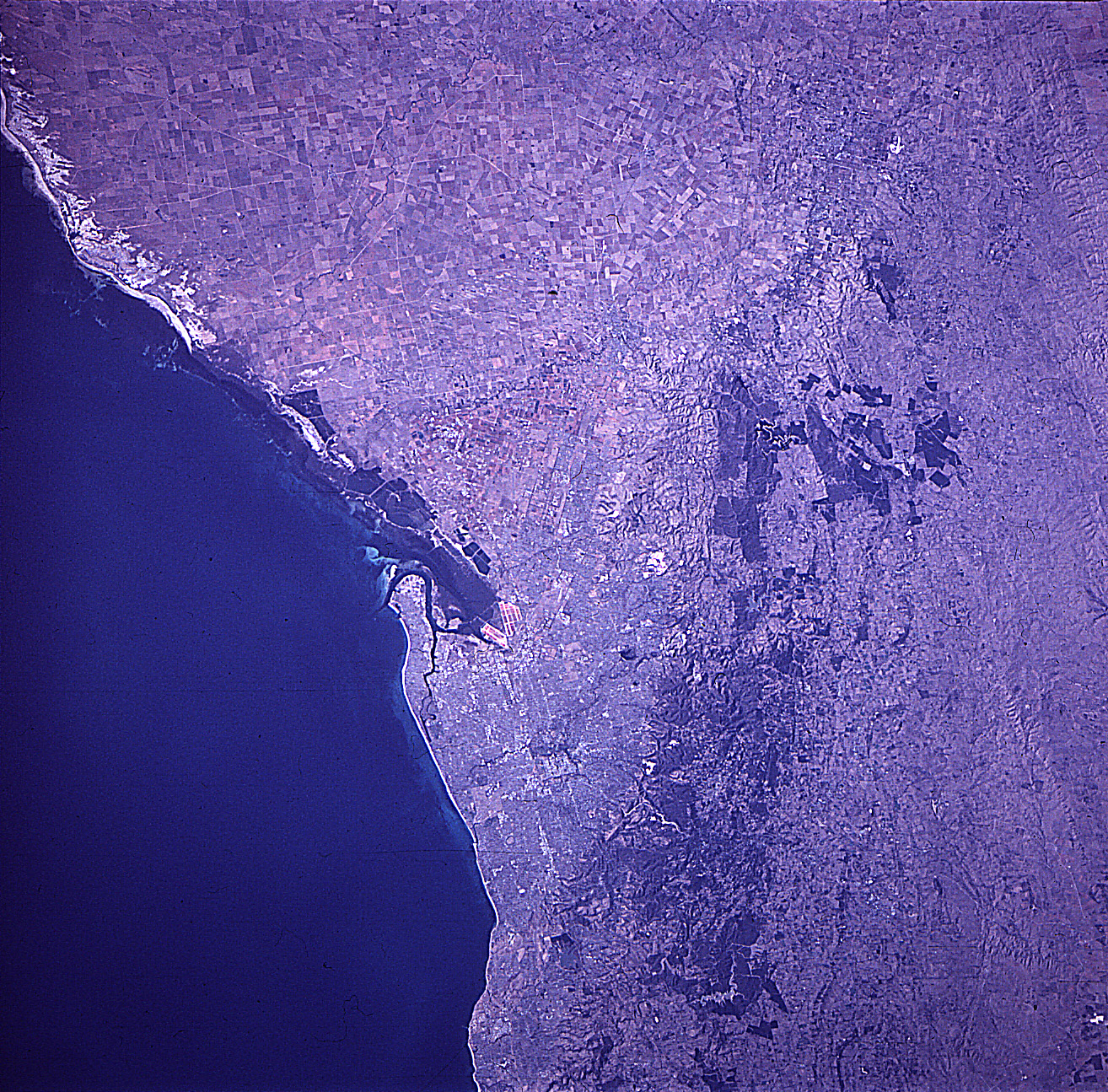
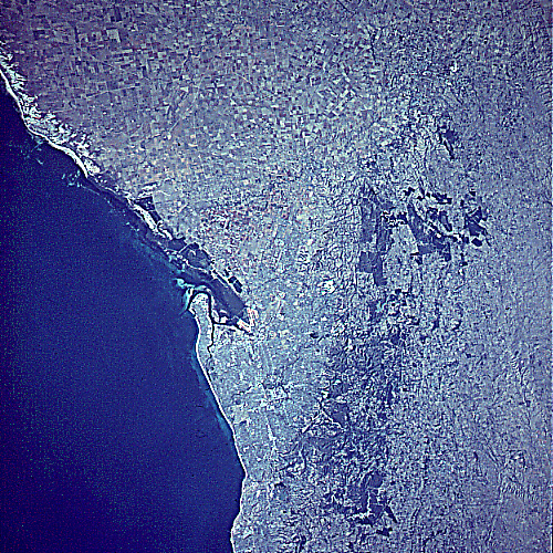
Image Caption: NASA7-709-078 Adelaide Area, South Australia, Australia Winter/Spring 1998
Australia's fifth largest city, Adelaide, is visible slightly below the center of the image. Adelaide is the capital of South Australia and has a metropolitan population that exceeds one million people. The Port of Adelaide, located northwest of the capital, has a sheltered harbor that has been created by the large sand spit that juts northward along the eastern shoreline of the Gulf of St. Vincent. A hilly region, known as the Adelaide Hills, and low Mount Lofty Ranges (darker northeast-southwest aligned corridor) border the eastern edge of Adelaide. The hilly region northeast of Adelaide is noted for the vineyards that produce excellent wines. An extensive landscape of flat, fertile plains are located north of the urban area. Cultivated fields are identified as a network of angular-looking patterns. Linear-looking sandy beaches (lighter colored terrain) are visible along the coastline north of Adelaide.
Australia's fifth largest city, Adelaide, is visible slightly below the center of the image. Adelaide is the capital of South Australia and has a metropolitan population that exceeds one million people. The Port of Adelaide, located northwest of the capital, has a sheltered harbor that has been created by the large sand spit that juts northward along the eastern shoreline of the Gulf of St. Vincent. A hilly region, known as the Adelaide Hills, and low Mount Lofty Ranges (darker northeast-southwest aligned corridor) border the eastern edge of Adelaide. The hilly region northeast of Adelaide is noted for the vineyards that produce excellent wines. An extensive landscape of flat, fertile plains are located north of the urban area. Cultivated fields are identified as a network of angular-looking patterns. Linear-looking sandy beaches (lighter colored terrain) are visible along the coastline north of Adelaide.
