NASA6-709-7
| NASA Photo ID | NASA6-709-7 |
| Focal Length | 100mm |
| Date taken | 1997.10.27 |
| Time taken | GMT |
Resolutions offered for this image:
4048 x 4048 pixels 639 x 639 pixels 5700 x 6000 pixels 500 x 526 pixels
4048 x 4048 pixels 639 x 639 pixels 5700 x 6000 pixels 500 x 526 pixels

Cloud masks available for this image:
Spacecraft nadir point:
Photo center point: 38.5° N, 16.5° E
Photo center point by machine learning:
Photo center point: 38.5° N, 16.5° E
Photo center point by machine learning:
Nadir to Photo Center:
Spacecraft Altitude: nautical miles (0km)
Country or Geographic Name: | ITALY |
Features: | BOOT OF ITALY |
| Features Found Using Machine Learning: | |
Cloud Cover Percentage: | 15 (11-25)% |
Sun Elevation Angle: | ° |
Sun Azimuth: | ° |
Camera: | Hasselblad |
Focal Length: | 100mm |
Camera Tilt: | Low Oblique |
Format: | 5069: Kodak Elite 100S, E6 Reversal, Replaces Lumiere, Warmer in tone vs. Lumiere |
Film Exposure: | Normal |
| Additional Information | |
| Width | Height | Annotated | Cropped | Purpose | Links |
|---|---|---|---|---|---|
| 4048 pixels | 4048 pixels | No | No | Earth From Space collection | Download Image |
| 639 pixels | 639 pixels | No | No | Earth From Space collection | Download Image |
| 5700 pixels | 6000 pixels | No | No | Download Image | |
| 500 pixels | 526 pixels | No | No | Download Image |
Download Packaged File
Download a Google Earth KML for this Image
View photo footprint information
Download a GeoTIFF for this photo
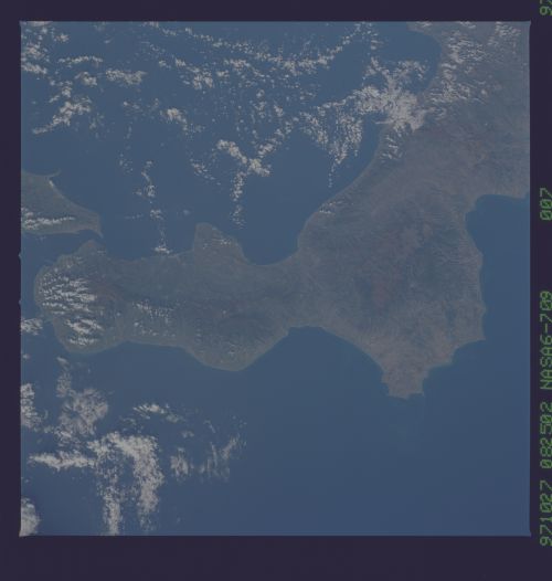
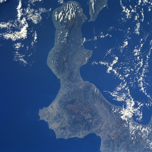
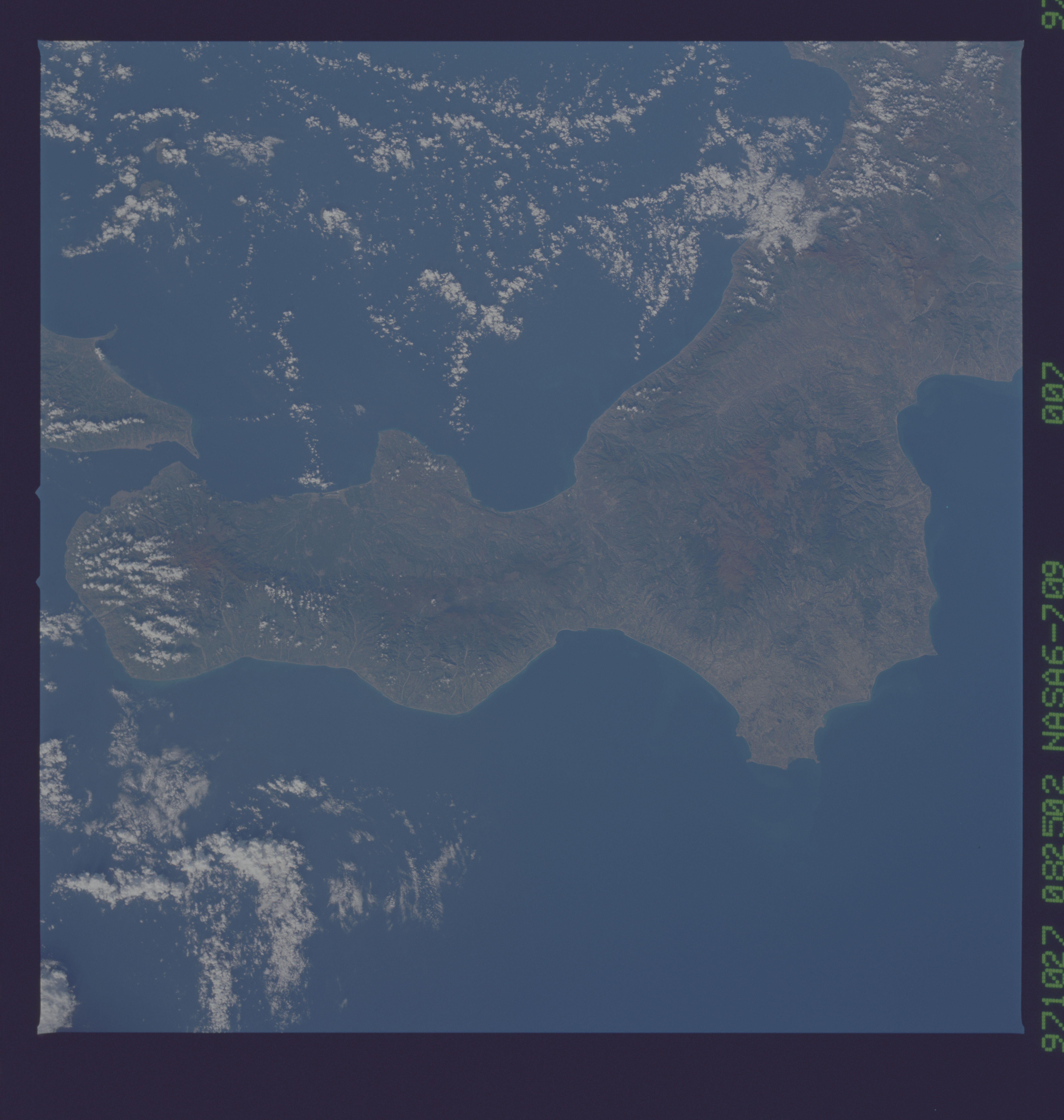
Image Caption: NASA6-709-007 Calabria, Italy Fall/Winter 1997
The elongated peninsula at the southern end of mainland Italy, commonly known as the toe (of the boot) of Italy, shows a mountainous spine that traverses the peninsula from northeast to southwest. The darker area inland from the coast is the rugged Calabrian Mountains where some peaks exceed 5000 feet (1542 meters) above sea level. This forested region is also known as the Silan uplands where a variety of lakes, meadows, and elevated pastures are intermixed with the wooded areas. The drainage pattern observed around the geologic structure (darker feature-bottom center) has the characteristics of an old, severely eroded, extinct volcano.
The elongated peninsula at the southern end of mainland Italy, commonly known as the toe (of the boot) of Italy, shows a mountainous spine that traverses the peninsula from northeast to southwest. The darker area inland from the coast is the rugged Calabrian Mountains where some peaks exceed 5000 feet (1542 meters) above sea level. This forested region is also known as the Silan uplands where a variety of lakes, meadows, and elevated pastures are intermixed with the wooded areas. The drainage pattern observed around the geologic structure (darker feature-bottom center) has the characteristics of an old, severely eroded, extinct volcano.
