ISS067-E-170382
| NASA Photo ID | ISS067-E-170382 |
| Focal Length | 180mm |
| Date taken | 2022.06.29 |
| Time taken | 11:21:26 GMT |
Resolutions offered for this image:
720 x 1080 pixels 2784 x 4176 pixels 2784 x 4176 pixels 4176 x 2784 pixels 640 x 427 pixels
720 x 1080 pixels 2784 x 4176 pixels 2784 x 4176 pixels 4176 x 2784 pixels 640 x 427 pixels
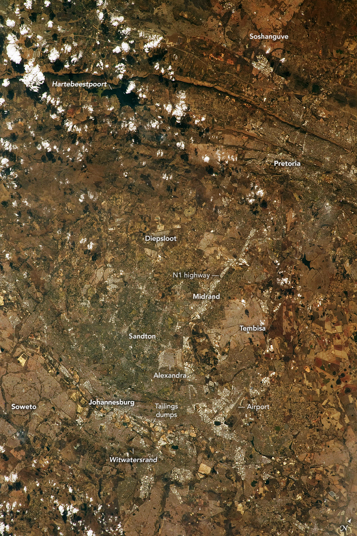


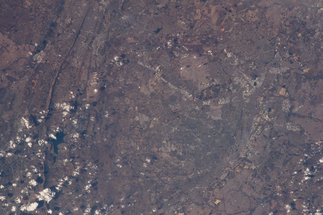
Spacecraft nadir point: 26.2° S, 30.6° E
Photo center point: 26.0° S, 28.1° E
Photo center point by machine learning: 25.97° S, 28.06° E
Photo center point: 26.0° S, 28.1° E
Photo center point by machine learning: 25.97° S, 28.06° E
Nadir to Photo Center: West
Spacecraft Altitude: 227 nautical miles (420km)

Country or Geographic Name: | REPUBLIC SOUTH AFRICA |
Features: | JOHANNESBURG, GUATENG PROVINCE, WITWATERSRAND, HARTBEESPOORT DAM, RIETVLEI DAM |
| Features Found Using Machine Learning: | |
Cloud Cover Percentage: | 10 (1-10)% |
Sun Elevation Angle: | 37° |
Sun Azimuth: | 337° |
Camera: | Nikon D5 Electronic Still Camera |
Focal Length: | 180mm |
Camera Tilt: | 34 degrees |
Format: | 5568E: 5568 x 3712 pixel CMOS sensor, 35.9 x 23.9 mm, total pixels: 21.33 million, Nikon FX format |
Film Exposure: | |
| Additional Information | |
| Width | Height | Annotated | Cropped | Purpose | Links |
|---|---|---|---|---|---|
| 720 pixels | 1080 pixels | Yes | No | NASA's Earth Observatory web site | Download Image |
| 2784 pixels | 4176 pixels | No | No | NASA's Earth Observatory web site | Download Image |
| 2784 pixels | 4176 pixels | No | No | NASA's Earth Observatory web site | Download Image |
| 4176 pixels | 2784 pixels | No | No | Download Image | |
| 640 pixels | 427 pixels | No | No | Download Image |
Download Packaged File
Download a Google Earth KML for this Image
View photo footprint information
Download a GeoTIFF for this photo
Image Caption: none
