ISS066-E-88446

| NASA Photo ID | ISS066-E-88446 |
| Focal Length | 24mm |
| Date taken | 2021.12.12 |
| Time taken | 01:10:10 GMT |
5011 x 3341 pixels 720 x 480 pixels 5568 x 3712 pixels 640 x 427 pixels
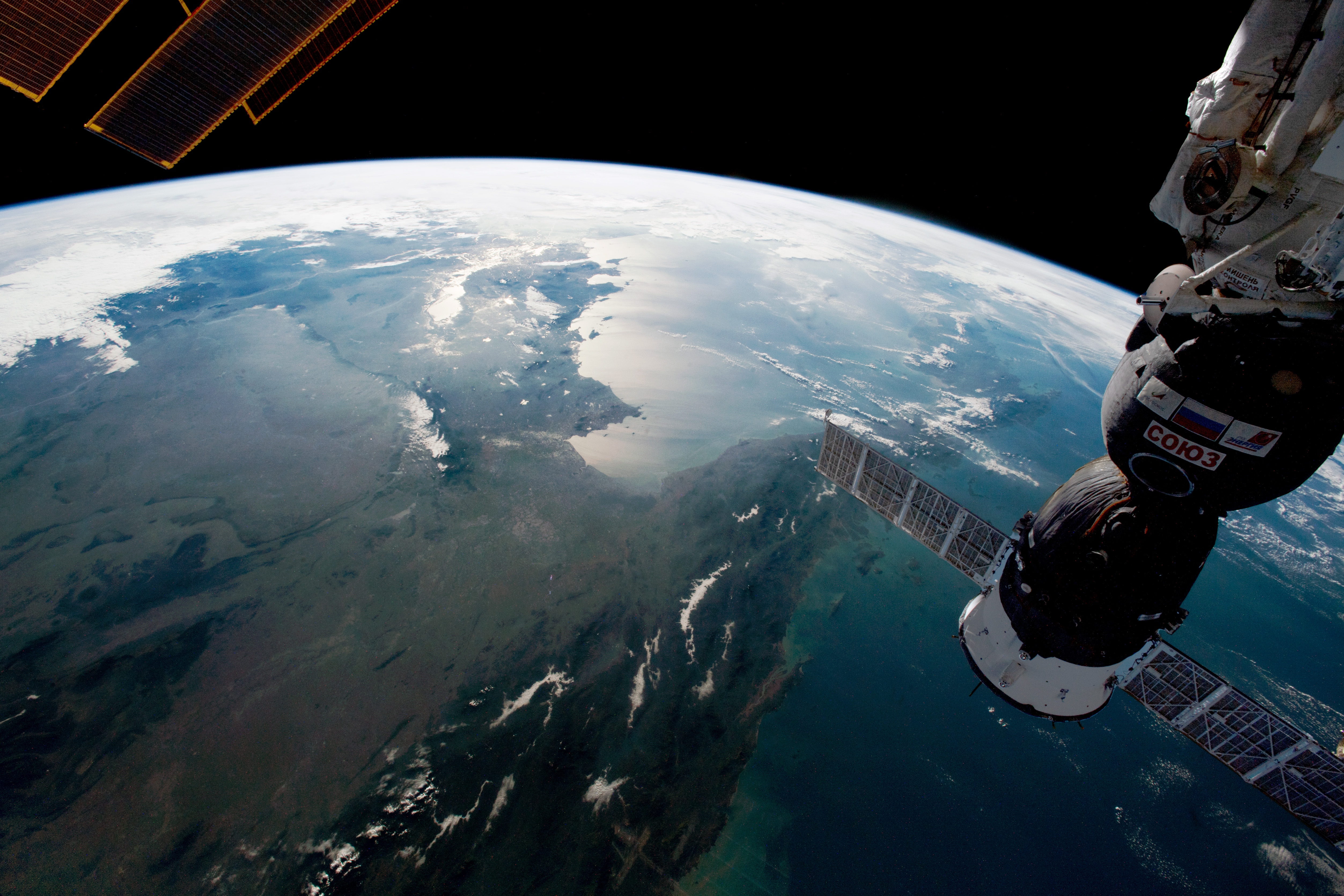
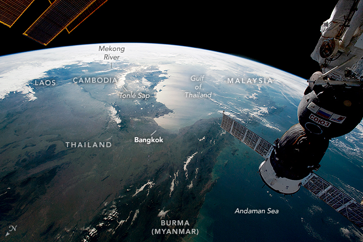
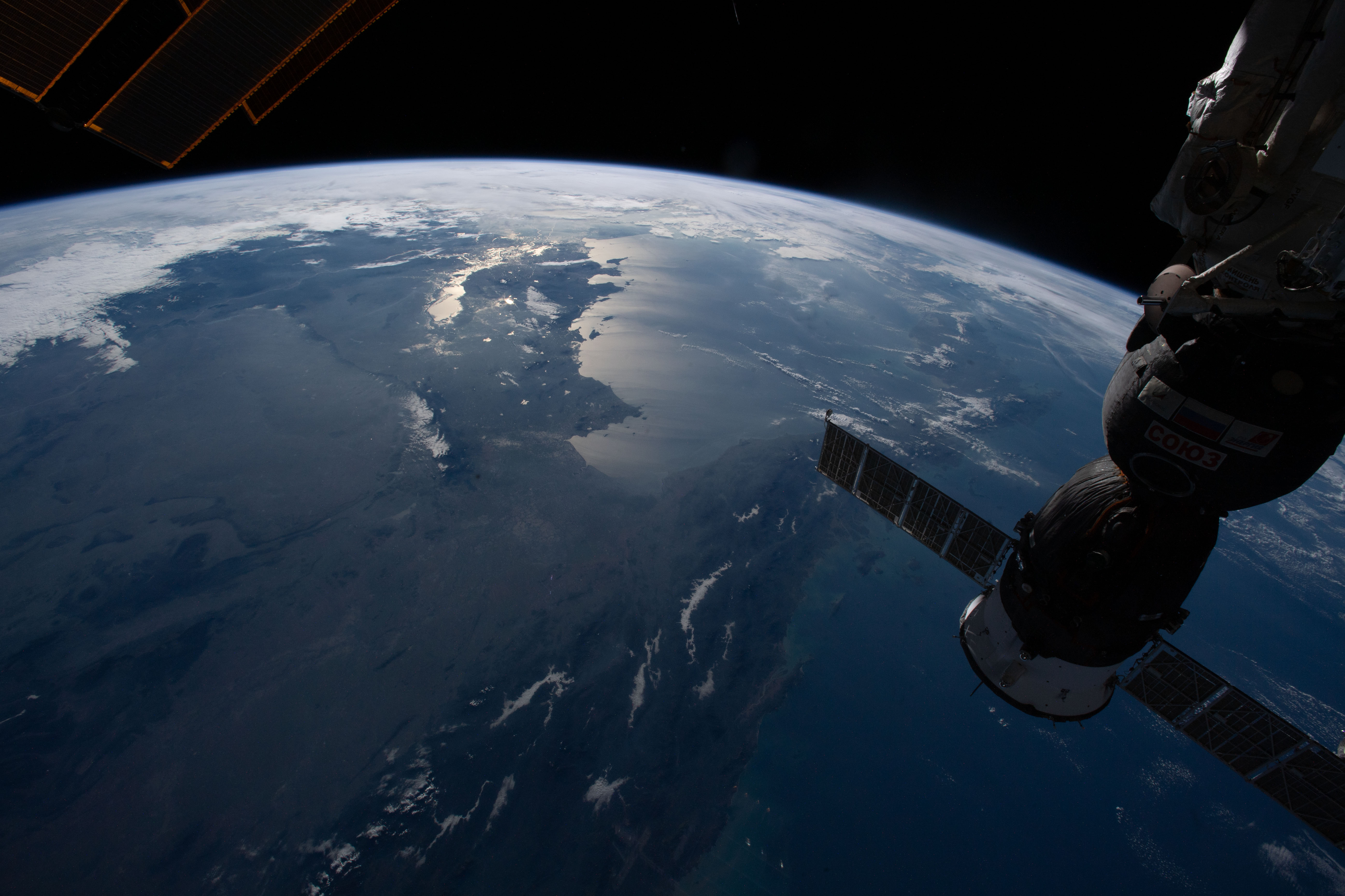

Photo center point:
Photo center point by machine learning:
Country or Geographic Name: | |
Features: | |
| Features Found Using Machine Learning: | PAN- |
Cloud Cover Percentage: | 13 (11-25)% |
Sun Elevation Angle: | 16° |
Sun Azimuth: | 119° |
Camera: | NIKON D5 S/N: 3502549 |
Focal Length: | 24mm |
Camera Tilt: | |
Format: | |
Film Exposure: | |
| Additional Information | |
| Width | Height | Annotated | Cropped | Purpose | Links |
|---|---|---|---|---|---|
| 5011 pixels | 3341 pixels | No | No | NASA's Earth Observatory web site | Download Image |
| 720 pixels | 480 pixels | Yes | No | NASA's Earth Observatory web site | Download Image |
| 5568 pixels | 3712 pixels | No | No | Download Image | |
| 640 pixels | 427 pixels | No | No | Download Image |
The wetlands of southern Cambodia are illuminated by sunglint in this panoramic photograph taken by an astronaut from the International Space Station (ISS). Large swaths of Southeast Asia—including Laos, Thailand, Burma (Myanmar), and Malaysia—fill the scene that looks to the south. Vietnam is mostly obscured by clouds on the southern and eastern edges of the peninsula.
Sometimes referred to as the Indochinese Peninsula or Indochina due to its geographic position between India and China, the region includes a mixture of fertile plains, tropical forests, mountain ranges, and urban areas (such as Bangkok). In the photo, sunlight reflects off of the Gulf of Thailand and the Tonle Sap floodplain, one of the region’s many marshes and wetlands.
The Mekong River flows down from the Tibetan Plateau and defines most of the border between Thailand and landlocked Laos. The river and its tributaries are a focal point around which human populations have settled and cultivated agriculture for centuries. The lower Mekong basin, transitioning from mountainous uplands to flat coastal lowlands, flows into the Gulf of Thailand and, ultimately, the South China Sea. It is through these waters that Mainland Southeast Asia is linked to Malaysia and Maritime Southeast Asia.
The tropical climate and the irrigation water provided by the river makes the peninsula well-suited for rice production. This staple crop has played a significant role in the cultural development and environmental change of the area. However, challenges to rice cultivation have increased in recent years due to extreme weather events such as droughts and floods.
