ISS066-E-86253
| NASA Photo ID | ISS066-E-86253 |
| Focal Length | 400mm |
| Date taken | 2021.12.04 |
| Time taken | 05:55:04 GMT |
5568 x 3712 pixels 720 x 480 pixels 5568 x 3712 pixels 640 x 427 pixels
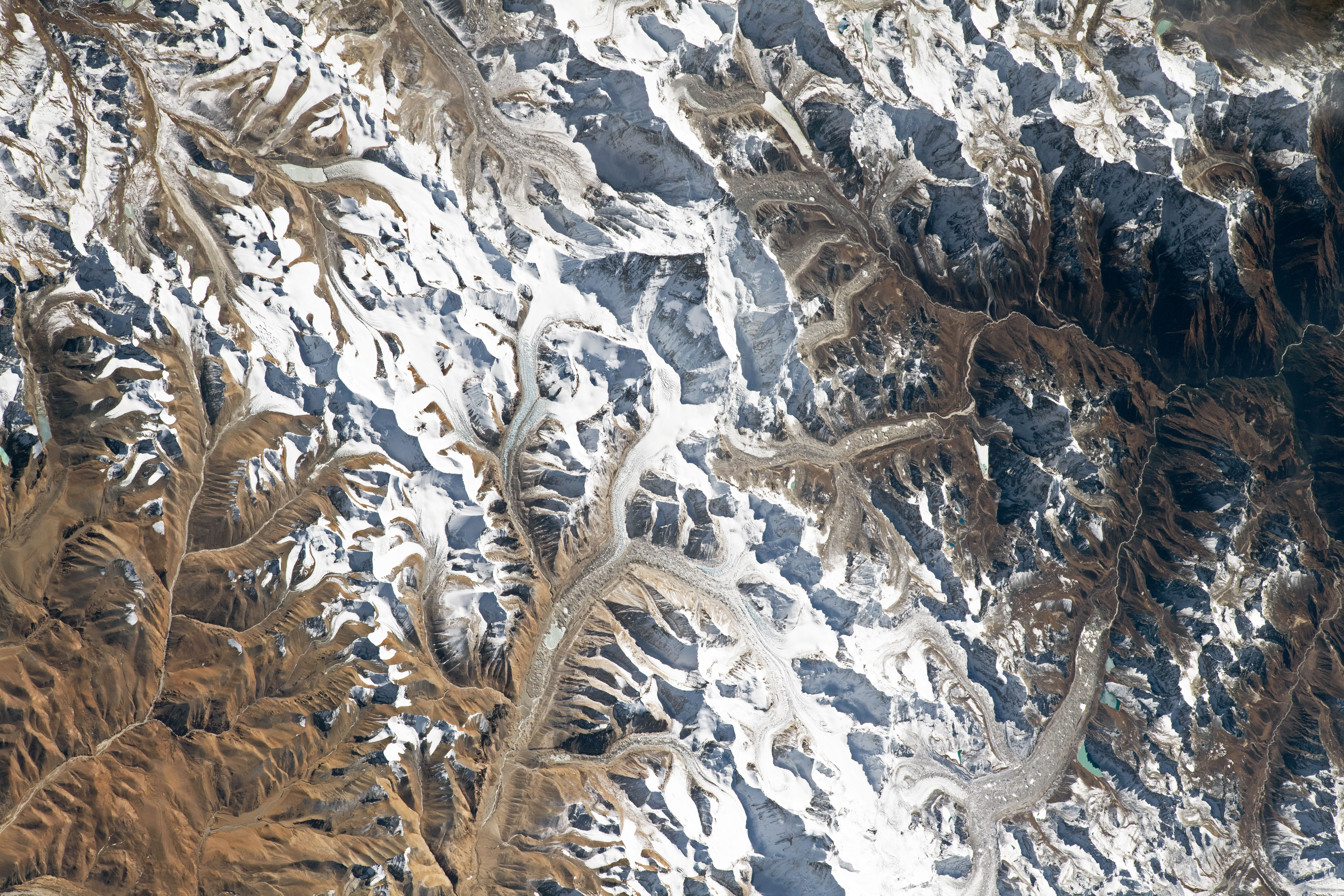
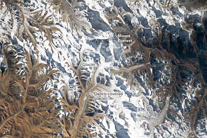


Photo center point: 28.0° N, 86.9° E
Photo center point by machine learning: 28.04° N, 86.88° E

Country or Geographic Name: | CHINA |
Features: | MOUNT EVEREST, HIMALAYAS, GLACIER |
| Features Found Using Machine Learning: | |
Cloud Cover Percentage: | 10 (1-10)% |
Sun Elevation Angle: | 37° |
Sun Azimuth: | 179° |
Camera: | Nikon D5 Electronic Still Camera |
Focal Length: | 400mm |
Camera Tilt: | 37 degrees |
Format: | 5568E: 5568 x 3712 pixel CMOS sensor, 35.9 x 23.9 mm, total pixels: 21.33 million, Nikon FX format |
Film Exposure: | |
| Additional Information | |
| Width | Height | Annotated | Cropped | Purpose | Links |
|---|---|---|---|---|---|
| 5568 pixels | 3712 pixels | Yes | No | Download Image | |
| 720 pixels | 480 pixels | Yes | No | Download Image | |
| 5568 pixels | 3712 pixels | No | No | Download Image | |
| 640 pixels | 427 pixels | No | No | Download Image |
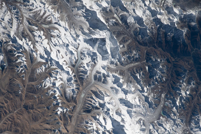
An astronaut onboard the International Space Station (ISS) took this near-nadir (almost straight down) photograph of Mount Everest. Such imagery provides a unique perspective on Earth’s tallest mountain (on dry land), which towers approximately 8848 meters (29,029 feet) above sea level.
This world-renowned summit sits on the Qinghai-Tibetan Plateau—a region sometimes called the “Roof of the World.” Everest continues to rise skyward by approximately 1 centimeter per year due to the progressive uplift of the crust caused by the convergence of the Indian and Eurasian tectonic plates.
Many glaciers flow down from the high snow-covered peaks on the plateau. As glaciers descend to lower and warmer elevations, much of the moving ice mass becomes obscured by rock debris (known as moraines) that accumulates on the top, sides, and terminus of the ice. As the glaciers melt, debris entrained in the ice can be deposited as sediments that geologists call glacial till.
