ISS066-E-77622
| NASA Photo ID | ISS066-E-77622 |
| Focal Length | 72mm |
| Date taken | 2021.11.10 |
| Time taken | 23:38:46 GMT |
4928 x 2768 pixels 720 x 702 pixels 4928 x 2768 pixels 640 x 359 pixels
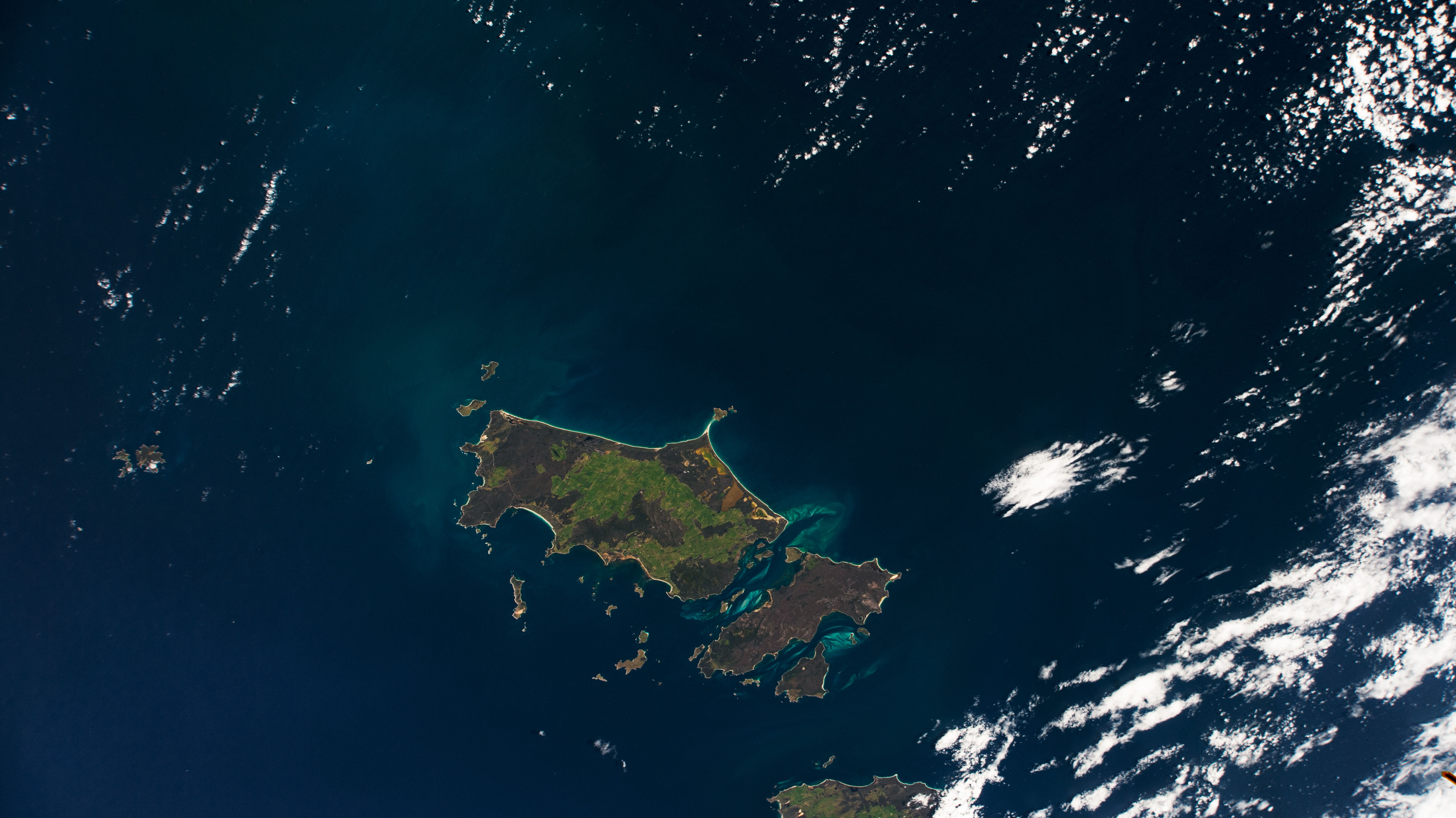
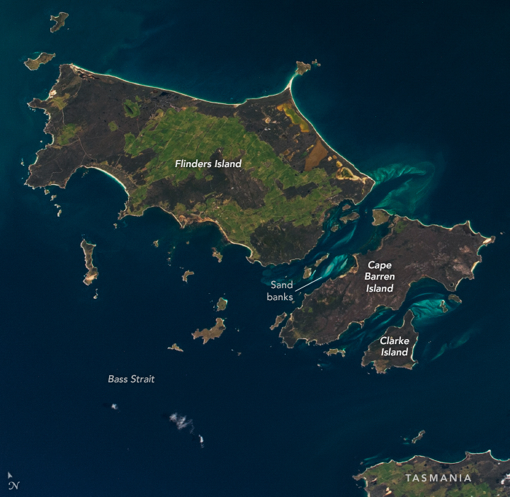


Photo center point: 40.0° S, 148.5° E
Photo center point by machine learning:
Country or Geographic Name: | AUSTRALIA-T |
Features: | ISLAND, CAPE PORTLAND, CLARKE ISLAND, CAPE BARREN ISLAND, LADY BARRON, WHITEMARK, LACKRANA, FLINDERS ISLAND, KILLIECRANKIE, WINGAROO, FURNEAUX GROUP, INNER SISTER ISLAND, SISTER ISLANDS CONSERVATION AREA, OUTER SISTER ISLAND, BASS STRAIGHT |
| Features Found Using Machine Learning: | |
Cloud Cover Percentage: | 25 (11-25)% |
Sun Elevation Angle: | 55° |
Sun Azimuth: | 64° |
Camera: | Nikon D4 Electronic Still Camera |
Focal Length: | 72mm |
Camera Tilt: | 34 degrees |
Format: | 4928E: 4928 x 3280 pixel CMOS sensor, 36.0mm x 23.9mm, total pixels: 16.6 million, Nikon FX format |
Film Exposure: | |
| Additional Information | Image acquired by ISS External High Definition Camera |
| Width | Height | Annotated | Cropped | Purpose | Links |
|---|---|---|---|---|---|
| 4928 pixels | 2768 pixels | Yes | Yes | Download Image | |
| 720 pixels | 702 pixels | Yes | Yes | Download Image | |
| 4928 pixels | 2768 pixels | No | No | Download Image | |
| 640 pixels | 359 pixels | No | No | Download Image |
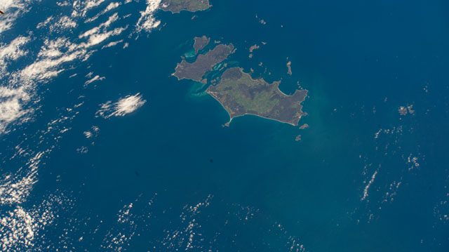
As the International Space Station (ISS) passed through the southernmost part of its cyclical orbit path, the Furneaux Islands (also known as the Furneaux Group) crossed into the field of view of a camera dedicated to Earth observation. The ISS External High-Definition Camera captured this view of the major islands of the eastern Bass Strait, which separates mainland Australia from Tasmania.
Named after British navigator Tobias Furneaux, the islands were first sighted by Europeans (but not visited) in 1773. Flinders, Cape Barren, and Clarke islands are the largest of more than 100 islands in the group.
The sparsely populated Flinders Island appears mostly two-toned from 400 kilometers (250 miles) above. Dark brownish scrub areas contrast with mottled green vegetated woodland and agricultural areas. Bright beaches outline the islands, and tidal sand banks are visible between them.
The Furneaux Group once formed the backbone of a land bridge between Tasmania and Victoria, Australia. That land bridge was submerged by rising sea levels at the end of the Earth's most recent ice age, with the topographic high points becoming islands.
