ISS065-E-93698
| NASA Photo ID | ISS065-E-93698 |
| Focal Length | 1150mm |
| Date taken | 2021.06.08 |
| Time taken | 14:01:01 GMT |
5568 x 3712 pixels 720 x 480 pixels 5568 x 3712 pixels 640 x 427 pixels
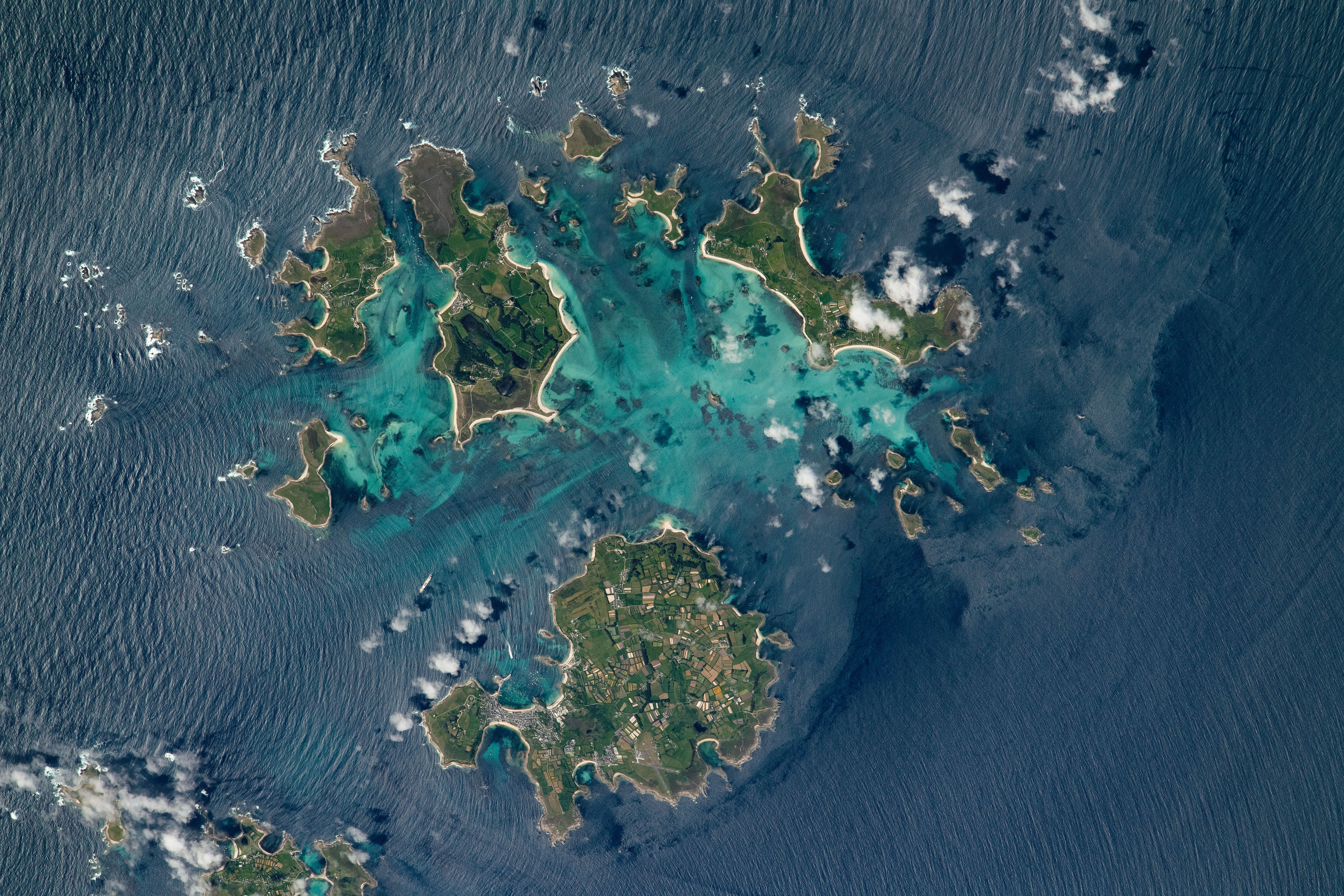
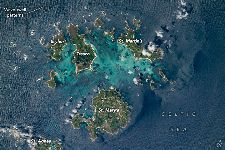


Photo center point: 49.9° N, 6.3° W
Photo center point by machine learning: 49.94° N, 6.30° W

Country or Geographic Name: | UK-ENGLAND |
Features: | ISLES OF SCILLY, WAVES, ST MARYS ISLAND, ST AGNES ISLAND, TRESCO ISLAND, BRYHER ISLAND, ST MARTINS ISLAND |
| Features Found Using Machine Learning: | |
Cloud Cover Percentage: | 10 (1-10)% |
Sun Elevation Angle: | 56° |
Sun Azimuth: | 224° |
Camera: | Nikon D5 Electronic Still Camera |
Focal Length: | 1150mm |
Camera Tilt: | 21 degrees |
Format: | 5568E: 5568 x 3712 pixel CMOS sensor, 35.9 x 23.9 mm, total pixels: 21.33 million, Nikon FX format |
Film Exposure: | |
| Additional Information | |
| Width | Height | Annotated | Cropped | Purpose | Links |
|---|---|---|---|---|---|
| 5568 pixels | 3712 pixels | Yes | No | Download Image | |
| 720 pixels | 480 pixels | Yes | No | Download Image | |
| 5568 pixels | 3712 pixels | No | No | Download Image | |
| 640 pixels | 427 pixels | No | No | Download Image |
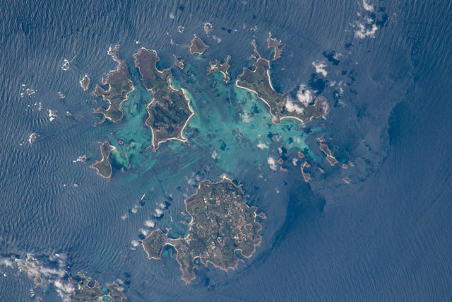
An astronaut aboard the International Space Station (ISS) shot this photograph that captures a some of the essence of tidal features around the Isles of Scilly, an archipelago located just southwest of Cornwall, England. The archipelago includes up to 150 inhabited islands in the Celtic Sea. Pictured are St. Mary's, Tresco, St. Martin's, Bryher, and St. Agnes, the largest islands in the chain.
Some of the coastal waters surrounding the islands have a bright turquoise hue, indicating the presence of shallow reefs and shoals. Deeper waters have richer blue hues. This photo also captures swell patterns caused by waves that intersect one another as they move around the islands due to the westerly sea breeze.
The Isles of Scilly are remnants of the underlying Cornubian Batholith, a mass of ancient volcanic rock (a plutonic intrusion) that formed the Cornish Peninsula. This intrusion originated with the crystallization of magma into igneous rock approximately 290 million years ago. It now sits an estimated 10 kilometers (6 miles) below the surface.
Tides ebb and flow throughout the year and, at their lowest, can expose sandbars that allow people to walk between some islands. Low tides also can expose large rocks along the shore that are used by gray seals to bask in the sun. And bottlenose dolphins migrate with the tidal cycles here, most notably during high tides, in search of fish to feed on.
