ISS065-E-66742

| NASA Photo ID | ISS065-E-66742 |
| Focal Length | 100mm |
| Date taken | 2021.05.25 |
| Time taken | 13:49:24 GMT |
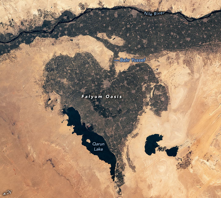
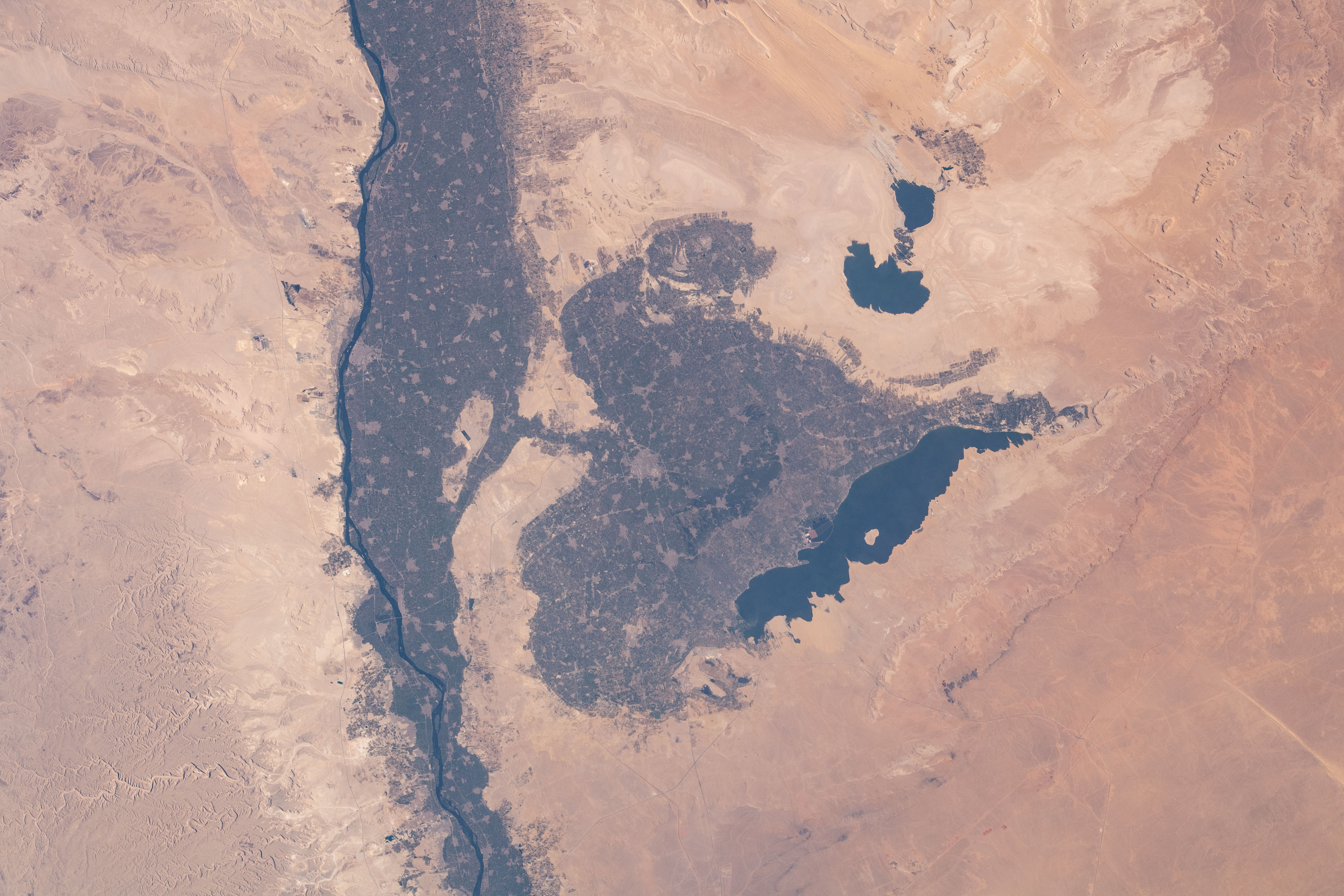


Photo center point:
Photo center point by machine learning: 29.32° N, 30.81° E

Country or Geographic Name: | |
Features: | |
| Features Found Using Machine Learning: | |
Cloud Cover Percentage: | 0 (no clouds present) |
Sun Elevation Angle: | 37° |
Sun Azimuth: | 275° |
Camera: | NIKON D5 S/N: 3502608 |
Focal Length: | 100mm |
Camera Tilt: | |
Format: | |
Film Exposure: | |
| Additional Information | |
| Width | Height | Annotated | Cropped | Purpose | Links |
|---|---|---|---|---|---|
| 720 pixels | 647 pixels | Yes | Yes | NASA's Earth Observatory web site | Download Image |
| 5568 pixels | 3712 pixels | No | No | Download Image | |
| 640 pixels | 427 pixels | No | No | Download Image |
While in orbit over Egypt, an astronaut on the International Space Station (ISS) captured a photograph of this heart-shaped basin bordering the Nile River and the Western Desert. The depression, known as the Faiyum Oasis, spreads across more than 1,200 square kilometers (450 square miles) and was formed from the ancient lakebed of Lake Moeris.
Partial damming of Lake Moeris during the reign of Ptolemy II allowed large areas of fertile alluvial soil to be reclaimed for agriculture. Today saltwater Lake Qarun (Birket Qarun), located on the northern margin of the depression, is the remnant of Moeris. The salinity of Lake Qarun is caused by high evaporation rates in the arid climate.
Farms and orchards fill the depression and line the western banks of the Nile. The numerous small gray patches are villages and towns in the intensively cultivated agricultural areas. The area has supported human life for more than 8,000 years and provides resources to many bird and fish species, as well as the endangered slender horned gazelle.
Bahr Yussef, which connects the Nile to the Faiyum Oasis, originally formed as a natural offshoot of the river. In 2300 BC, it was widened and deepened into a canal to help regulate flow to the oasis. The canal transports freshwater and sediment to the area before emptying into Lake Qarun.
