ISS065-E-31847
| NASA Photo ID | ISS065-E-31847 |
| Focal Length | 200mm |
| Date taken | 2021.05.10 |
| Time taken | 01:19:16 GMT |
4670 x 3113 pixels 720 x 480 pixels 5568 x 3712 pixels 640 x 427 pixels
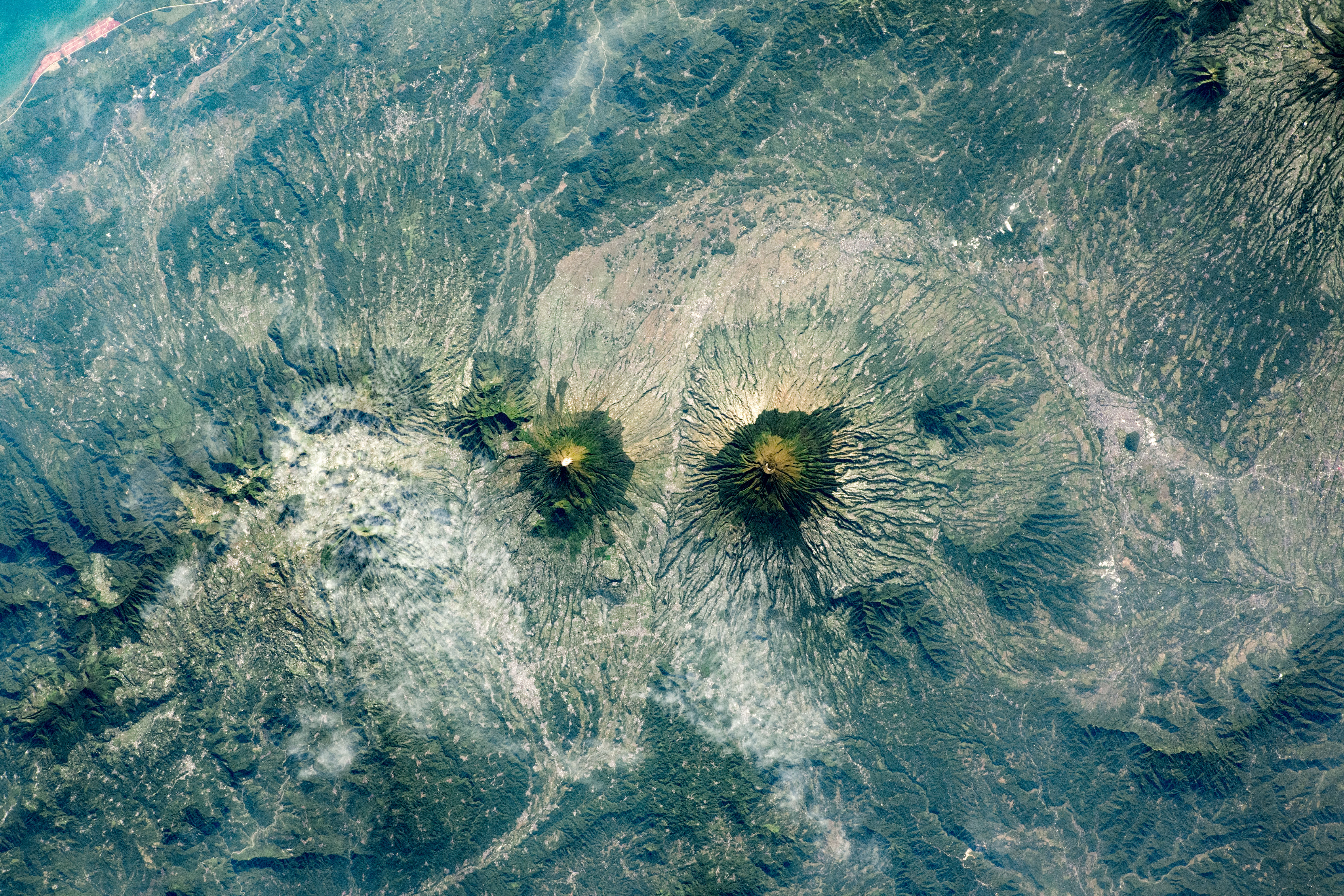
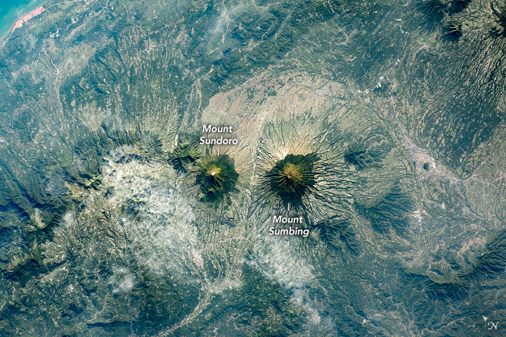


Photo center point: 7.3° S, 110.0° E
Photo center point by machine learning:
Country or Geographic Name: | INDONESIA-J |
Features: | SUNDORO VOLCANO, SUMBING VOLCANO, SERAYU RIVER |
| Features Found Using Machine Learning: | |
Cloud Cover Percentage: | 10 (1-10)% |
Sun Elevation Angle: | 35° |
Sun Azimuth: | 61° |
Camera: | Nikon D5 Electronic Still Camera |
Focal Length: | 200mm |
Camera Tilt: | 27 degrees |
Format: | 5568E: 5568 x 3712 pixel CMOS sensor, 35.9 x 23.9 mm, total pixels: 21.33 million, Nikon FX format |
Film Exposure: | |
| Additional Information | |
| Width | Height | Annotated | Cropped | Purpose | Links |
|---|---|---|---|---|---|
| 4670 pixels | 3113 pixels | Yes | Yes | Download Image | |
| 720 pixels | 480 pixels | Yes | Yes | Download Image | |
| 5568 pixels | 3712 pixels | No | No | Download Image | |
| 640 pixels | 427 pixels | No | No | Download Image |
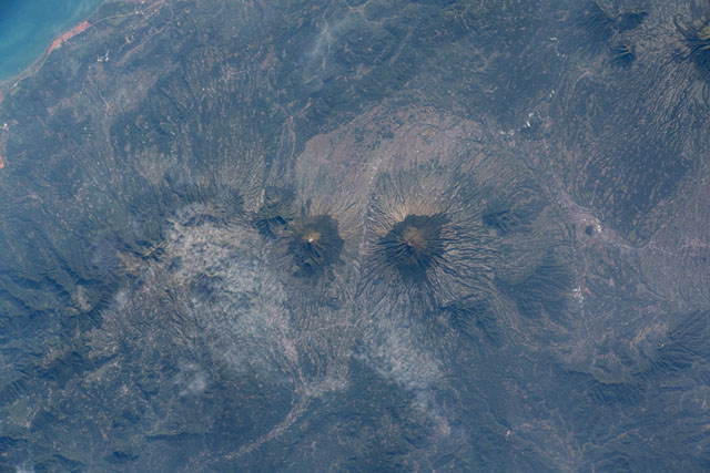
An astronaut onboard the International Space Station (ISS) shot this photograph of two neighboring stratovolcanoes on Java, the most populated island of Indonesia. Mount Sundoro and Mount Sumbing are two symmetrical, cone-shaped peaks in Central Java province that are part of a larger east to west chain of volcanoes. Both peaks rise more than 3,000 meters (10,000 feet) above sea level and are still active, though they have not erupted since 1730 (Sumbing) and 1971 (Sundoro).
The brighter zones encircling the bases of both volcanoes include areas of intensive agriculture; these contrast with the dark forests on the higher slopes. The peaks of Sumbing and Sundoro rise high enough that the rocky summits elevations reach above the tree line.
The rich volcanic soils surrounding the peaks are very fertile, providing productive farmland in this region of Central Java. The tropical climate of Indonesia also provides abundant rain and sunlight. The area’s main crop is rice, grown in irrigated fields. Other lowland crops include corn, sugarcane, and coffee.
