ISS065-E-31198
| NASA Photo ID | ISS065-E-31198 |
| Focal Length | 1150mm |
| Date taken | 2021.05.09 |
| Time taken | 00:24:26 GMT |
5065 x 3377 pixels 720 x 480 pixels 5568 x 3712 pixels 640 x 427 pixels
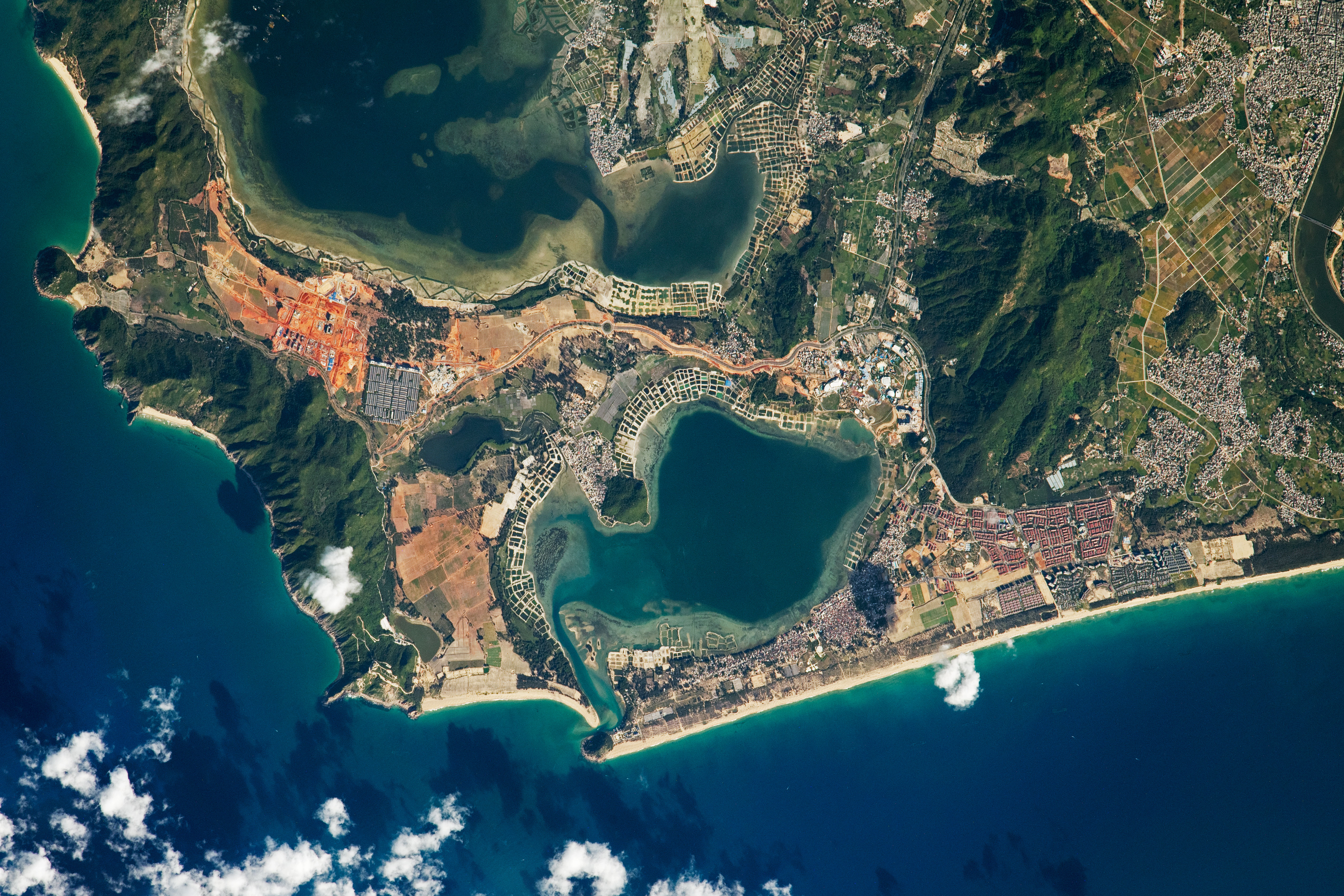
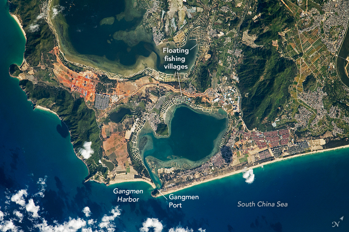


Photo center point: 18.4° N, 110.0° E
Photo center point by machine learning:
Country or Geographic Name: | CHINA |
Features: | TONGQI HARBOR, XINCUN HARBOR, GANGMEN HARBOR, LINGSHUI PORT |
| Features Found Using Machine Learning: | |
Cloud Cover Percentage: | 25 (11-25)% |
Sun Elevation Angle: | 30° |
Sun Azimuth: | 79° |
Camera: | Nikon D5 Electronic Still Camera |
Focal Length: | 1150mm |
Camera Tilt: | 29 degrees |
Format: | 5568E: 5568 x 3712 pixel CMOS sensor, 35.9 x 23.9 mm, total pixels: 21.33 million, Nikon FX format |
Film Exposure: | |
| Additional Information | |
| Width | Height | Annotated | Cropped | Purpose | Links |
|---|---|---|---|---|---|
| 5065 pixels | 3377 pixels | Yes | No | Download Image | |
| 720 pixels | 480 pixels | Yes | No | Download Image | |
| 5568 pixels | 3712 pixels | No | No | Download Image | |
| 640 pixels | 427 pixels | No | No | Download Image |
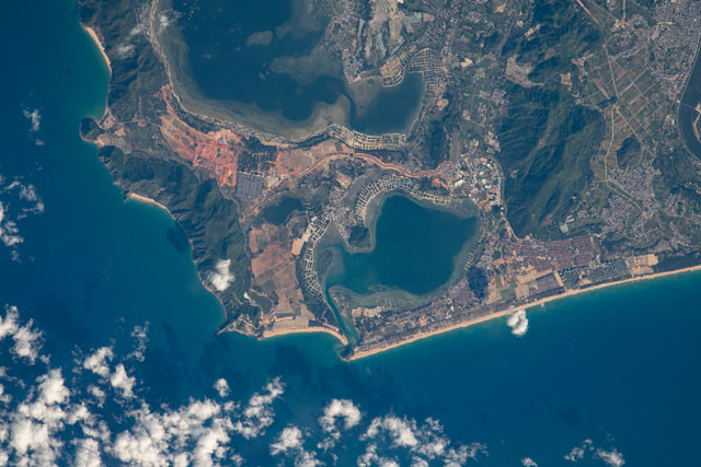
Situated in the South China Sea, the large island of Hainan is China's southernmost province, spanning approximately 339,000 hectares (1,300 square miles). This photograph, taken by an astronaut onboard the International Space Station (ISS), focuses on the landscape around Gangmen Harbor and captures many typical characteristics of Hainan: forested mountain terrain juxtaposed with dense populations. Cleared lands show up with bright orange and red soils that owe their color to the oxidation of iron-rich sediments. The coasts are lined with tropical beaches, while the inner bays are lined with floating fishing villages often built in a grid-like patterns in shallow waters.
Lingshui Li Autonomous County, at the south end of Hainan, sustains a large nomadic sea community. China is already a world leader in wild catch fish production, and fish farming is rapidly expanding. China grows nearly 60 percent of the world's farmed fish, particularly for carp and tilapia. These aquaculture sites are often paired with fishing ports (such as Gangmen) that provide efficient transport for fish, machinery, and construction materials needed to sustain aquacultural production.
