ISS064-E-44615

| NASA Photo ID | ISS064-E-44615 |
| Focal Length | 95mm |
| Date taken | 2021.03.18 |
| Time taken | 20:51:08 GMT |
720 x 1080 pixels 720 x 1080 pixels 5568 x 3712 pixels 640 x 427 pixels

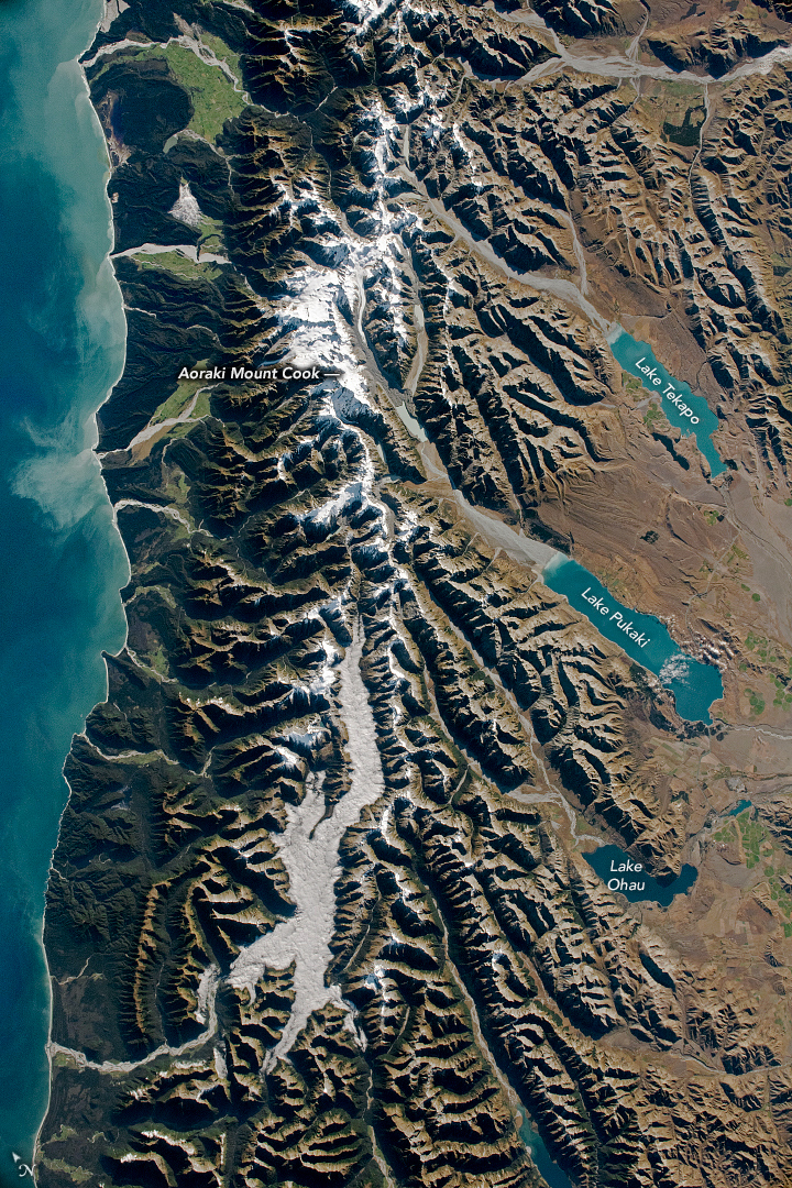
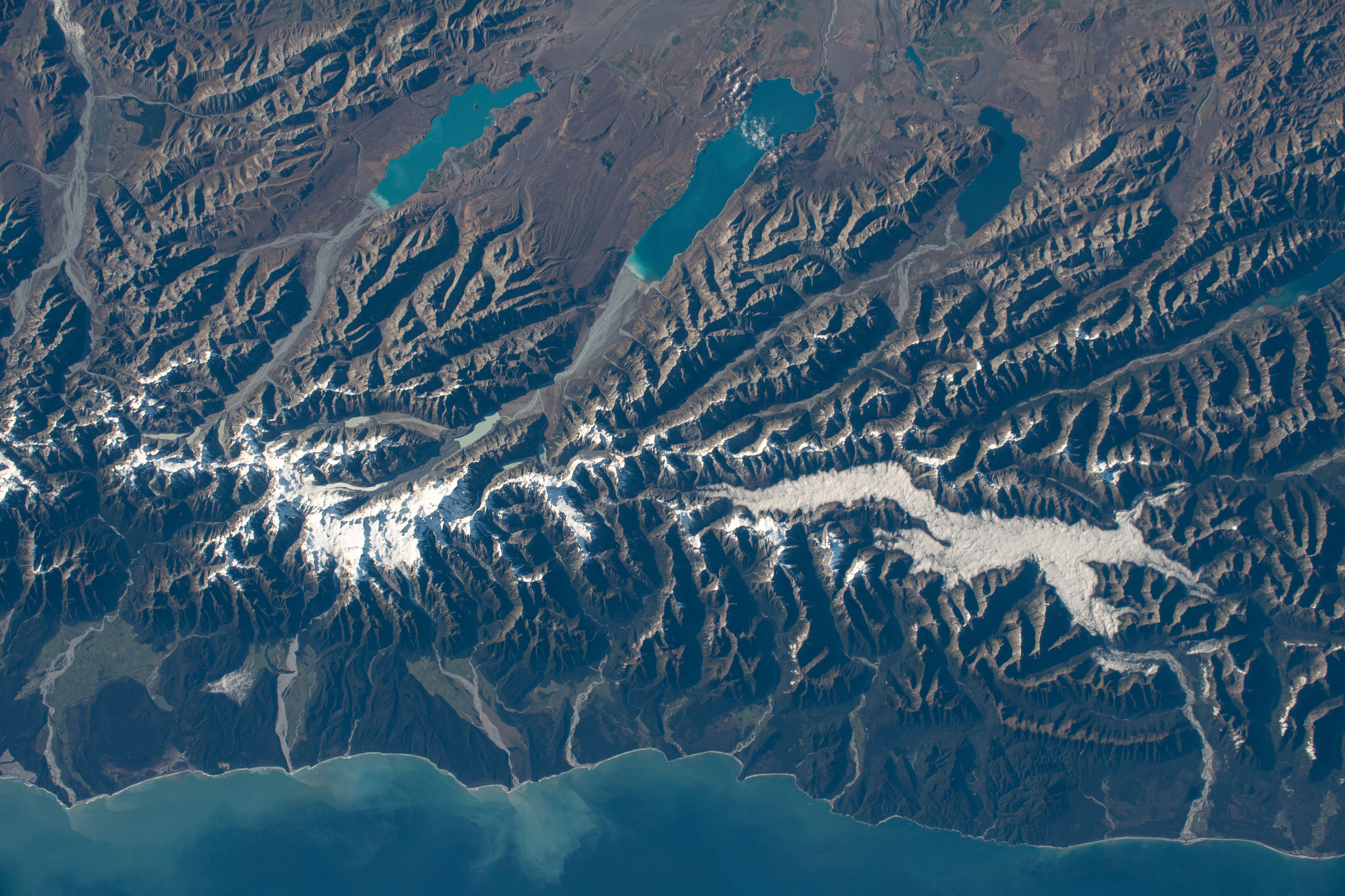

Photo center point: 43.8° S, 170.0° E
Photo center point by machine learning:
Country or Geographic Name: | NEW ZEALAND-SI |
Features: | SOUTHERN ALPS MOUNTAINS, GLACIERS, LAKE PUKAKI, LAKE TEKAPO |
| Features Found Using Machine Learning: | |
Cloud Cover Percentage: | 10 (1-10)% |
Sun Elevation Angle: | 22° |
Sun Azimuth: | 68° |
Camera: | Nikon D5 Electronic Still Camera |
Focal Length: | 95mm |
Camera Tilt: | 5 degrees |
Format: | 5568E: 5568 x 3712 pixel CMOS sensor, 35.9 x 23.9 mm, total pixels: 21.33 million, Nikon FX format |
Film Exposure: | |
| Additional Information | |
| Width | Height | Annotated | Cropped | Purpose | Links |
|---|---|---|---|---|---|
| 720 pixels | 1080 pixels | Yes | No | Download Image | |
| 720 pixels | 1080 pixels | Yes | No | Download Image | |
| 5568 pixels | 3712 pixels | No | No | Download Image | |
| 640 pixels | 427 pixels | No | No | Download Image |
An astronaut onboard the International Space Station shot this photograph of the Southern Alps. This mountain range forms the spine of New Zealand's South Island, where plate tectonics and glaciers have dramatically shaped the land through earthquakes, mountain building, and erosion.
New Zealand's highest peak, Aoraki Mount Cook, reaches 3,724 meters (12,218 feet) above sea level. South of Aoraki, puffy clouds fill a major valley. Rivers run through deep glacial valleys; their tan and gray colors are due to the load of sediment (including glacial flour) they carry down from the mountains.
Along the west coast, wide river channels travel short distances from the Alps to the sea. On the east side, the rivers run through deep valleys and into a series of turquoise, parallel lakes that were originally carved out by large glaciers. Around 20,000 years ago, during the most recent glacial maximum, most of this area was covered by massive glaciers that later scraped and scoured the surface when they retreated.
The Southern Alps create an orographic effect that separates New Zealand’s wettest and driest climates. The narrow strip of green, vegetated land along the coast receives the country's highest annual rainfall due to westerlies that blow in from the Tasman Sea and drop their moisture as they run into the mountains. In contrast, New Zealand's driest areas lie just southeast of the mountains, where the brightly colored lakes stand out against the dry, tan landscapes.
