ISS064-E-44411
| NASA Photo ID | ISS064-E-44411 |
| Focal Length | 78mm |
| Date taken | 2021.03.17 |
| Time taken | 18:45:02 GMT |
5261 x 3507 pixels 720 x 480 pixels 5568 x 3712 pixels 640 x 427 pixels
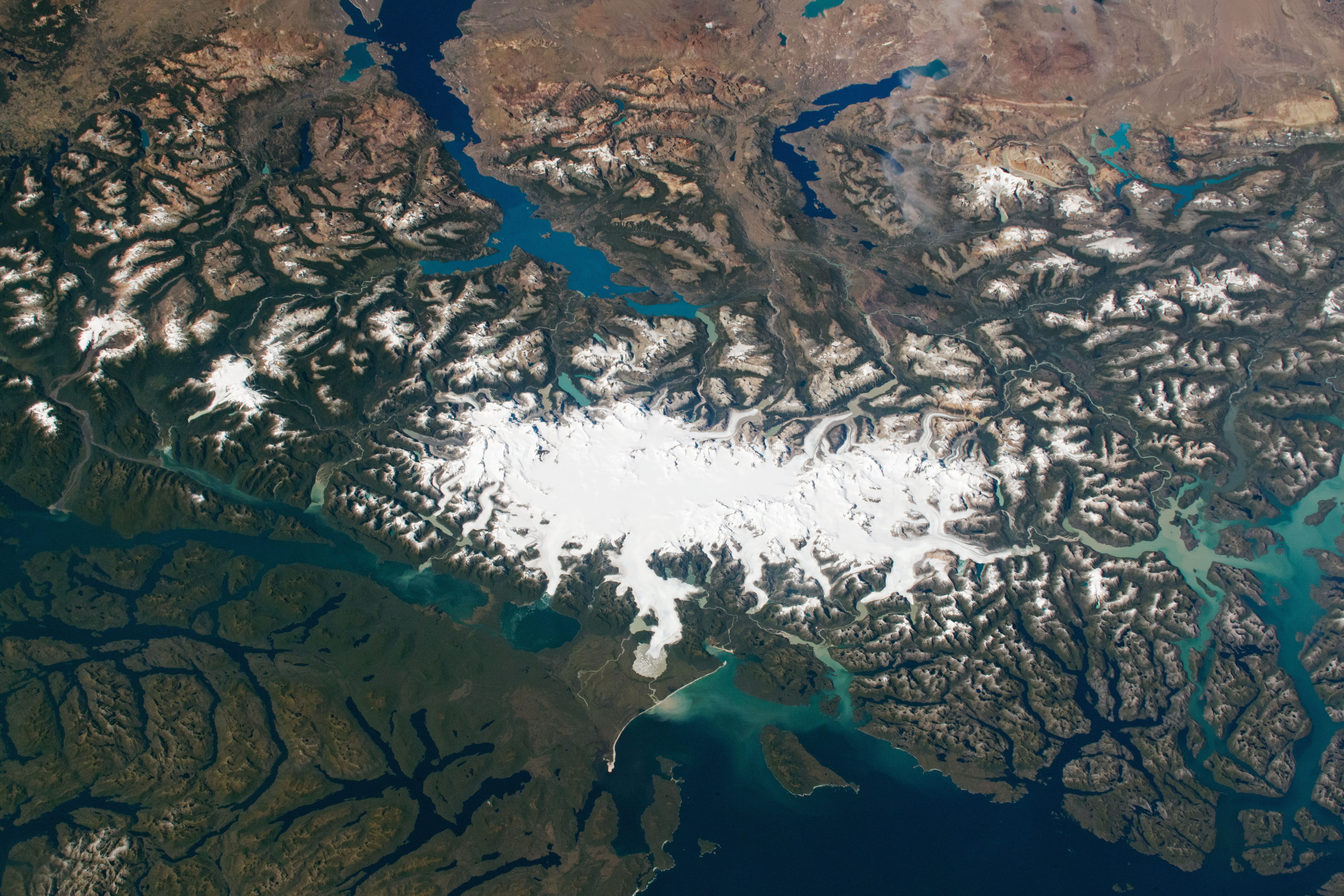
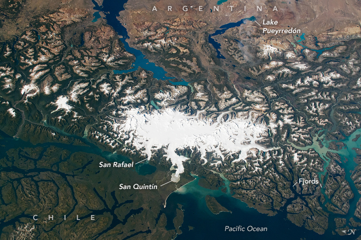
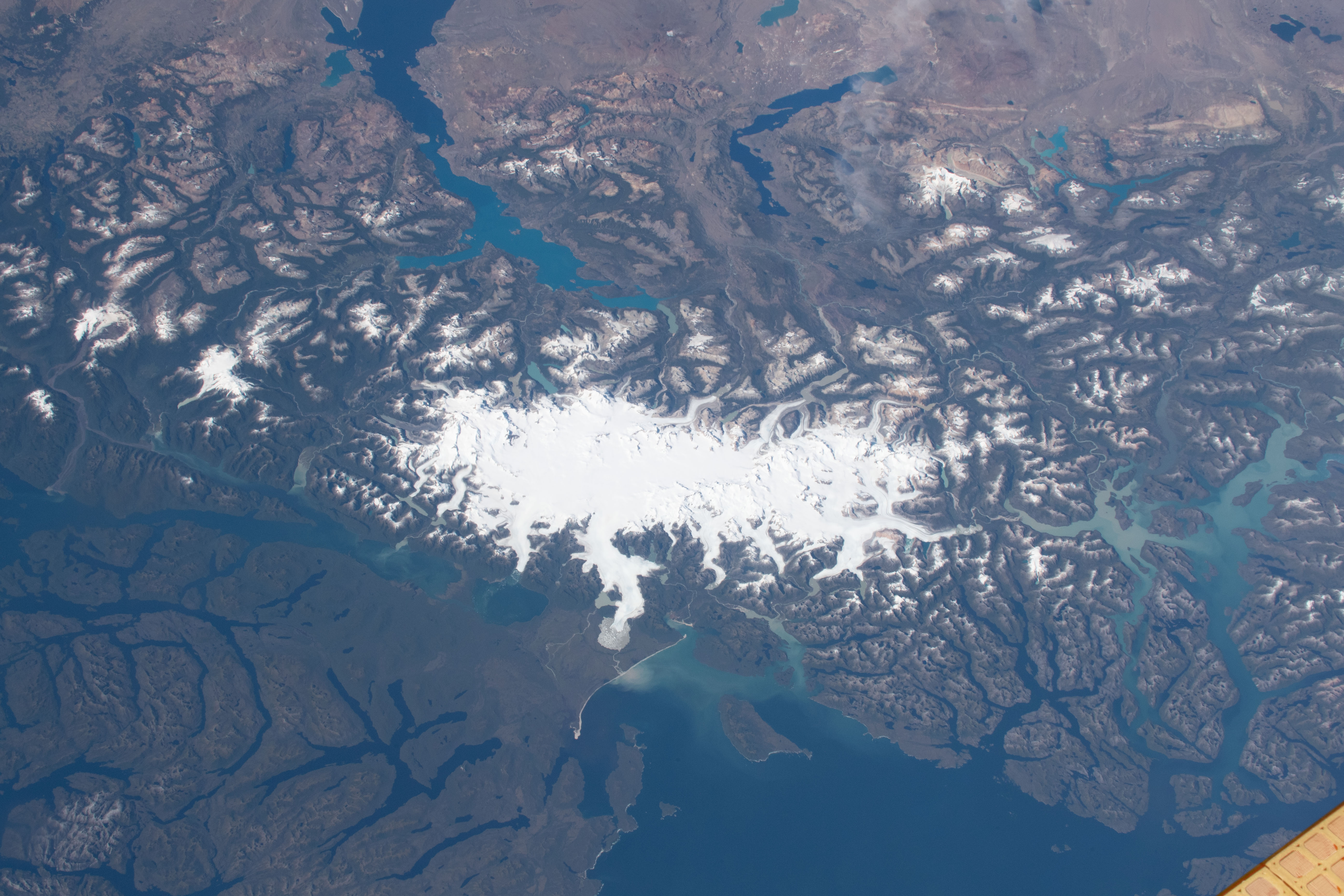


Photo center point: 47.0° S, 73.0° W
Photo center point by machine learning:
Country or Geographic Name: | CHILE |
Features: | NORTHERN PATAGONIA ICE FIELD, GLACIERS |
| Features Found Using Machine Learning: | |
Cloud Cover Percentage: | 10 (1-10)% |
Sun Elevation Angle: | 41° |
Sun Azimuth: | 329° |
Camera: | Nikon D5 Electronic Still Camera |
Focal Length: | 78mm |
Camera Tilt: | 44 degrees |
Format: | 5568E: 5568 x 3712 pixel CMOS sensor, 35.9 x 23.9 mm, total pixels: 21.33 million, Nikon FX format |
Film Exposure: | |
| Additional Information | |
| Width | Height | Annotated | Cropped | Purpose | Links |
|---|---|---|---|---|---|
| 5261 pixels | 3507 pixels | Yes | No | Download Image | |
| 720 pixels | 480 pixels | Yes | No | Download Image | |
| 5568 pixels | 3712 pixels | No | No | Download Image | |
| 640 pixels | 427 pixels | No | No | Download Image |
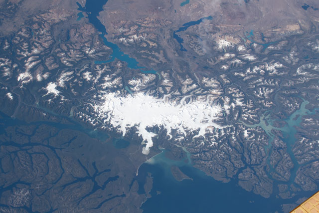
An astronaut on the International Space Station took this photograph of the southern Andes Mountains. The mountain peaks here reach high enough and temperatures remain cold enough year-round that permanent ice persists today. The brilliant white Northern Patagonian Icefield is the smaller of two icefields (the other being the Southern Patagonian) that are often observed from space by astronauts.
The icefield was significantly larger about 18,000 years ago, during the coldest phase of the last Ice Age. It covered almost the entire view in this image - an enormous area considering that the present icefield is more than 100 kilometers (60 miles) long.
Glacial ice moves slowly downhill under its own weight. As it flows, it cuts valleys into the underlying rocks. There have been several ice ages in the past, and scientists now know that the lakes at the top of this image and the network of valleys (fjords) at the bottom were gouged out by the erosion of moving glacial ice when the icefields were much larger.
Two of the biggest glaciers flowing off the icefield, San Rafael and San Quintin, are prominent features on the Pacific side of the icefield. (Note that north is to the left in this photo.) Both have been melting faster than the ice has been supplied from upstream. The retreat of the snout of San Quintin has been documented in previous detailed photos taken by astronauts.
In a recently published survey of glaciers, scientists showed that the Patagonian icefields follow the global trend of ice melting and loss. Ice losses here have occurred because air temperatures have been increasing along the length of the Andes, even while there has been a small increase in precipitation (snow) that feeds the glaciers.
