ISS064-E-38875

| NASA Photo ID | ISS064-E-38875 |
| Focal Length | 95mm |
| Date taken | 2021.02.26 |
| Time taken | 22:01:48 GMT |
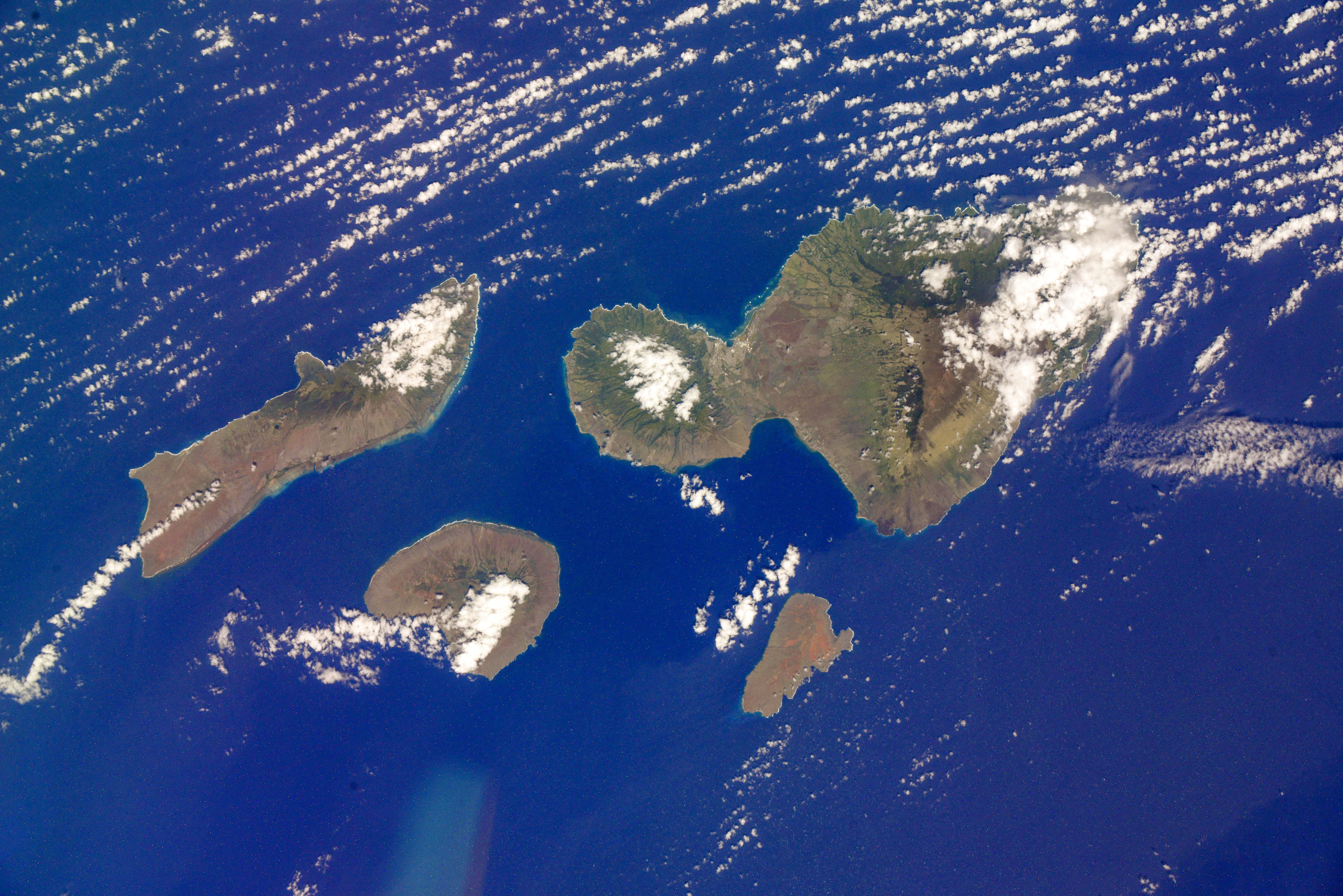
Spacecraft nadir point: 19.9° N, 155.8° W
Photo center point: 20.9° N, 156.6° W
Photo center point by machine learning:
Photo center point: 20.9° N, 156.6° W
Photo center point by machine learning:
Nadir to Photo Center: Northwest
Spacecraft Altitude: 226 nautical miles (419km)
Camera: | Nikon D800E Electronic Still Camera |
Focal Length: | 95mm |
Camera Tilt: | 19 degrees |
Format: | 7360E: 7360 x 4912 pixel CMOS sensor, 35.9mm x 24.0mm, total pixels: 36.8 million, Nikon FX format |
Film Exposure: | |
| Additional Information | Russian imagery |
| Width | Height | Annotated | Cropped | Purpose | Links |
|---|---|---|---|---|---|
| 7360 pixels | 4912 pixels | No | No | Download Image | |
| 640 pixels | 427 pixels | No | No | Download Image |
Download Packaged File
Download a Google Earth KML for this Image
View photo footprint information
Download a GeoTIFF for this photo
Image Caption: none
