ISS063-E-60908
| NASA Photo ID | ISS063-E-60908 |
| Focal Length | 500mm |
| Date taken | 2020.07.28 |
| Time taken | 17:59:16 GMT |


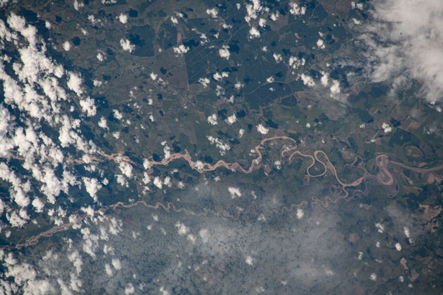
Spacecraft nadir point: 1.7° S, 75.3° W
Photo center point: 4.3° N, 73.1° W
Photo center point by machine learning:
Photo center point: 4.3° N, 73.1° W
Photo center point by machine learning:
Nadir to Photo Center: North
Spacecraft Altitude: 226 nautical miles (419km)
Country or Geographic Name: | COLOMBIA |
Features: | HUMEA RIVER, GUACAVIA RIVER, META DEPARTMENT |
| Features Found Using Machine Learning: | |
Cloud Cover Percentage: | 100 (76-100)% |
Sun Elevation Angle: | 66° |
Sun Azimuth: | 329° |
Camera: | Nikon D5 Electronic Still Camera |
Focal Length: | 500mm |
Camera Tilt: | High Oblique |
Format: | 5568E: 5568 x 3712 pixel CMOS sensor, 35.9 x 23.9 mm, total pixels: 21.33 million, Nikon FX format |
Film Exposure: | |
| Additional Information | |
| Width | Height | Annotated | Cropped | Purpose | Links |
|---|---|---|---|---|---|
| 5568 pixels | 3712 pixels | No | No | Download Image | |
| 640 pixels | 427 pixels | No | No | Download Image |
Download Packaged File
Download a Google Earth KML for this Image
View photo footprint information
Download a GeoTIFF for this photo
Georeferenced by human interaction - exported 2020-07-30-141657-UTCGeoreferenced by human interaction - exported 2020-08-11-200050-UTC
Georeferenced by human interaction - exported 2020-08-11-200612-UTC
An explanation of the georeference file(s) above
Image Caption: none
