ISS063-E-52878
| NASA Photo ID | ISS063-E-52878 |
| Focal Length | 50mm |
| Date taken | 2020.07.13 |
| Time taken | 21:21:43 GMT |
5568 x 3712 pixels 720 x 600 pixels 5568 x 3712 pixels 640 x 427 pixels
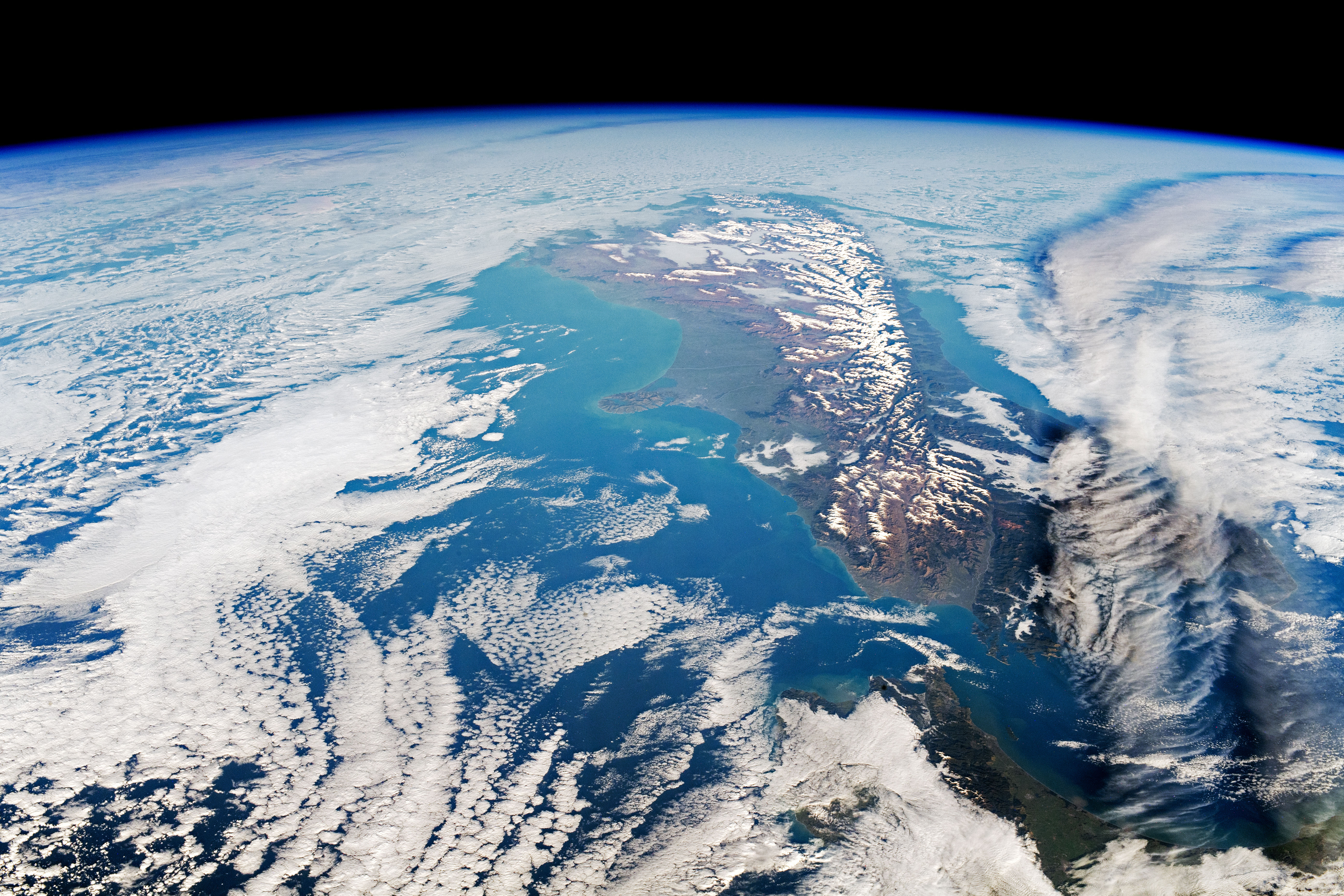
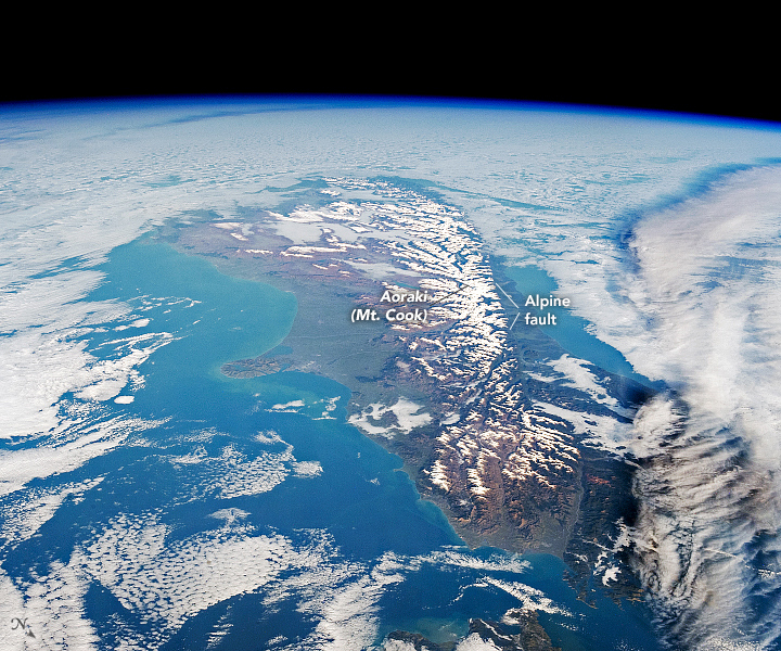


Photo center point: 41.5° S, 176.5° E
Photo center point by machine learning:
Country or Geographic Name: | NEW ZEALAND-NI |
Features: | EARTH LIMB, SOUTH ISLAND |
| Features Found Using Machine Learning: | |
Cloud Cover Percentage: | 75 (51-75)% |
Sun Elevation Angle: | 19° |
Sun Azimuth: | 53° |
Camera: | Nikon D5 Electronic Still Camera |
Focal Length: | 50mm |
Camera Tilt: | High Oblique |
Format: | 5568E: 5568 x 3712 pixel CMOS sensor, 35.9 x 23.9 mm, total pixels: 21.33 million, Nikon FX format |
Film Exposure: | |
| Additional Information | |
| Width | Height | Annotated | Cropped | Purpose | Links |
|---|---|---|---|---|---|
| 5568 pixels | 3712 pixels | Yes | Yes | Download Image | |
| 720 pixels | 600 pixels | Yes | Yes | Download Image | |
| 5568 pixels | 3712 pixels | No | No | Download Image | |
| 640 pixels | 427 pixels | No | No | Download Image |
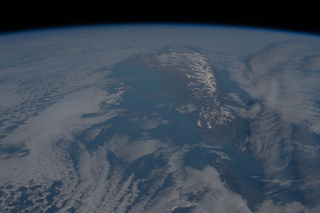
An astronaut onboard the International Space Station (ISS) took this photograph of South Island, New Zealand—also designated by the Māori name "Te Waipounamu" by the New Zealand Geographic Board. The island's snowcapped Southern Alps poked through wispy winter clouds that also hovered over the sea surface.
Stretching hundreds of kilometers across South Island, the Southern Alps form a spine of white that contrasts with the surrounding green and brown landscape. The highest peak in the mountain range, known as Aoraki Mount Cook, rises approximately 3,750 meters (12,300 feet) above sea level. The elevation of the range creates a rain-shadow effect east of the mountain range (left in this south-facing view). The mountains and their foothills on the west side experience frequent rain and snowfall year-round, while the downwind (east side) of these peaks have a more arid climate and many cloud-free days.
South Island is also marked by the Alpine Fault, the major surface expression of the boundary between the Indo-Australian and the Pacific tectonic plates. The central section of the fault runs the length of South Island. As the plates progressively converge, the Southern Alps shouldd continue to rise skyward over time.
