ISS063-E-51544
| NASA Photo ID | ISS063-E-51544 |
| Focal Length | 28mm |
| Date taken | 2020.07.20 |
| Time taken | 15:08:59 GMT |
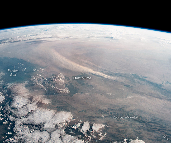


Photo center point: 30.5° N, 47.5° E
Photo center point by machine learning:
Country or Geographic Name: | IRAQ |
Features: | PERSIAN GULF, ZAGROS MOUNTAINS |
| Features Found Using Machine Learning: | PAN- |
Cloud Cover Percentage: | 50 (26-50)% |
Sun Elevation Angle: | 9° |
Sun Azimuth: | 289° |
Camera: | Nikon D5 Electronic Still Camera |
Focal Length: | 28mm |
Camera Tilt: | 27 degrees |
Format: | 5568E: 5568 x 3712 pixel CMOS sensor, 35.9 x 23.9 mm, total pixels: 21.33 million, Nikon FX format |
Film Exposure: | |
| Additional Information | |
| Width | Height | Annotated | Cropped | Purpose | Links |
|---|---|---|---|---|---|
| 720 pixels | 600 pixels | Yes | Yes | Download Image | |
| 5568 pixels | 3712 pixels | No | No | Download Image | |
| 640 pixels | 427 pixels | No | No | Download Image |
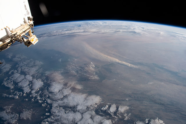
An astronaut aboard the International Space Station (ISS) took these photographs of southern Iraq and Saudi Arabia during the summer dust-storm season in the Persian Gulf.
The oblique (first) image gives the wide context of the storm as strong winds raised a dust plume hundreds of miles long. The focal length of the camera lens (28 mm) mimics closely the astronaut's view because it is similar to that of the human eye. The astronaut was looking southwest across the entire lowland of southern Iraq from a point over Iran's Zagros Mountains. The dust was blowing south into Saudi Arabia; clouds hovered over the mountains (foreground) and the horizon.
The second photo was taken just over a minute later. It shows that the dust plume was rising from a relatively small patch of lighter-toned ground near the Euphrates River. This patch of desert lacks irrigation canals and is quite bare of vegetation. The surrounding landscapes are darker-toned because they are covered with croplands (irrigated with water from the Tigris and Euphrates rivers), as well as some wetlands and dark-toned reservoirs. No plumes rose from these areas, where the effects of irrigation - wet soils and crop growth - protect the surface from wind erosion.
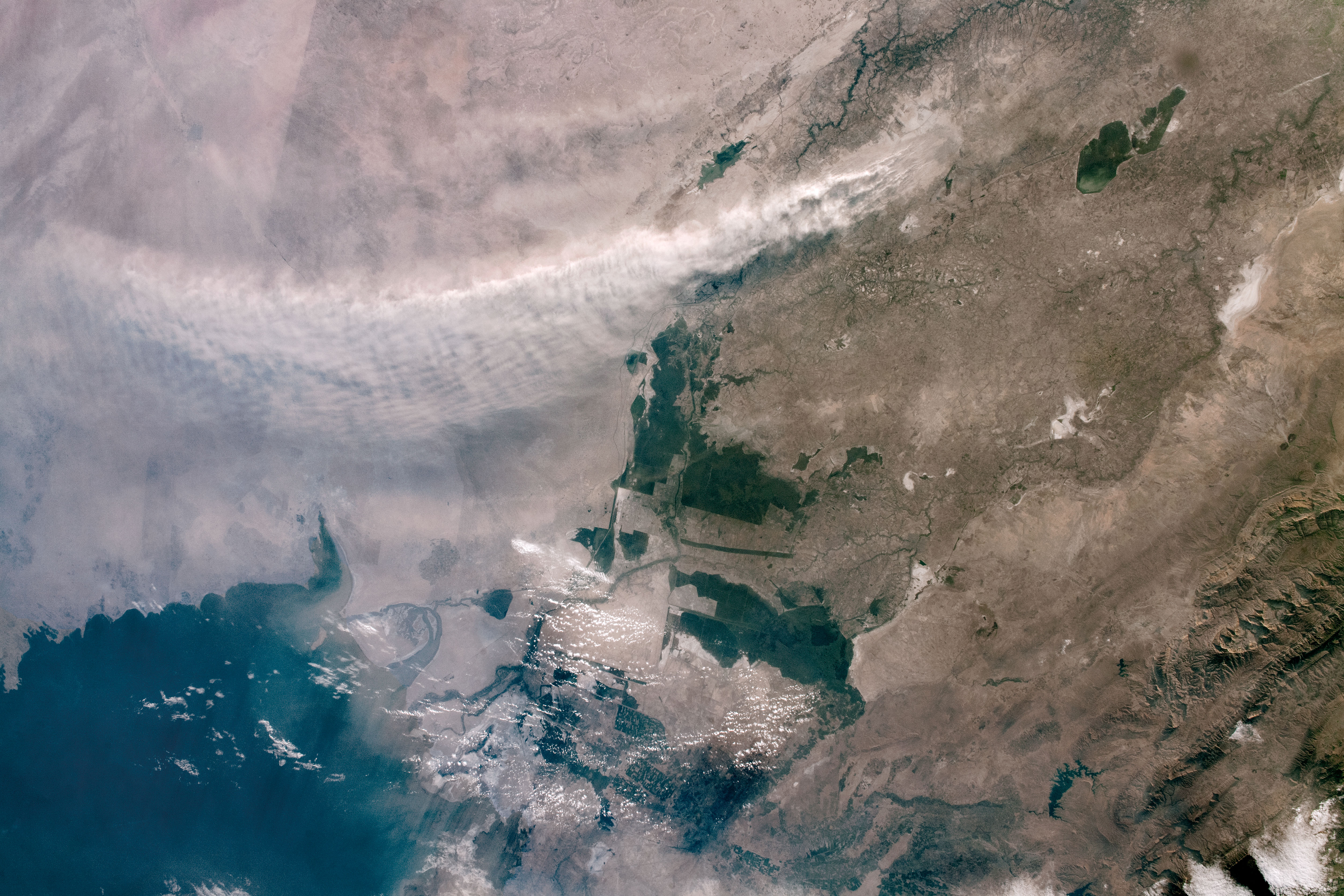
The dust plume is also an excellent example of the interconnected nature of Earth's systems. Extensive irrigation in southern Iraq has progressively reduced the areas exposed directly to wind erosion. Thus the amount of dust being transported to Saudi Arabia has decreased over time - probably since irrigated agriculture began here several thousand years ago.
The ability to change quickly from a regional, oblique view (often including the horizon or Earth limb) to a detailed view (looking more vertically) is one of the strengths of astronaut handheld photography that sets it apart from most automated satellite imaging systems.
